
$1,150
/ Month
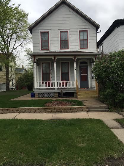
169 W Mc Boal St Unit #1
Saint Paul, MN 55102
2 Weeks Ago
Favorites
169 W Mc Boal St Unit #1

Favorites
Check Back Soon for Upcoming Availability
| Beds | Baths | Average SF |
|---|---|---|
| 1 Bedroom 1 Bedroom 1 Br | 1 Bath 1 Bath 1 Ba | 927 SF |
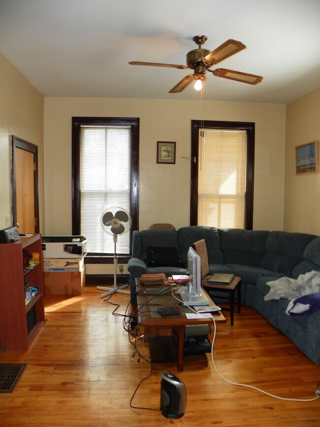
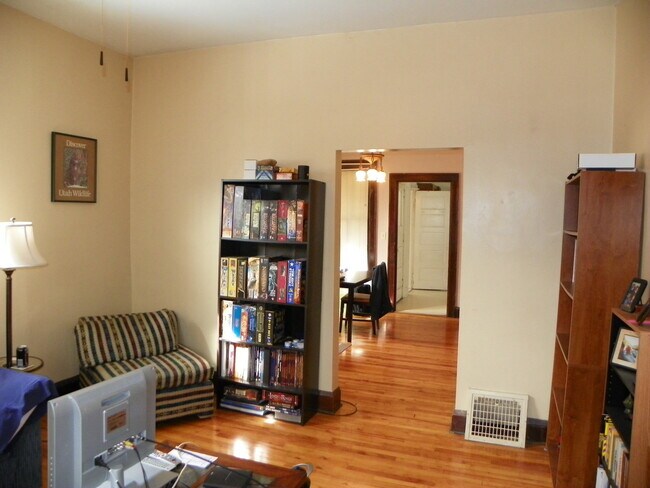
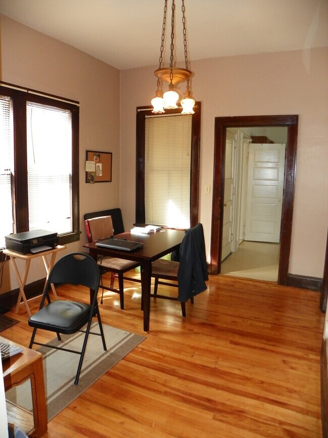
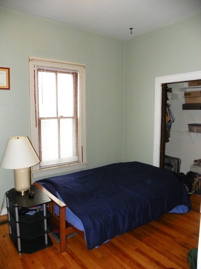
About This Property
Come home to your new address in St. Paul, MN. This property can be found at 169 W Mc Boal St in St. Paul. With this great space, you'll feel right at home. To learn more about this property, schedule a showing.
169 W Mc Boal St is an apartment community located in Ramsey County and the 55102 ZIP Code.
Location
Get Directions
Often referred to as the “West End,” West Seventh is a convenient neighborhood located on the Riverview Corridor transit system, making travel to Downtown Saint Paul, the Minneapolis-Saint Paul Airport, and the Mall of America simple for locals.
Residents of West Seventh enjoy direct access to Interstate 35E and Xcel Energy Center. There are a plethora of amenities and attractions along the Mississippi River – from parks to historic landmarks and the High Bridge Dog Park.
Many of West Seventh’s restaurants are found along 7th Street West, like Bad Weather Brewing Company, Cossetta’s, and JR Mac’s Bar & Grill. Residents adore the proximity to the airport, and Saint Paul attractions and shopping.
Learn more about living in West SeventhBelow are rent ranges for similar nearby apartments
| Beds | Average Size | Lowest | Typical | Premium |
|---|---|---|---|---|
| Studio Studio Studio | 533-534 Sq Ft | $995 | $1,276 | $2,656 |
| 1 Bed 1 Bed 1 Bed | 755-758 Sq Ft | $950 | $1,709 | $3,627 |
| 2 Beds 2 Beds 2 Beds | 1219 Sq Ft | $1,195 | $2,407 | $6,406 |
| 3 Beds 3 Beds 3 Beds | 1617 Sq Ft | $1,499 | $2,768 | $4,999 |
| 4 Beds 4 Beds 4 Beds | 1855 Sq Ft | $850 | $1,698 | $2,695 |
Education
| Colleges & Universities | Distance | ||
|---|---|---|---|
| Colleges & Universities | Distance | ||
| Drive: | 4 min | 1.3 mi | |
| Drive: | 5 min | 2.4 mi | |
| Drive: | 6 min | 3.3 mi | |
| Drive: | 6 min | 3.4 mi |
169 W Mc Boal St Unit #1 is within 4 minutes or 1.3 miles from Saint Paul College. It is also near Metropolitan State University and Concordia Univ.-Saint Paul.
Transportation options available in Saint Paul include Central Station, located 1.3 miles from 169 W Mc Boal St Unit #1. 169 W Mc Boal St Unit #1 is near Minneapolis-St Paul International/Wold-Chamberlain, located 9.0 miles or 15 minutes away.
| Transit / Subway | Distance | ||
|---|---|---|---|
| Transit / Subway | Distance | ||
| Drive: | 3 min | 1.3 mi | |
| Drive: | 3 min | 1.3 mi | |
| Drive: | 4 min | 1.6 mi | |
| Drive: | 4 min | 1.6 mi | |
| Drive: | 3 min | 1.6 mi |
| Commuter Rail | Distance | ||
|---|---|---|---|
| Commuter Rail | Distance | ||
|
|
Drive: | 4 min | 1.7 mi |
|
|
Drive: | 20 min | 10.6 mi |
|
|
Drive: | 25 min | 17.9 mi |
|
|
Drive: | 35 min | 26.1 mi |
|
|
Drive: | 37 min | 27.7 mi |
| Airports | Distance | ||
|---|---|---|---|
| Airports | Distance | ||
|
Minneapolis-St Paul International/Wold-Chamberlain
|
Drive: | 15 min | 9.0 mi |
Time and distance from 169 W Mc Boal St Unit #1.
| Shopping Centers | Distance | ||
|---|---|---|---|
| Shopping Centers | Distance | ||
| Drive: | 3 min | 1.7 mi | |
| Drive: | 3 min | 1.8 mi | |
| Drive: | 3 min | 1.8 mi |
169 W Mc Boal St Unit #1 has 3 shopping centers within 1.8 miles, which is about a 3-minute drive. The miles and minutes will be for the farthest away property.
| Parks and Recreation | Distance | ||
|---|---|---|---|
| Parks and Recreation | Distance | ||
|
Irvine Park
|
Walk: | 5 min | 0.3 mi |
|
Science Museum of Minnesota
|
Walk: | 10 min | 0.5 mi |
|
Mississippi National River & Recreation Area
|
Walk: | 11 min | 0.6 mi |
|
Minnesota Children's Museum
|
Walk: | 19 min | 1.0 mi |
|
Kellogg Mall Park
|
Drive: | 2 min | 1.2 mi |
169 W Mc Boal St Unit #1 has 5 parks within 1.2 miles, including Irvine Park, Science Museum of Minnesota, and Mississippi National River & Recreation Area.
| Hospitals | Distance | ||
|---|---|---|---|
| Hospitals | Distance | ||
| Walk: | 5 min | 0.3 mi | |
| Walk: | 18 min | 0.9 mi | |
| Drive: | 4 min | 1.7 mi |
169 W Mc Boal St Unit #1 has 3 hospitals within 1.7 miles, the nearest is Allina United Hospital which is 0.3 mile away and a 5 minute walk.
| Military Bases | Distance | ||
|---|---|---|---|
| Military Bases | Distance | ||
| Drive: | 14 min | 7.7 mi |
169 W Mc Boal St Unit #1 is 7.7 miles and a 14 minute drive from Fort Snelling Military Reservation.
You May Also Like
Similar Rentals Nearby


What Are Walk Score®, Transit Score®, and Bike Score® Ratings?
Walk Score® measures the walkability of any address. Transit Score® measures access to public transit. Bike Score® measures the bikeability of any address.
What is a Sound Score Rating?
A Sound Score Rating aggregates noise caused by vehicle traffic, airplane traffic and local sources
169 W Mc Boal St
Saint Paul, MN 55102