
Holden House
1554 Midway Pky,
Saint Paul, MN 55108
Studio - 2 Beds $1,295 - $2,395

Union Park is a neighborhood in St. Paul, Minnesota with a population of 17,138. Union Park is in Ramsey County and is one of Minnesota's best places to live. Living in Union Park offers residents an urban suburban mix feel and most residents rent their homes. In Union Park, there are a lot of bars, restaurants, coffee shops, and parks.
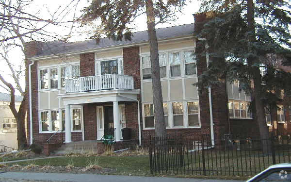
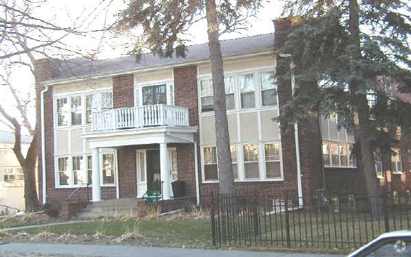
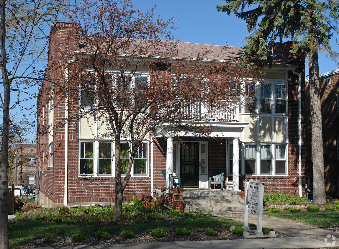
Montrose Place is an apartment community located in Ramsey County and the 55104 ZIP Code. This area is served by the St. Paul Public attendance zone.
Along the shore of the Mississippi River, Merriam Park West offers riverfront parks, a large golf course, and quaint local restaurants just minutes from downtown Saint Paul, Minnesota. Stop on in at Izzy’s Ice Cream Café, or grab a treat at Black Coffee and Waffle Bar. Local businesses thrive alongside riverfront community spaces like Shadow Falls Park, a picturesque nature preserve.
The University of Saint Thomas resides on the south end of town, and the neighborhood offers a blend of private and public schools, churches, and every day conveniences. Situated just five miles southeast of Minneapolis and seven miles northeast of the Minneapolis-Saint Paul International Airport, this neighborhood is in a premier location for commuting, shopping, dining, and entertainment.
Learn more about living in Merriam Park West| Colleges & Universities | Distance | ||
|---|---|---|---|
| Colleges & Universities | Distance | ||
| Walk: | 9 min | 0.5 mi | |
| Drive: | 4 min | 2.0 mi | |
| Drive: | 4 min | 2.2 mi | |
| Drive: | 7 min | 2.5 mi |


Transportation options available in Saint Paul include Fairview Ave Station, located 1.6 miles from Montrose Place. Montrose Place is near Minneapolis-St Paul International/Wold-Chamberlain, located 7.3 miles or 16 minutes away.
| Transit / Subway | Distance | ||
|---|---|---|---|
| Transit / Subway | Distance | ||
| Drive: | 3 min | 1.6 mi | |
| Drive: | 4 min | 1.7 mi | |
| Drive: | 5 min | 2.0 mi | |
| Drive: | 4 min | 2.0 mi | |
|
|
Drive: | 8 min | 2.7 mi |
| Commuter Rail | Distance | ||
|---|---|---|---|
| Commuter Rail | Distance | ||
|
|
Drive: | 13 min | 6.0 mi |
|
|
Drive: | 11 min | 6.1 mi |
|
|
Drive: | 21 min | 14.6 mi |
|
|
Drive: | 31 min | 23.4 mi |
|
|
Drive: | 32 min | 25.1 mi |
| Airports | Distance | ||
|---|---|---|---|
| Airports | Distance | ||
|
Minneapolis-St Paul International/Wold-Chamberlain
|
Drive: | 16 min | 7.3 mi |
Time and distance from Montrose Place.
| Shopping Centers | Distance | ||
|---|---|---|---|
| Shopping Centers | Distance | ||
| Drive: | 5 min | 2.2 mi | |
| Drive: | 4 min | 2.2 mi | |
| Drive: | 5 min | 2.3 mi |
| Parks and Recreation | Distance | ||
|---|---|---|---|
| Parks and Recreation | Distance | ||
|
Brackett Park
|
Drive: | 4 min | 1.4 mi |
|
Longfellow Park
|
Drive: | 5 min | 1.8 mi |
|
Macalester College Observatory
|
Drive: | 4 min | 2.2 mi |
|
Tower Hill Park
|
Drive: | 6 min | 2.4 mi |
|
Hiawatha School Park
|
Drive: | 7 min | 2.4 mi |
| Hospitals | Distance | ||
|---|---|---|---|
| Hospitals | Distance | ||
| Drive: | 6 min | 3.4 mi | |
| Drive: | 10 min | 3.6 mi | |
| Drive: | 10 min | 3.6 mi |
| Military Bases | Distance | ||
|---|---|---|---|
| Military Bases | Distance | ||
| Drive: | 14 min | 6.2 mi |
What Are Walk Score®, Transit Score®, and Bike Score® Ratings?
Walk Score® measures the walkability of any address. Transit Score® measures access to public transit. Bike Score® measures the bikeability of any address.
What is a Sound Score Rating?
A Sound Score Rating aggregates noise caused by vehicle traffic, airplane traffic and local sources
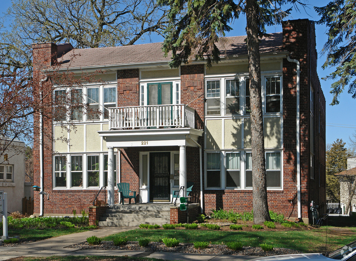
221 Montrose Pl
Saint Paul, MN 55104


