
$915
/ Month
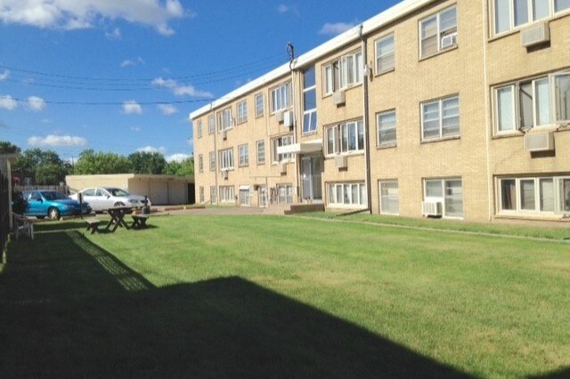
550 View St Unit 25
Saint Paul, MN 55102
2 Weeks Ago
Favorites
550 View St Unit 25

Favorites
Check Back Soon for Upcoming Availability
| Beds | Baths | Average SF |
|---|---|---|
| 1 Bedroom 1 Bedroom 1 Br | 1 Bath 1 Bath 1 Ba | 700 SF |
Fees and Policies
The fees below are based on community-supplied data and may exclude additional fees and utilities.
- Cats Allowed
-
Fees not specified
-
Weight limit--
-
Pet Limit--
- Parking
-
Surface Lot--
Details
Utilities Included
-
Gas
-
Water
-
Heat
-
Trash Removal
-
Sewer
-
Air Conditioning
Lease Options
-
12 Months
About This Property
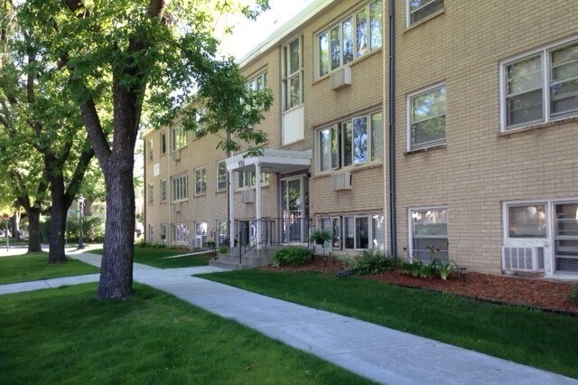
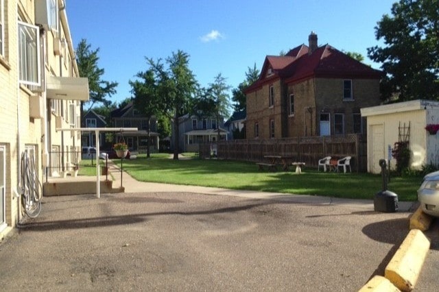
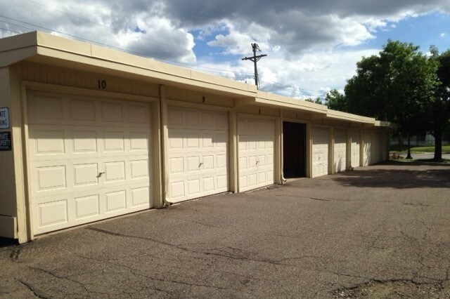
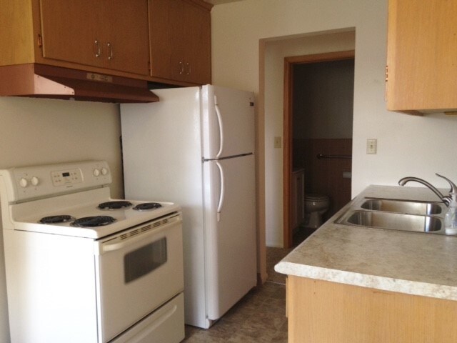
Our lovely, mid-century modern 1BR apartment is available now! Conveniently located in the West 7th Street neighborhood of St. Paul, this quiet apartment is minutes to downtown St. Paul, MSP Airport, Mississippi River Valley and Harriet Island Regional Park, and features: - Well-lit, first floor unit - Spacious closets in living room and bedroom - Abundant cupboard space in eat-in kitchen - Built-in AC unit in living room - Additional storage included - Coin-operated laundry on-site - Heat, water and basic trash removal are included - Free off street parking and Garage spots available for rent - Residents can also enjoy a lovely large backyard on nice days. If interested, please respond to this ad. Also feel free to check out our website at steffenzennerproperties.com where you can see more photos and information about all of our properties throughout Saint Paul and Roseville. Thanks!
550 View St is an apartment community located in Ramsey County and the 55102 ZIP Code.
Apartment Features
- Smoke Free
- Eat-in Kitchen
- Kitchen
- Laundry Facilities
Location
Get Directions
Often referred to as the “West End,” West Seventh is a convenient neighborhood located on the Riverview Corridor transit system, making travel to Downtown Saint Paul, the Minneapolis-Saint Paul Airport, and the Mall of America simple for locals.
Residents of West Seventh enjoy direct access to Interstate 35E and Xcel Energy Center. There are a plethora of amenities and attractions along the Mississippi River – from parks to historic landmarks and the High Bridge Dog Park.
Many of West Seventh’s restaurants are found along 7th Street West, like Bad Weather Brewing Company, Cossetta’s, and JR Mac’s Bar & Grill. Residents adore the proximity to the airport, and Saint Paul attractions and shopping.
Learn more about living in West SeventhBelow are rent ranges for similar nearby apartments
Amenities
- Smoke Free
- Eat-in Kitchen
- Kitchen
- Laundry Facilities
Expenses
Utilities Included
Gas, Water, Heat, Trash Removal, Sewer, Air Conditioning
Included
Education
| Colleges & Universities | Distance | ||
|---|---|---|---|
| Colleges & Universities | Distance | ||
| Drive: | 6 min | 2.5 mi | |
| Drive: | 7 min | 2.7 mi | |
| Drive: | 8 min | 2.8 mi | |
| Drive: | 7 min | 3.2 mi |
550 View St Unit 25 is within 7 minutes or 2.7 miles from Macalester College. It is also near Concordia Univ.-Saint Paul and Saint Paul College.
Transportation options available in Saint Paul include Victoria St Station, located 2.7 miles from 550 View St Unit 25. 550 View St Unit 25 is near Minneapolis-St Paul International/Wold-Chamberlain, located 6.1 miles or 12 minutes away.
| Transit / Subway | Distance | ||
|---|---|---|---|
| Transit / Subway | Distance | ||
| Drive: | 7 min | 2.7 mi | |
| Drive: | 8 min | 2.9 mi | |
| Drive: | 7 min | 2.9 mi | |
| Drive: | 8 min | 3.5 mi | |
| Drive: | 7 min | 3.8 mi |
| Commuter Rail | Distance | ||
|---|---|---|---|
| Commuter Rail | Distance | ||
|
|
Drive: | 6 min | 3.3 mi |
|
|
Drive: | 21 min | 9.7 mi |
|
|
Drive: | 27 min | 19.7 mi |
|
|
Drive: | 37 min | 27.8 mi |
|
|
Drive: | 39 min | 29.4 mi |
| Airports | Distance | ||
|---|---|---|---|
| Airports | Distance | ||
|
Minneapolis-St Paul International/Wold-Chamberlain
|
Drive: | 12 min | 6.1 mi |
Time and distance from 550 View St Unit 25.
| Shopping Centers | Distance | ||
|---|---|---|---|
| Shopping Centers | Distance | ||
| Drive: | 4 min | 1.4 mi | |
| Drive: | 4 min | 1.4 mi | |
| Drive: | 4 min | 1.4 mi |
550 View St Unit 25 has 3 shopping centers within 1.4 miles, which is about a 4-minute drive. The miles and minutes will be for the farthest away property.
| Parks and Recreation | Distance | ||
|---|---|---|---|
| Parks and Recreation | Distance | ||
|
Highland Park and Golf Course
|
Drive: | 3 min | 1.3 mi |
|
Science Museum of Minnesota
|
Drive: | 4 min | 2.3 mi |
|
Irvine Park
|
Drive: | 5 min | 2.4 mi |
|
Macalester College Observatory
|
Drive: | 6 min | 2.7 mi |
|
Cherokee Regional Park
|
Drive: | 7 min | 2.8 mi |
550 View St Unit 25 has 5 parks within 2.8 miles, including Highland Park and Golf Course, Irvine Park, and Science Museum of Minnesota.
| Hospitals | Distance | ||
|---|---|---|---|
| Hospitals | Distance | ||
| Drive: | 4 min | 1.8 mi | |
| Drive: | 6 min | 2.9 mi | |
| Drive: | 7 min | 3.8 mi |
550 View St Unit 25 has 3 hospitals within 3.8 miles, the nearest is Allina United Hospital which is 1.8 miles away and a 4 minute drive.
| Military Bases | Distance | ||
|---|---|---|---|
| Military Bases | Distance | ||
| Drive: | 11 min | 4.8 mi |
550 View St Unit 25 is 4.8 miles and a 11 minute drive from Fort Snelling Military Reservation.
You May Also Like
Similar Rentals Nearby


What Are Walk Score®, Transit Score®, and Bike Score® Ratings?
Walk Score® measures the walkability of any address. Transit Score® measures access to public transit. Bike Score® measures the bikeability of any address.
What is a Sound Score Rating?
A Sound Score Rating aggregates noise caused by vehicle traffic, airplane traffic and local sources
550 View St
Saint Paul, MN 55102