
$1,499
/ Month
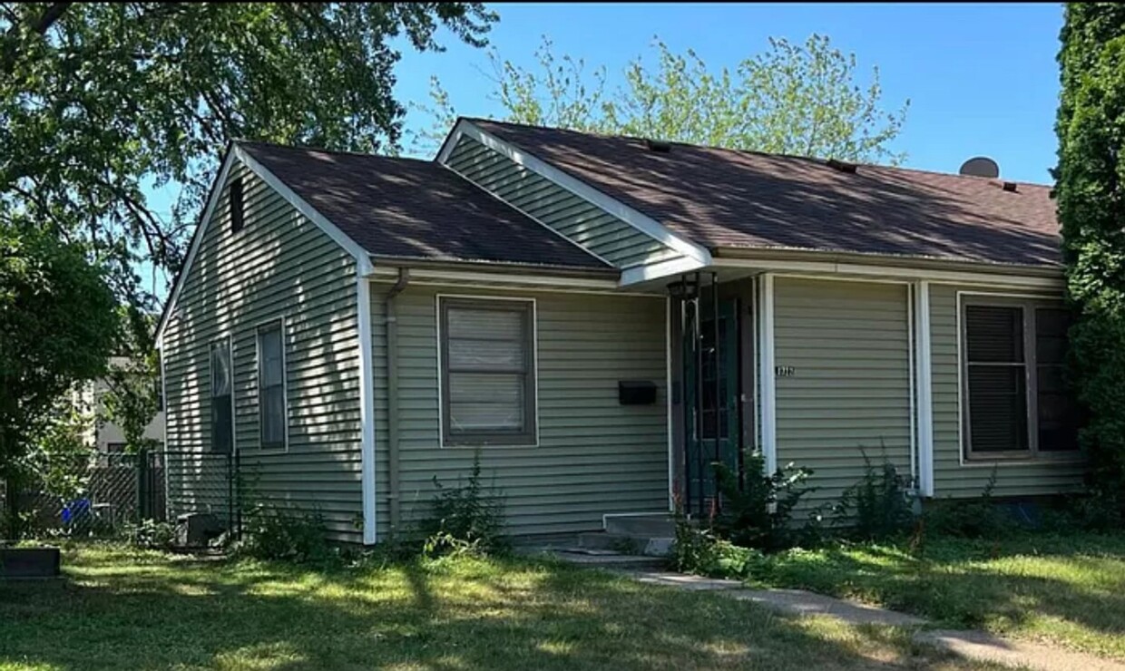
1722-1728 Ford Pkwy Unit 1722
Saint Paul, MN 55116
2 Weeks Ago
Favorites
1722-1728 Ford Pkwy Unit 1722

Favorites
Check Back Soon for Upcoming Availability
| Beds | Baths | Average SF |
|---|---|---|
| 2 Bedrooms 2 Bedrooms 2 Br | 1 Bath 1 Bath 1 Ba | — |
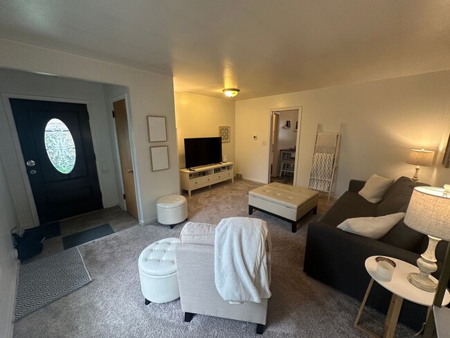
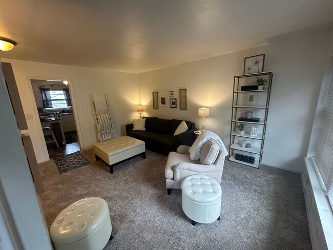
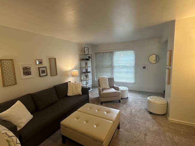
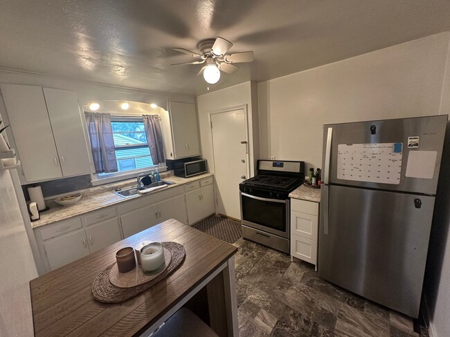
About This Property
Explore this great property in St. Paul, MN. Located at 1722-1728 Ford Pkwy in St. Paul, this property provides easy access to city amenities and attractions. Stop searching and start living in your new home. Let us assist you! Contact us now to discuss the next steps!
1722-1728 Ford Pkwy is an apartment community located in Ramsey County and the 55116 ZIP Code.
Location
Get Directions
The Highland community lies in the southwestern corner of Saint Paul, just 10 miles from Downtown Minneapolis. Highland is to the north of Fort Snelling, adjacent to the Mississippi River.
A 50/50 blend of commercial and residential buildings, Highland residents enjoy plentiful shopping and restaurants near their apartments. Saint Catherine University resides here, and it’s in walking distance of local eateries at the corner of Cleveland Avenue South and Ford Parkway.
A predominantly residential neighborhood, there are tons of outdoor activities to do, like improving your game at the Highland National Golf Course or picnicking at Crosby Farm Park. For easy travel, residents are comforted by their proximity to Interstate 35E and the international airport. The amusement park and aquarium at Mall of America are a short 10-minute drive from Highland.
Learn more about living in HighlandBelow are rent ranges for similar nearby apartments
| Beds | Average Size | Lowest | Typical | Premium |
|---|---|---|---|---|
| Studio Studio Studio | 499 Sq Ft | $846 | $1,315 | $1,795 |
| 1 Bed 1 Bed 1 Bed | 738-746 Sq Ft | $962 | $1,492 | $3,510 |
| 2 Beds 2 Beds 2 Beds | 1092-1094 Sq Ft | $1,195 | $1,980 | $4,650 |
| 3 Beds 3 Beds 3 Beds | 1671 Sq Ft | $1,905 | $2,627 | $5,495 |
| 4 Beds 4 Beds 4 Beds | 2243 Sq Ft | $850 | $3,318 | $7,500 |
Education
| Colleges & Universities | Distance | ||
|---|---|---|---|
| Colleges & Universities | Distance | ||
| Drive: | 4 min | 1.1 mi | |
| Drive: | 4 min | 1.7 mi | |
| Drive: | 6 min | 2.7 mi | |
| Drive: | 6 min | 3.0 mi |
1722-1728 Ford Pkwy Unit 1722 is within 4 minutes or 1.1 miles from St. Catherine University. It is also near Macalester College and Univ. of St Thomas, St. Paul.
Transportation options available in Saint Paul include Snelling Ave Station, located 3.0 miles from 1722-1728 Ford Pkwy Unit 1722. 1722-1728 Ford Pkwy Unit 1722 is near Minneapolis-St Paul International/Wold-Chamberlain, located 5.3 miles or 11 minutes away.
| Transit / Subway | Distance | ||
|---|---|---|---|
| Transit / Subway | Distance | ||
| Drive: | 7 min | 3.0 mi | |
|
|
Drive: | 8 min | 3.1 mi |
|
|
Drive: | 8 min | 3.4 mi |
|
|
Drive: | 8 min | 3.6 mi |
|
|
Drive: | 9 min | 4.0 mi |
| Commuter Rail | Distance | ||
|---|---|---|---|
| Commuter Rail | Distance | ||
|
|
Drive: | 11 min | 6.3 mi |
|
|
Drive: | 19 min | 9.2 mi |
|
|
Drive: | 27 min | 17.8 mi |
|
|
Drive: | 37 min | 26.6 mi |
|
|
Drive: | 38 min | 28.3 mi |
| Airports | Distance | ||
|---|---|---|---|
| Airports | Distance | ||
|
Minneapolis-St Paul International/Wold-Chamberlain
|
Drive: | 11 min | 5.3 mi |
Time and distance from 1722-1728 Ford Pkwy Unit 1722.
| Shopping Centers | Distance | ||
|---|---|---|---|
| Shopping Centers | Distance | ||
| Walk: | 14 min | 0.8 mi | |
| Walk: | 14 min | 0.8 mi | |
| Walk: | 17 min | 0.9 mi |
1722-1728 Ford Pkwy Unit 1722 has 3 shopping centers within 0.9 mile, which is about a 17-minute walk. The miles and minutes will be for the farthest away property.
| Parks and Recreation | Distance | ||
|---|---|---|---|
| Parks and Recreation | Distance | ||
|
Highland Park and Golf Course
|
Drive: | 3 min | 1.5 mi |
|
Macalester College Observatory
|
Drive: | 4 min | 1.8 mi |
|
Hidden Falls Park
|
Drive: | 6 min | 2.0 mi |
|
Minnehaha Falls Pergola Garden
|
Drive: | 7 min | 2.4 mi |
|
Crosby Farm Regional Park
|
Drive: | 6 min | 2.5 mi |
1722-1728 Ford Pkwy Unit 1722 has 5 parks within 2.5 miles, including Highland Park and Golf Course, Macalester College Observatory, and Hidden Falls Park.
| Hospitals | Distance | ||
|---|---|---|---|
| Hospitals | Distance | ||
| Drive: | 9 min | 4.2 mi | |
| Drive: | 10 min | 4.9 mi | |
| Drive: | 11 min | 6.8 mi |
1722-1728 Ford Pkwy Unit 1722 has 3 hospitals within 6.8 miles, the nearest is Allina United Hospital which is 4.2 miles away and a 9 minute drive.
| Military Bases | Distance | ||
|---|---|---|---|
| Military Bases | Distance | ||
| Drive: | 10 min | 4.0 mi |
1722-1728 Ford Pkwy Unit 1722 is 4.0 miles and a 10 minute drive from Fort Snelling Military Reservation.
You May Also Like
Similar Rentals Nearby


What Are Walk Score®, Transit Score®, and Bike Score® Ratings?
Walk Score® measures the walkability of any address. Transit Score® measures access to public transit. Bike Score® measures the bikeability of any address.
What is a Sound Score Rating?
A Sound Score Rating aggregates noise caused by vehicle traffic, airplane traffic and local sources
1722-1728 Ford Pkwy
Saint Paul, MN 55116