Apartments for Rent in Boston MA - 52,950 Rentals
-
-
-
-
-
-
-
-
-
-
-
-
-
-
-
-
-
-
-
1 / 33

-
-
-
-
-
-
-
-
-
-
-
-
-
-
-
-
-
-
-
-
-
-
Showing 40 of 700 Results - Page 1 of 18


Find the Perfect Boston, MA Apartment
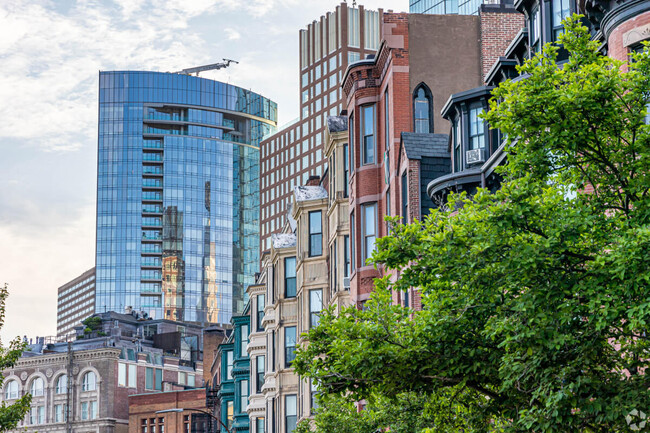
Boston, MA Apartments for Rent
Whether you're captivated by historic charm, a vibrant arts scene, or world-class educational institutions, renting a Boston apartment offers a diverse array of options to suit every lifestyle in the beautiful state of Massachusetts. From luxury Boston Apartments with stunning skyline views to quaint apartments in historic brownstones, and spacious suburban Boston rental homes, the selection of apartments for rent in Boston is as varied as the city itself. The city's blend of history, culture, and modern amenities makes it a fantastic place to call home. Let Apartments.com help you find your perfect Boston apartment for rent!
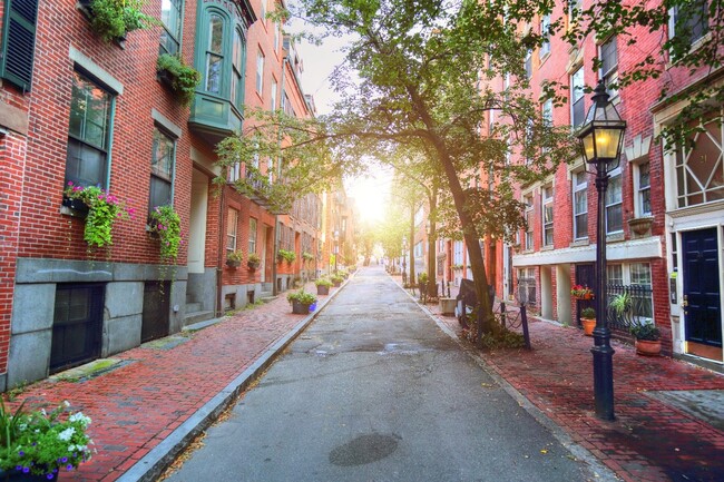
Boston, MA Neighborhoods to Explore
Boston's neighborhoods each have a distinct personality. The Back Bay is renowned for its Victorian brownstones and upscale shopping on Newbury Street, offering a blend of historic elegance and modern convenience. For those seeking a more artistic vibe, the South End of Boston is a hub of creativity, featuring galleries, trendy eateries, and charming brick row houses. If you prefer a bustling urban environment, Downtown Boston provides high-rise apartments close to major employment centers and cultural landmarks. Meanwhile, Jamaica Plain offers a more laid-back atmosphere with its green spaces and community-focused lifestyle.
Nearby Boston Universities
Boston, MA is a global education hub, home to prestigious institutions like Harvard University, Massachusetts Institute of Technology (MIT), and Boston University. This academic richness makes the city particularly appealing to students and academics. Areas such as Cambridge and Allston are popular among students, offering a variety of rental options from shared apartments to cozy studios, all within easy reach of campus facilities and vibrant student life.
Amenities Boston Apartment Renters Value
Apartment renters in Boston often seek amenities that complement the city's urban lifestyle. Fitness centers and apartments with in-unit laundry facilities are highly valued, while Boston pet-friendly apartments cater to animal lovers. For those who appreciate luxury, many high-end rentals include rooftop lounges with panoramic views, concierge services, and state-of-the-art fitness centers. Additionally, the growing demand for sustainability has led to an increase in Boston apartment complexes offering EV charging stations.
Experience the Best of Boston
Once settled in your new Boston apartment you can discover endless opportunities for exploration and enjoyment. History enthusiasts can walk the Freedom Trail, while sports fans can catch a game at Fenway Park. The city's cultural offerings are rich, with institutions like the Museum of Fine Arts and the Boston Symphony Orchestra providing world-class experiences. Outdoor enthusiasts will appreciate the scenic beauty of the Charles River Esplanade and Boston Common, while food lovers can indulge in the diverse culinary scene, from seafood at the Seaport to Italian cuisine in the North End.
From the historic elegance of Beacon Hill to the modern allure of Seaport District, apartments in Boston, MA cater to a wide range of preferences and lifestyles. Explore your options and discover your ideal Boston apartment in this dynamic city, where history and innovation come together to create a truly unique living experience.
Boston, MA Rental Insights
Average Rent Rates
What is the average rent in Boston, MA?
The average rent in Boston is $3,529. When you rent an apartment in Boston, you can expect to pay as little as $2,910 or as much as $5,997, depending on the location and the size of the apartment.
What is the average rent of a Studio apartment in Boston, MA?
The average rent for a studio apartment in Boston, MA is $2,910 per month.
What is the average rent of a 1 bedroom apartment in Boston, MA?
The average rent for a one bedroom apartment in Boston, MA is $3,534 per month.
What is the average rent of a 2 bedroom apartment in Boston, MA?
The average rent for a two bedroom apartment in Boston, MA is $4,468 per month.
What is the average rent of a 3 bedroom apartment in Boston, MA?
The average rent for a three bedroom apartment in Boston, MA is $5,997 per month.
Education
What colleges and universities are in Boston, MA?
If you’re a student moving to an apartment in Boston, you’ll have access to UMass Boston, Northeastern University, and Wentworth Inst. of Technology.
Helpful Rental Guides for Boston, MA


Search Nearby Rentals
Rentals Near Boston
- Dorchester Apartments For Rent
- South Boston Apartments For Rent
- Roxbury Apartments For Rent
- Roxbury Crossing Apartments For Rent
- Mission Hill Apartments For Rent
- North Quincy Apartments For Rent
- Mattapan Apartments For Rent
- Jamaica Plain Apartments For Rent
- Roslindale Apartments For Rent
- East Cambridge Apartments For Rent
Neighborhood Apartment Rentals
- Downtown Boston Apartments for Rent
- Route 1 North Apartments for Rent
- 95-North Apartments for Rent
- Route 1 South Apartments for Rent
- South Shore Apartments for Rent
- 495-South Apartments for Rent
- Savin Hill Flats Apartments for Rent
- Jones Hill Apartments for Rent
- Savin Hill Historic District Apartments for Rent
- Uphams Corner Apartments for Rent