
Holden House
1554 Midway Pky,
Saint Paul, MN 55108
$1,365 - $2,740 Total Monthly Price
Studio - 3 Beds 12 Month Lease
Bedrooms
2 bd
Bathrooms
1 ba
Square Feet
725 sq ft
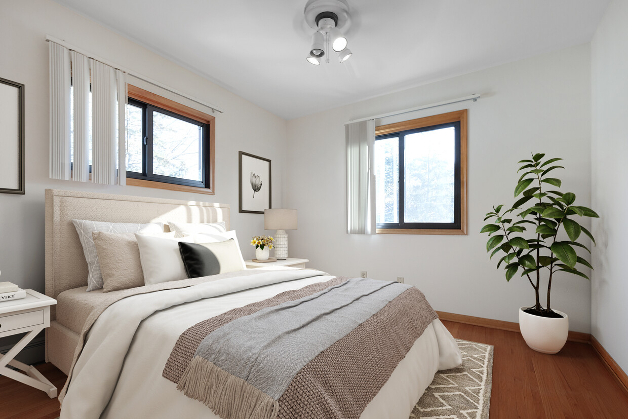
St. Clair Ave. has a small-town neighborhood feel with great dining, shopping, recreation and entertainment around every corner. Convenient access to downtown St. Paul and Minneapolis, numerous universities, parks, bus lines and running/biking paths along the Mississippi River. This apartment homes feature carpeted or hardwood floors in select units, ceiling fans, modern kitchen appliances, blinds and lots of closet space. There is off-street parking and a laundry facility at this property as well.
St. Clair Ave. has a small-town neighborhood feel with great dining, shopping, recreation and entertainment around every corner. Convenient access to downtown St. Paul and Minneapolis, numerous universities, parks, bus lines and running/biking paths along the Mississippi River. This apartment homes feature carpeted or hardwood floors in select units, ceiling fans, modern kitchen appliances, blinds and lots of closet space. There is off-street parking and a laundry facility at this property as well.
St. Clair Commons | 2016 is an apartment community located in Ramsey County and the 55105 ZIP Code. This area is served by the St. Paul Public attendance zone.
Macalester-Groveland, sometimes shortened to Mac-Grove, stretches from the eastern banks of the Mississippi River to Summit Hill. Mac-Grove is a largely residential neighborhood, touting an array of apartments and single-family homes available for rent.
The neighborhood contains the picturesque Summit Avenue Historic District, which boasts an impressive collection of Victorian-era homes between dense canopies of lush trees. One block south of Summit Avenue is the vibrant Grand Avenue, which is teeming with specialty shops, independent coffeehouses, and eclectic eateries.
Mac-Grove is famously convenient to multiple private colleges, including the University of Saint Thomas, Saint Catherine University, and Macalester College, making the neighborhood a top choice for many students, faculty, and staff. The community celebrates the start of the summer season every year with the annual Grand Old Day Festival.
Learn more about living in Macalester-Groveland| Colleges & Universities | Distance | ||
|---|---|---|---|
| Colleges & Universities | Distance | ||
| Walk: | 16 min | 0.9 mi | |
| Drive: | 4 min | 1.2 mi | |
| Drive: | 3 min | 1.2 mi | |
| Drive: | 5 min | 2.4 mi |


Transportation options available in Saint Paul include Fairview Ave Station, located 2.0 miles from St. Clair Commons | 2016. St. Clair Commons | 2016 is near Minneapolis-St Paul International/Wold-Chamberlain, located 5.9 miles or 13 minutes away.
| Transit / Subway | Distance | ||
|---|---|---|---|
| Transit / Subway | Distance | ||
| Drive: | 4 min | 2.0 mi | |
| Drive: | 5 min | 2.4 mi | |
| Drive: | 5 min | 2.9 mi | |
|
|
Drive: | 8 min | 3.5 mi |
|
|
Drive: | 8 min | 3.8 mi |
| Commuter Rail | Distance | ||
|---|---|---|---|
| Commuter Rail | Distance | ||
|
|
Drive: | 11 min | 6.5 mi |
|
|
Drive: | 16 min | 7.1 mi |
|
|
Drive: | 24 min | 15.7 mi |
|
|
Drive: | 34 min | 24.5 mi |
|
|
Drive: | 35 min | 26.1 mi |
| Airports | Distance | ||
|---|---|---|---|
| Airports | Distance | ||
|
Minneapolis-St Paul International/Wold-Chamberlain
|
Drive: | 13 min | 5.9 mi |
Time and distance from St. Clair Commons | 2016.
| Shopping Centers | Distance | ||
|---|---|---|---|
| Shopping Centers | Distance | ||
| Drive: | 3 min | 1.3 mi | |
| Drive: | 3 min | 1.3 mi | |
| Drive: | 4 min | 1.4 mi |
| Parks and Recreation | Distance | ||
|---|---|---|---|
| Parks and Recreation | Distance | ||
|
Macalester College Observatory
|
Drive: | 2 min | 1.2 mi |
|
Minnehaha Park
|
Drive: | 7 min | 2.7 mi |
|
Minnehaha Falls Pergola Garden
|
Drive: | 7 min | 2.8 mi |
|
Hiawatha School Park
|
Drive: | 7 min | 3.0 mi |
|
Longfellow Park
|
Drive: | 8 min | 3.2 mi |
| Hospitals | Distance | ||
|---|---|---|---|
| Hospitals | Distance | ||
| Drive: | 8 min | 4.3 mi | |
| Drive: | 9 min | 4.5 mi | |
| Drive: | 9 min | 5.4 mi |
| Military Bases | Distance | ||
|---|---|---|---|
| Military Bases | Distance | ||
| Drive: | 12 min | 4.7 mi |
$1,750 - $2,740
Total Monthly Price2-3 Beds
Pets Allowed Fitness Center In Unit Washer & Dryer Maintenance on site Controlled Access
$2,113 - $5,156
Total Monthly Price2 Beds
Pets Allowed Fitness Center Pool In Unit Washer & Dryer Walk-In Closets High-Speed Internet Controlled Access
$2,809 - $6,246
Total Monthly Price2 Beds
Pets Allowed Fitness Center Pool Dishwasher Refrigerator Clubhouse Maintenance on site
$2,361 - $3,361
Total Monthly Price2 Beds
Pets Allowed Fitness Center Pool In Unit Washer & Dryer Maintenance on site Stainless Steel Appliances Granite Countertops
What Are Walk Score®, Transit Score®, and Bike Score® Ratings?
Walk Score® measures the walkability of any address. Transit Score® measures access to public transit. Bike Score® measures the bikeability of any address.
What is a Sound Score Rating?
A Sound Score Rating aggregates noise caused by vehicle traffic, airplane traffic and local sources

2016 St Clair Ave
Saint Paul, MN 55105


