
Holden House
1554 Midway Pky,
Saint Paul, MN 55108
Studio - 2 Beds $1,477 - $2,450
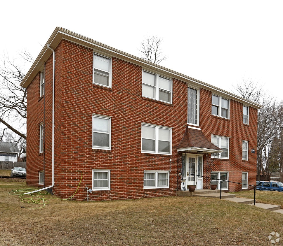
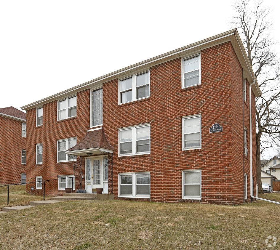
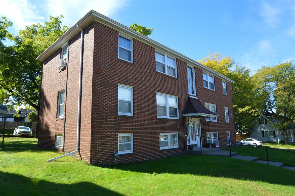
Find your new home at St. Clair Apartments. The 1994 St Clair Ave location in the Macalester-Groveland neighborhood of St. Paul is perfectly situated for work or play. The leasing team will assist you in finding your new place. Contact us or stop by today.
St. Clair Apartments is an apartment community located in Ramsey County and the 55105 ZIP Code. This area is served by the St. Paul Public attendance zone.
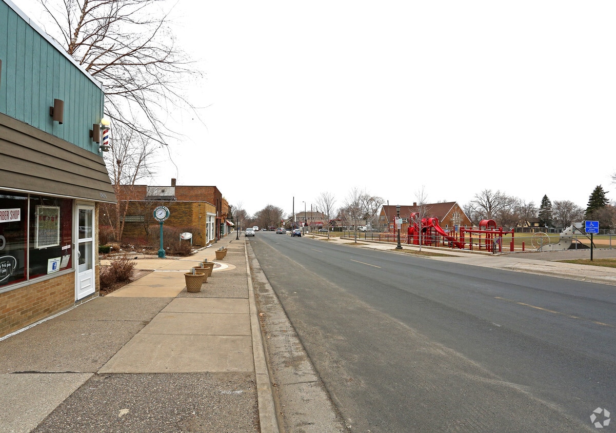
Macalester-Groveland, sometimes shortened to Mac-Grove, stretches from the eastern banks of the Mississippi River to Summit Hill. Mac-Grove is a largely residential neighborhood, touting an array of apartments and single-family homes available for rent.
The neighborhood contains the picturesque Summit Avenue Historic District, which boasts an impressive collection of Victorian-era homes between dense canopies of lush trees. One block south of Summit Avenue is the vibrant Grand Avenue, which is teeming with specialty shops, independent coffeehouses, and eclectic eateries.
Mac-Grove is famously convenient to multiple private colleges, including the University of Saint Thomas, Saint Catherine University, and Macalester College, making the neighborhood a top choice for many students, faculty, and staff. The community celebrates the start of the summer season every year with the annual Grand Old Day Festival.
Learn more about living in Macalester-Groveland| Colleges & Universities | Distance | ||
|---|---|---|---|
| Colleges & Universities | Distance | ||
| Walk: | 14 min | 0.8 mi | |
| Walk: | 17 min | 0.9 mi | |
| Drive: | 3 min | 1.2 mi | |
| Drive: | 5 min | 2.4 mi |


Transportation options available in Saint Paul include Fairview Ave Station, located 2.0 miles from St. Clair Apartments. St. Clair Apartments is near Minneapolis-St Paul International/Wold-Chamberlain, located 6.0 miles or 13 minutes away.
| Transit / Subway | Distance | ||
|---|---|---|---|
| Transit / Subway | Distance | ||
| Drive: | 4 min | 2.0 mi | |
| Drive: | 5 min | 2.4 mi | |
| Drive: | 5 min | 2.8 mi | |
|
|
Drive: | 8 min | 3.5 mi |
|
|
Drive: | 9 min | 3.9 mi |
| Commuter Rail | Distance | ||
|---|---|---|---|
| Commuter Rail | Distance | ||
|
|
Drive: | 11 min | 6.5 mi |
|
|
Drive: | 16 min | 7.2 mi |
|
|
Drive: | 24 min | 15.7 mi |
|
|
Drive: | 34 min | 24.5 mi |
|
|
Drive: | 35 min | 26.2 mi |
| Airports | Distance | ||
|---|---|---|---|
| Airports | Distance | ||
|
Minneapolis-St Paul International/Wold-Chamberlain
|
Drive: | 13 min | 6.0 mi |
Time and distance from St. Clair Apartments.
| Shopping Centers | Distance | ||
|---|---|---|---|
| Shopping Centers | Distance | ||
| Drive: | 3 min | 1.3 mi | |
| Drive: | 3 min | 1.4 mi | |
| Drive: | 4 min | 1.4 mi |
| Parks and Recreation | Distance | ||
|---|---|---|---|
| Parks and Recreation | Distance | ||
|
Macalester College Observatory
|
Drive: | 2 min | 1.2 mi |
|
Minnehaha Park
|
Drive: | 7 min | 2.8 mi |
|
Minnehaha Falls Pergola Garden
|
Drive: | 7 min | 2.9 mi |
|
Hiawatha School Park
|
Drive: | 7 min | 3.0 mi |
|
Longfellow Park
|
Drive: | 8 min | 3.3 mi |
| Hospitals | Distance | ||
|---|---|---|---|
| Hospitals | Distance | ||
| Drive: | 8 min | 4.3 mi | |
| Drive: | 9 min | 4.5 mi | |
| Drive: | 9 min | 5.4 mi |
| Military Bases | Distance | ||
|---|---|---|---|
| Military Bases | Distance | ||
| Drive: | 12 min | 4.7 mi |
What Are Walk Score®, Transit Score®, and Bike Score® Ratings?
Walk Score® measures the walkability of any address. Transit Score® measures access to public transit. Bike Score® measures the bikeability of any address.
What is a Sound Score Rating?
A Sound Score Rating aggregates noise caused by vehicle traffic, airplane traffic and local sources


