
Holden House
1554 Midway Pky,
Saint Paul, MN 55108
$1,395 - $2,395
Studio - 2 Beds
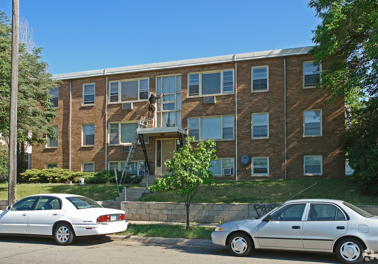
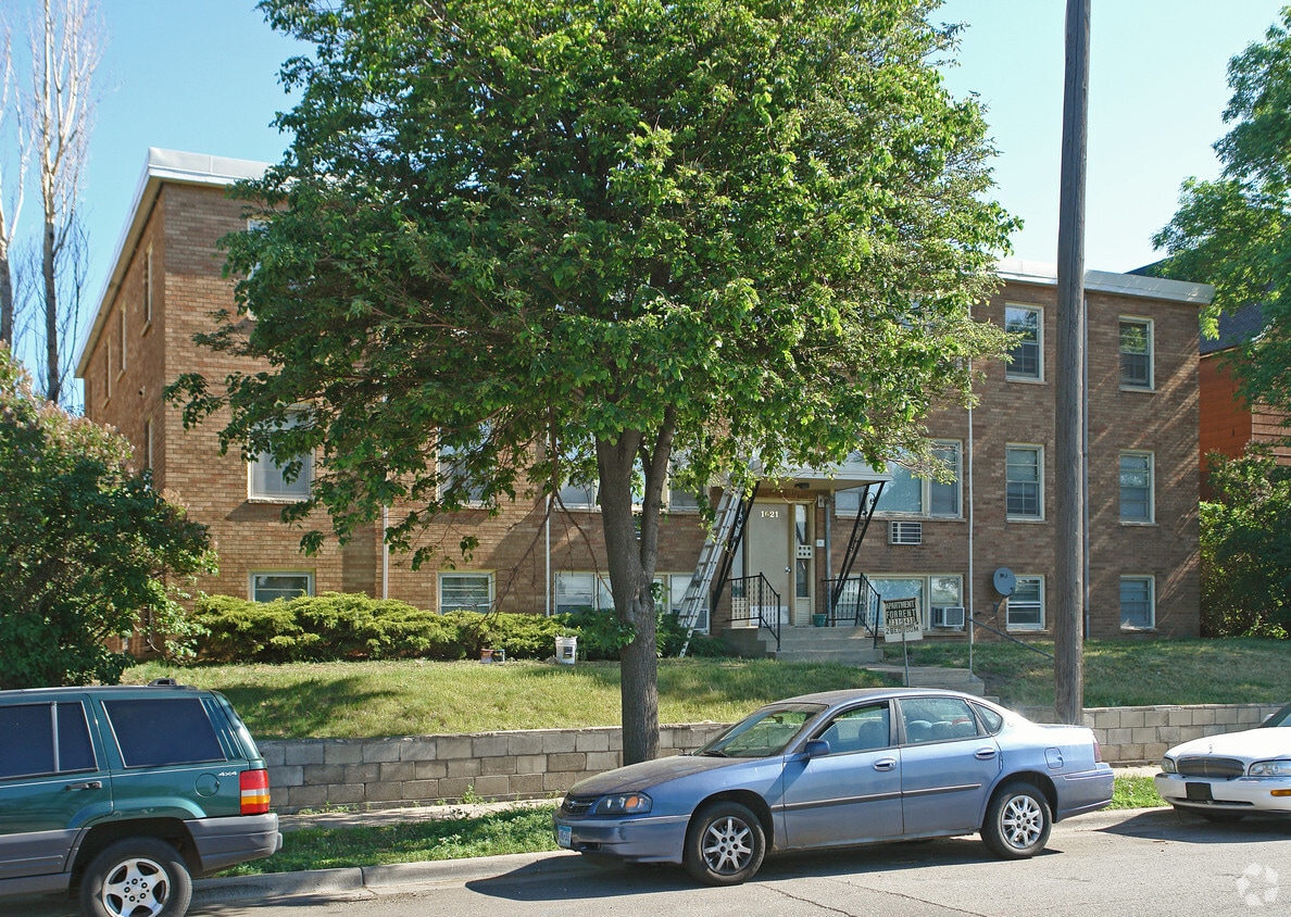

Find your new home at 1621 St Anthony Ave in St. Paul, MN. This property is situated in the Merriam Park East area of St. Paul. From pricing to features, the professional leasing team is excited to help you find your new place. It's time to love where you live. Stop by for a visit today.
1621 St Anthony Ave is an apartment community located in Ramsey County and the 55104 ZIP Code. This area is served by the St. Paul Public attendance zone.
Air Conditioning
Hardwood Floors
Double Pane Windows
Carpet
Apartments and condos in classic brick buildings welcome renters to the Merriam Park East neighborhood of Saint Paul. With the University of Minnesota just beyond Merriam Park East's borders, this community is popular with students and faculty. Interstate 94 cuts conveniently through the neighborhood, connecting residents to Minneapolis, two miles to the west, or Saint Paul, two miles to the east.
Residents of Merriam Park East find abundant shopping opportunities at local malls and up and down Marshall Boulevard, while the Town and Country Club to the west beckons golfers. The winding Mississippi River, less than a mile away, provides beautiful walking and jogging opportunities.
Learn more about living in Merriam Park East| Colleges & Universities | Distance | ||
|---|---|---|---|
| Colleges & Universities | Distance | ||
| Drive: | 3 min | 1.2 mi | |
| Drive: | 3 min | 1.4 mi | |
| Drive: | 5 min | 1.4 mi | |
| Drive: | 5 min | 2.1 mi |


Transportation options available in Saint Paul include Snelling Ave Station, located 0.4 mile from 1621 St Anthony Ave. 1621 St Anthony Ave is near Minneapolis-St Paul International/Wold-Chamberlain, located 7.7 miles or 16 minutes away.
| Transit / Subway | Distance | ||
|---|---|---|---|
| Transit / Subway | Distance | ||
| Walk: | 6 min | 0.4 mi | |
| Walk: | 13 min | 0.7 mi | |
| Walk: | 14 min | 0.8 mi | |
| Drive: | 3 min | 1.4 mi | |
| Drive: | 5 min | 1.9 mi |
| Commuter Rail | Distance | ||
|---|---|---|---|
| Commuter Rail | Distance | ||
|
|
Drive: | 9 min | 4.9 mi |
|
|
Drive: | 14 min | 6.9 mi |
|
|
Drive: | 23 min | 15.5 mi |
|
|
Drive: | 32 min | 24.3 mi |
|
|
Drive: | 34 min | 26.0 mi |
| Airports | Distance | ||
|---|---|---|---|
| Airports | Distance | ||
|
Minneapolis-St Paul International/Wold-Chamberlain
|
Drive: | 16 min | 7.7 mi |
Time and distance from 1621 St Anthony Ave.
| Shopping Centers | Distance | ||
|---|---|---|---|
| Shopping Centers | Distance | ||
| Walk: | 10 min | 0.5 mi | |
| Walk: | 11 min | 0.6 mi | |
| Drive: | 3 min | 1.4 mi |
| Parks and Recreation | Distance | ||
|---|---|---|---|
| Parks and Recreation | Distance | ||
|
Macalester College Observatory
|
Drive: | 3 min | 1.4 mi |
|
Newell Park
|
Drive: | 4 min | 1.5 mi |
|
Como Park
|
Drive: | 6 min | 2.7 mi |
|
Marjorie McNeely Conservatory
|
Drive: | 8 min | 3.0 mi |
|
The Raptor Center - University of Minnesota
|
Drive: | 9 min | 3.2 mi |
| Hospitals | Distance | ||
|---|---|---|---|
| Hospitals | Distance | ||
| Drive: | 7 min | 3.8 mi | |
| Drive: | 8 min | 3.9 mi | |
| Drive: | 8 min | 4.3 mi |
| Military Bases | Distance | ||
|---|---|---|---|
| Military Bases | Distance | ||
| Drive: | 15 min | 6.5 mi |
What Are Walk Score®, Transit Score®, and Bike Score® Ratings?
Walk Score® measures the walkability of any address. Transit Score® measures access to public transit. Bike Score® measures the bikeability of any address.
What is a Sound Score Rating?
A Sound Score Rating aggregates noise caused by vehicle traffic, airplane traffic and local sources

1621 St Anthony Ave
Saint Paul, MN 55104


