-
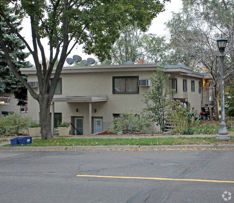
1006 Randolph Ave
-
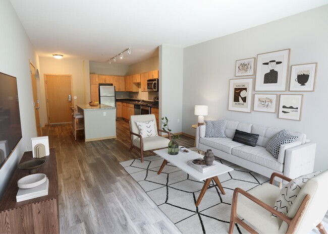
Primary Photo
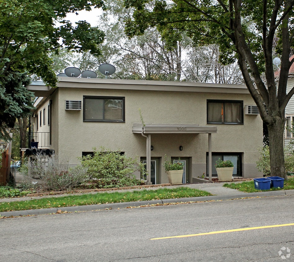
1006 Randolph Ave
1006 Randolph Ave,
Saint Paul,
MN
55102
2 Weeks Ago
Favorites
1006 Randolph Ave
Favorites
No Unit Information Available for this Listing
Fees and Policies
Details
Property Information
-
Built in 1959
-
7 units/2 stories
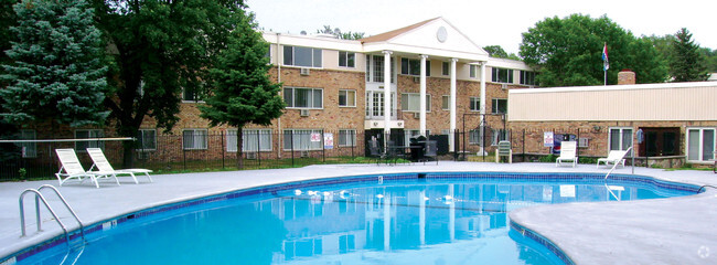
About 1006 Randolph Ave
Discover your new place at 1006 Randolph Ave in St. Paul, MN. You'll find this community in the West Seventh area of St. Paul. The professional leasing staff is eager for your visit. Contact us or stop by today.
1006 Randolph Ave is an apartment community located in Ramsey County and the 55102 ZIP Code. This area is served by the St. Paul Public attendance zone.
Location
Get Directions
Often referred to as the “West End,” West Seventh is a convenient neighborhood located on the Riverview Corridor transit system, making travel to Downtown Saint Paul, the Minneapolis-Saint Paul Airport, and the Mall of America simple for locals.
Residents of West Seventh enjoy direct access to Interstate 35E and Xcel Energy Center. There are a plethora of amenities and attractions along the Mississippi River – from parks to historic landmarks and the High Bridge Dog Park.
Many of West Seventh’s restaurants are found along 7th Street West, like Bad Weather Brewing Company, Cossetta’s, and JR Mac’s Bar & Grill. Residents adore the proximity to the airport, and Saint Paul attractions and shopping.
Learn more about living in West Seventh
Education
| Colleges & Universities | Distance | ||
|---|---|---|---|
| Colleges & Universities | Distance | ||
| Drive: | 4 min | 2.0 mi | |
| Drive: | 6 min | 2.2 mi | |
| Drive: | 5 min | 2.2 mi | |
| Drive: | 6 min | 3.1 mi |
1006 Randolph Ave is within 4 minutes or 2.0 miles from Macalester College. It is also near Concordia Univ.-Saint Paul and St. Catherine University.
Schools


Public Elementary School
Grades PK-5
438 Students
Attendance Zone
Public Middle School
Grades 6-8
805 Students
Attendance Zone
Public High School
Grades 9-12
1,390 Students
Attendance Zone
Private Elementary & Middle School
Grades K-8
77 Students
Nearby
Private Elementary School
Grades PK-3
19 Students
Nearby
Private High School
Grades 9-12
1,220 Students
Nearby
School data provided by
 The GreatSchools Rating helps parents compare schools within a state based on a variety of school quality indicators and provides a helpful picture of how effectively each school serves all of its students. Ratings are on a scale of 1 (below average) to 10 (above average) and can include test scores, college readiness, academic progress, advanced courses, equity, discipline and attendance data. We also advise parents to visit schools, consider other information on school performance and programs, and consider family needs as part of the school selection process.
View GreatSchools Rating Methodology
View GreatSchools Rating Methodology
Transportation options available in Saint Paul include Lexington Pkwy Station, located 2.3 miles from 1006 Randolph Ave. 1006 Randolph Ave is near Minneapolis-St Paul International/Wold-Chamberlain, located 6.1 miles or 12 minutes away.
| Transit / Subway | Distance | ||
|---|---|---|---|
| Transit / Subway | Distance | ||
| Drive: | 5 min | 2.3 mi | |
| Drive: | 5 min | 2.6 mi | |
| Drive: | 6 min | 3.1 mi | |
| Drive: | 7 min | 3.1 mi | |
| Drive: | 6 min | 3.2 mi |
| Commuter Rail | Distance | ||
|---|---|---|---|
| Commuter Rail | Distance | ||
|
|
Drive: | 7 min | 3.7 mi |
| Drive: | 19 min | 9.5 mi | |
| Drive: | 26 min | 19.2 mi | |
| Drive: | 36 min | 27.8 mi | |
| Drive: | 38 min | 29.4 mi |
| Airports | Distance | ||
|---|---|---|---|
| Airports | Distance | ||
|
Minneapolis-St Paul International/Wold-Chamberlain
|
Drive: | 12 min | 6.1 mi |
Time and distance from 1006 Randolph Ave.
| Shopping Centers | Distance | ||
|---|---|---|---|
| Shopping Centers | Distance | ||
| Drive: | 3 min | 1.6 mi | |
| Drive: | 3 min | 1.6 mi | |
| Drive: | 3 min | 1.7 mi |
1006 Randolph Ave has 3 shopping centers within 1.7 miles, which is about a 3-minute drive. The miles and minutes will be for the farthest away property.
| Parks and Recreation | Distance | ||
|---|---|---|---|
| Parks and Recreation | Distance | ||
|
Highland Park and Golf Course
|
Drive: | 2 min | 1.3 mi |
|
Macalester College Observatory
|
Drive: | 4 min | 2.0 mi |
|
Irvine Park
|
Drive: | 5 min | 2.5 mi |
|
Crosby Farm Regional Park
|
Drive: | 6 min | 3.4 mi |
|
Cherokee Regional Park
|
Drive: | 8 min | 3.8 mi |
1006 Randolph Ave has 5 parks within 3.8 miles, including Highland Park and Golf Course, Macalester College Observatory, and Irvine Park.
| Hospitals | Distance | ||
|---|---|---|---|
| Hospitals | Distance | ||
| Drive: | 4 min | 2.2 mi | |
| Drive: | 5 min | 2.9 mi | |
| Drive: | 6 min | 3.4 mi |
1006 Randolph Ave has 3 hospitals within 3.4 miles, the nearest is Allina United Hospital which is 2.2 miles away and a 4 minute drive.
| Military Bases | Distance | ||
|---|---|---|---|
| Military Bases | Distance | ||
| Drive: | 11 min | 4.9 mi |
1006 Randolph Ave is 4.9 miles and a 11 minute drive from Fort Snelling Military Reservation.
You May Also Like
Similar Rentals Nearby


What Are Walk Score®, Transit Score®, and Bike Score® Ratings?
Walk Score® measures the walkability of any address. Transit Score® measures access to public transit. Bike Score® measures the bikeability of any address.
What is a Sound Score Rating?
A Sound Score Rating aggregates noise caused by vehicle traffic, airplane traffic and local sources
Responded To This Review