
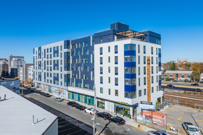
43 Mount Pleasant Ave
43 Mount Pleasant Ave,
Boston,
MA
02119
2 Weeks Ago
Favorites
43 Mount Pleasant Ave
Favorites
Check Back Soon for Upcoming Availability
| Beds | Baths | Average SF | Availability |
|---|---|---|---|
| 3 Bedrooms 3 Bedrooms 3 Br | 2.5 Baths 2.5 Baths 2.5 Ba | 650 SF | Not Available |
Fees and Policies
Details
Property Information
-
Built in 1969
-
4 units/3 stories
About 43 Mount Pleasant Ave Boston, MA 02119
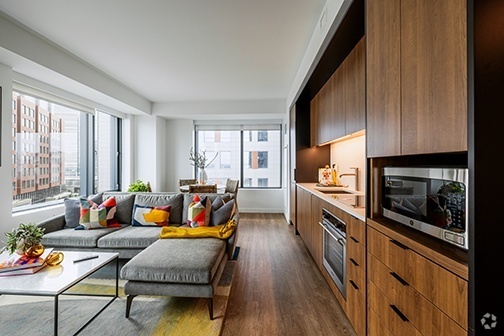
43 Mount Pleasant Ave offers a mixture of comfort and quality. This community is located in the Lower Roxbury area of Boston. The leasing team is ready to show off our wonderful community. Stop by the leasing office to talk about renting your new apartment.
43 Mount Pleasant Ave is an apartment community located in Suffolk County and the 02119 ZIP Code. This area is served by the Boston Public Schools attendance zone.
Location
Get Directions
Situated between the South End and Dudley Square, Lower Roxbury is a predominantly residential neighborhood brimming with apartments and town houses available for rent. Residents enjoy a walkable urban environment filled with diverse historical architecture.
Warren Street and Washington Street are the neighborhood’s main commercial thoroughfares, touting rows of specialty shops, markets, and eateries in historic buildings. Northeastern University, Wentworth Institute of Technology, and Massachusetts College of Art and Design are all just northwest of Lower Roxbury, offering the community a bevy of cultural and educational amenities. Getting around from Lower Roxbury is easy with access to multiple T stops on the Orange Line.
Learn more about living in Lower RoxburyBelow are rent ranges for similar nearby apartments
| Beds | Average Size | Lowest | Typical | Premium |
|---|---|---|---|---|
| Studio Studio Studio | 5188 Sq Ft | $1,800 | $2,118 | $2,709 |
| 1 Bed 1 Bed 1 Bed | 4614-4619 Sq Ft | $1,900 | $2,447 | $3,699 |
| 2 Beds 2 Beds 2 Beds | 3799-3800 Sq Ft | $2,200 | $3,339 | $8,700 |
| 3 Beds 3 Beds 3 Beds | 5058 Sq Ft | $1,075 | $4,330 | $7,400 |
| 4 Beds 4 Beds 4 Beds | 6541 Sq Ft | $1,150 | $5,252 | $9,000 |
Education
| Colleges & Universities | Distance | ||
|---|---|---|---|
| Colleges & Universities | Distance | ||
| Drive: | 3 min | 1.4 mi | |
| Drive: | 3 min | 1.6 mi | |
| Drive: | 5 min | 1.7 mi | |
| Drive: | 4 min | 1.7 mi |
43 Mount Pleasant Ave is within 5 minutes or 1.7 miles from Northeastern University. It is also near Wentworth Inst. of Technology and MCPHS University, Boston.
Schools


Public Elementary & Middle School
Grades PK-8
724 Students
Attendance Zone
Charter Elementary School
Grades PK-5
278 Students
Attendance Zone
Public Middle & High School
Grades 7-12
1,567 Students
Attendance Zone
Public Middle School
Grades 6-8
205 Students
Attendance Zone
Charter High School
Grades 9-10 & 12
321 Students
Attendance Zone
Public High School
Grades 9-12
1,087 Students
Attendance Zone
Private Elementary School
Grades PK-6
128 Students
Nearby
Private Middle & High School
Grades 7-12
292 Students
Nearby
School data provided by
 The GreatSchools Rating helps parents compare schools within a state based on a variety of school quality indicators and provides a helpful picture of how effectively each school serves all of its students. Ratings are on a scale of 1 (below average) to 10 (above average) and can include test scores, college readiness, academic progress, advanced courses, equity, discipline and attendance data. We also advise parents to visit schools, consider other information on school performance and programs, and consider family needs as part of the school selection process.
View GreatSchools Rating Methodology
View GreatSchools Rating Methodology
Transportation options available in Boston include Roxbury Crossing Station, located 1.0 miles from 43 Mount Pleasant Ave. 43 Mount Pleasant Ave is near General Edward Lawrence Logan International, located 5.6 miles or 11 minutes away.
| Transit / Subway | Distance | ||
|---|---|---|---|
| Transit / Subway | Distance | ||
|
|
Walk: | 20 min | 1.0 mi |
|
|
Drive: | 3 min | 1.4 mi |
|
|
Drive: | 3 min | 1.5 mi |
|
|
Drive: | 4 min | 1.6 mi |
|
|
Drive: | 4 min | 1.7 mi |
| Commuter Rail | Distance | ||
|---|---|---|---|
| Commuter Rail | Distance | ||
| Walk: | 18 min | 1.0 mi | |
|
|
Walk: | 20 min | 1.1 mi |
|
|
Drive: | 4 min | 1.7 mi |
|
|
Drive: | 7 min | 2.2 mi |
|
|
Drive: | 6 min | 2.6 mi |
| Airports | Distance | ||
|---|---|---|---|
| Airports | Distance | ||
|
General Edward Lawrence Logan International
|
Drive: | 11 min | 5.6 mi |
Time and distance from 43 Mount Pleasant Ave.
| Shopping Centers | Distance | ||
|---|---|---|---|
| Shopping Centers | Distance | ||
| Walk: | 14 min | 0.8 mi | |
| Drive: | 3 min | 1.4 mi | |
| Drive: | 4 min | 1.8 mi |
43 Mount Pleasant Ave has 3 shopping centers within 1.8 miles, which is about a 4-minute walk. The miles and minutes will be for the farthest away property.
| Parks and Recreation | Distance | ||
|---|---|---|---|
| Parks and Recreation | Distance | ||
|
Roxbury Heritage State Park
|
Walk: | 14 min | 0.7 mi |
|
Lower Neponset River Trail
|
Drive: | 4 min | 1.9 mi |
|
Franklin Park Zoo
|
Drive: | 4 min | 2.2 mi |
|
Boston Public Garden
|
Drive: | 6 min | 2.5 mi |
|
Charles River Reservation
|
Drive: | 6 min | 2.9 mi |
43 Mount Pleasant Ave has 5 parks within 2.9 miles, including Roxbury Heritage State Park, Lower Neponset River Trail, and Franklin Park Zoo.
| Hospitals | Distance | ||
|---|---|---|---|
| Hospitals | Distance | ||
| Walk: | 13 min | 0.7 mi | |
| Walk: | 16 min | 0.9 mi | |
| Drive: | 4 min | 1.7 mi |
43 Mount Pleasant Ave has 3 hospitals within 1.7 miles, the nearest is Boston Medical Center which is 0.7 mile away and a 13 minute walk.
| Military Bases | Distance | ||
|---|---|---|---|
| Military Bases | Distance | ||
| Drive: | 32 min | 16.9 mi |
43 Mount Pleasant Ave is 16.9 miles and a 32 minute drive from Hanscom Air Force Base.
You May Also Like
What neighborhood is the property located in?
43 Mount Pleasant Ave Boston, MA 02119 is in Lower Roxbury in the city of Boston. Here you’ll find three shopping centers within 1.8 miles of the property. Five parks are within 2.9 miles, including Roxbury Heritage State Park, Lower Neponset River Trail, and Franklin Park Zoo.
Similar Rentals Nearby


What Are Walk Score®, Transit Score®, and Bike Score® Ratings?
Walk Score® measures the walkability of any address. Transit Score® measures access to public transit. Bike Score® measures the bikeability of any address.
What is a Sound Score Rating?
A Sound Score Rating aggregates noise caused by vehicle traffic, airplane traffic and local sources
43 Mount Pleasant Ave
Boston, MA 02119
Responded To This Review