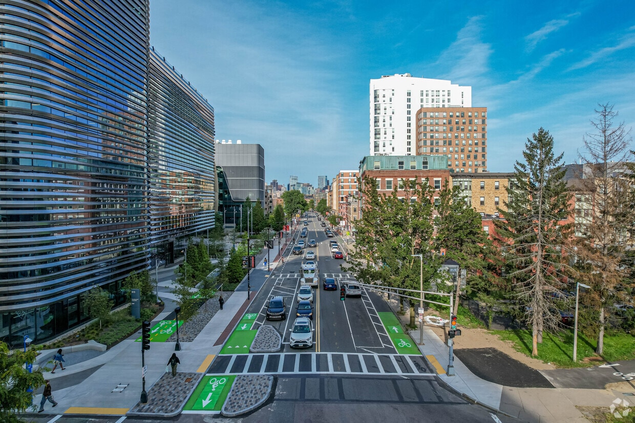
In Lower Roxbury you can see people walking and biking throughout the town.
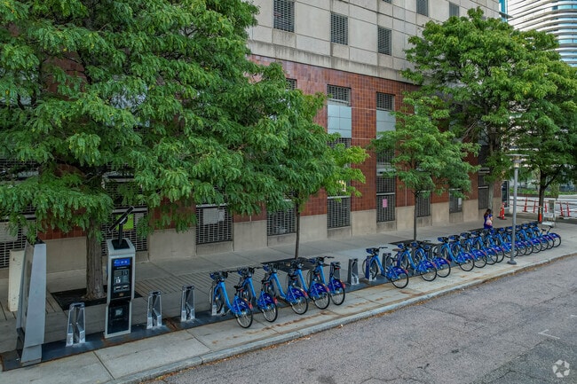
Blue bike stations can also be found in Lower Roxbury.
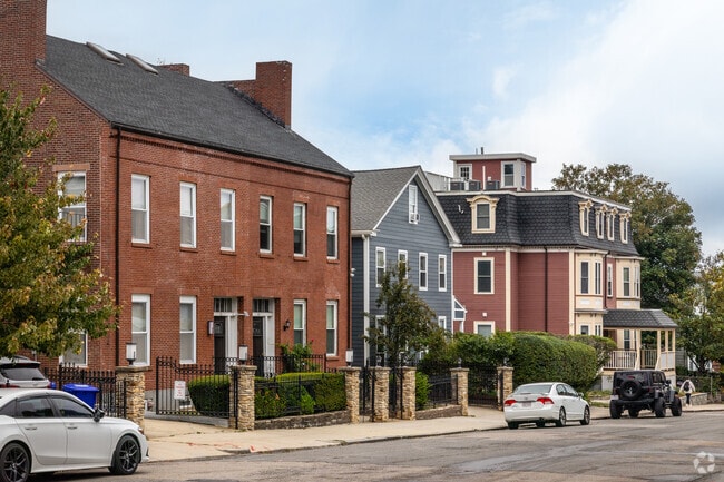
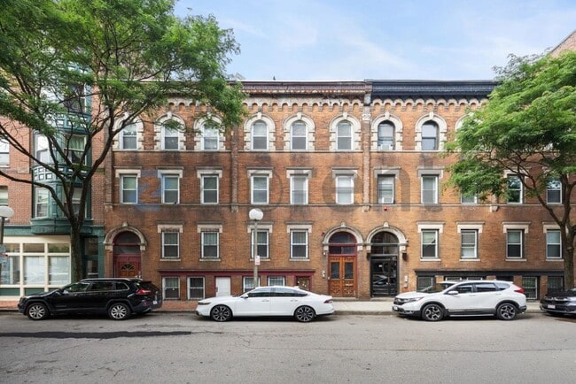
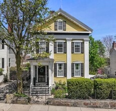
A variety of historic styles can be found throughout Lower Roxbury.
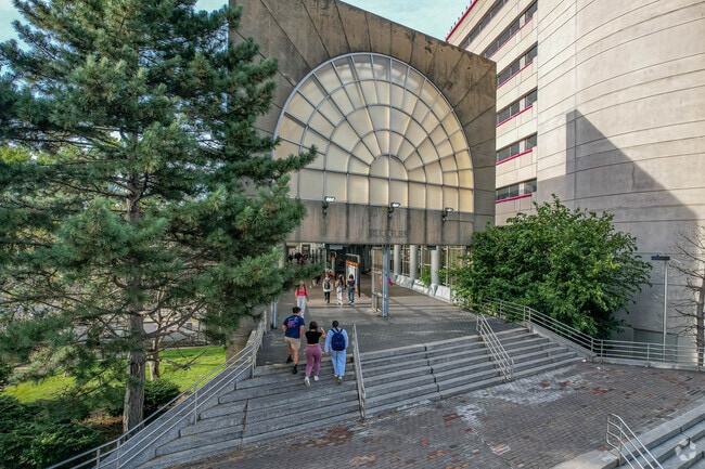
Ruggles Station is one of the many nearby train stations in Lower Roxbury.
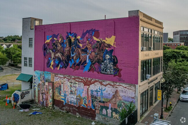
Lower Roxbury features several large murals.

Area Guide

Lower Roxbury Boston, MA

Urban convenience in the heart of South Boston

Urban Historic Walkable

Lower Roxbury carries a quiet confidence that sets it apart from Boston's busier, more tourist-trafficked districts. Positioned between the South End and greater Roxbury, this historically rooted neighborhood draws renters who want genuine city living without the noise of a commercial center. Tremont Street runs through its core, and the Southwest Corridor Park borders the area, offering green space woven into everyday commutes.

Boston Medical Center anchors the neighborhood's eastern edge, bringing steady institutional presence and making it a practical base for those connected to the city's healthcare sector. Northeastern University's campus sits close by, adding an academic presence to the surrounding streets.

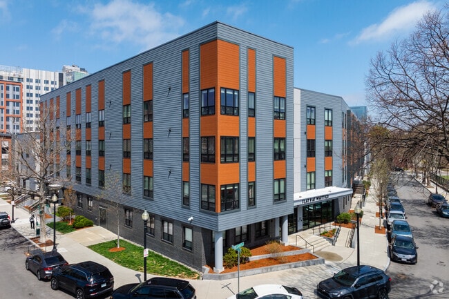
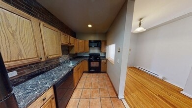
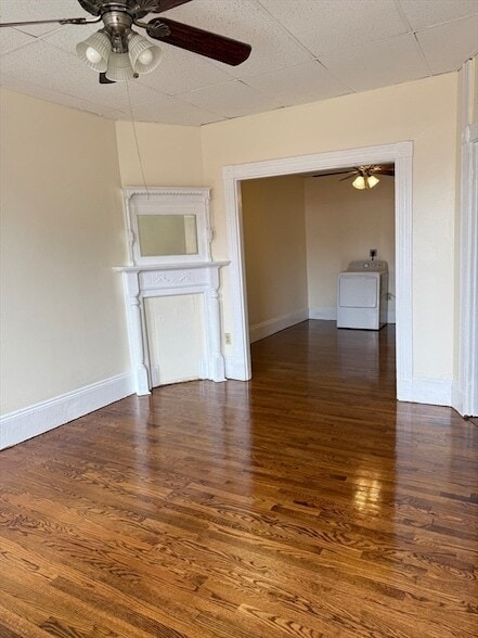
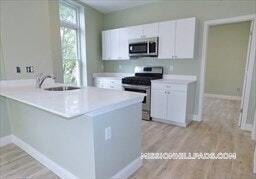
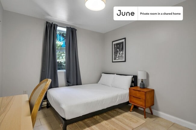
The housing stock reflects decades of layered development. Victorian-era row houses line many of the side streets, their brick facades and bay windows speaking to the neighborhood's 19th-century roots. Alongside them, newer mixed-income apartment communities and mixed-use buildings offer contemporary living options without erasing the area's architectural character. Renters can find everything from compact units in converted row houses to recently built apartment communities with updated finishes.

Nubian Square, historically known as Dudley Square, sits nearby and serves as a commercial and cultural anchor for the broader Roxbury community. With a Walk Score of 100 and strong MBTA access, Lower Roxbury keeps Downtown Boston and the rest of the city within easy reach.

Explore the Neighborhood

A variety of historic styles can be found throughout Lower Roxbury.

Ruggles Station is one of the many nearby train stations in Lower Roxbury.

Lower Roxbury features several large murals.

Southwest Corridor Park lets Lower Roxbury residents commute by foot or on wheels.

Historic Nubian Square in Lower Roxbury has many shops and dining options to choose from.

Unique duplexes and creative colors make each house unique and full of character in Lower Roxbury.

Rent Trends

As of August 2026, the average apartment rent in Lower Roxbury is $2,414 for a studio, $2,671 for one bedroom, $3,130 for two bedrooms, and $3,743 for three bedrooms. Apartment rent in Lower Roxbury has decreased by -0.7% in the past year.

  • Studio

  • 473 sq ft

    Average Sq Ft

  • $2,414/month

    Average Rent

  • 1 BR

  • 671 sq ft

    Average Sq Ft

  • $2,671/month

    Average Rent

  • 2 BR

  • 856 sq ft

    Average Sq Ft

  • $3,130/month

    Average Rent

  • 3 BR

  • 625 sq ft

    Average Sq Ft

  • $3,743/month

    Average Rent

Learn More About Lower Roxbury

Getting Around

Exceptionally Walkable

Walkability

100 / 100

Exceptional Public Transit

Transit

100 / 100

Fairly Drivable

Drivability

40 / 100

Very Bikeable

Bikeability

80 / 100

Daily Essentials

Supermarket Within a 5 Minute Walk

Groceries

90 / 100

Exceptional Restaurant Variety Nearby

Restaurants

90 / 100

Exceptional Café Variety Nearby

Cafes

100 / 100

Exceptional Variety of Shops Nearby

Shopping

90 / 100

Recreation

Exceptional Amount of Park Space Nearby

Parks

100 / 100

Exceptional Wellness Amenity Variety Nearby

Wellness

90 / 100

Local Vibe

Highly Vibrant Atmosphere

Vibrancy

80 / 100

Exceptional Nightlife Variety Nearby

Nightlife

90 / 100

Somewhat Noisy

Quiet Score

80 / 100

Points of Interest

Parks and Recreation

  • Roxbury Heritage State Park
  • Lower Neponset River Trail
  • Franklin Park Zoo
  • Boston Public Garden
  • Charles River Reservation

Airports

  • General Edward Lawrence Logan International

Top Apartments in Lower Roxbury

Houses for Rent in Lower Roxbury

Living in Lower Roxbury

History

-

Lower Roxbury sits within one of Boston's most historically layered corridors, where 19th-century brick row houses and bay-windowed facades reflect the neighborhood's Victorian-era development. The area developed as part of the broader Roxbury district, which was an independent town before being annexed by Boston in 1868. That deep civic history remains visible in the built environment: original brownstone-fronted row houses line residential side streets, and the Southwest Corridor Park, built on the former right-of-way of a canceled highway project, now threads green space through the neighborhood.

The nearby Nubian Square, historically known as Dudley Square, has served as a commercial and civic center for Roxbury for well over a century and still anchors the area's cultural identity. Roxbury Heritage State Park preserves the Dillaway-Thomas House, a colonial-era landmark that offers a tangible connection to the neighborhood's pre-Revolutionary past. Boston Medical Center, which traces its roots to City Hospital founded in 1864, continues to shape the eastern edge of the neighborhood, and its historic brick buildings stand alongside newer medical facilities as evidence of the area's long institutional presence.

Restaurants

-

Lower Roxbury sits at a crossroads of culinary traditions shaped by the neighborhood's diverse community. The area's proximity to Nubian Square, the historic commercial hub of Roxbury, puts residents within easy reach of Caribbean, West African, and soul food dining options that reflect the community's cultural roots. Tremont Street and its surrounding corridors connect to the South End's broader dining landscape, where contemporary American kitchens and globally influenced menus line the stretch toward Back Bay. Boston Medical Center's presence draws a range of casual lunch spots and neighborhood eateries, and with a perfect Walk Score, residents can access dozens of dining options on foot or with a short ride on the Orange Line.

Transportation

-

Lower Roxbury is well-positioned for getting around Boston with or without a car. The Orange Line runs along the neighborhood's western edge via the Southwest Corridor, with easy access to Ruggles Station connecting residents to Back Bay, Downtown Crossing, and points south toward Jamaica Plain. Several MBTA bus routes serve the area along Tremont and Washington Streets, and the Southwest Corridor Park doubles as a dedicated walking and cycling path that links the neighborhood to the South End and beyond without mixing with traffic. Drivers can reach the Massachusetts Turnpike (I-90) and I-93 within minutes, and Logan International Airport is roughly 13 minutes away by car or accessible by transit with an Orange Line transfer to the Blue Line. The neighborhood's Walk Score of 100 means most daily errands are easily handled on foot.

Parks

-

The Southwest Corridor Park runs directly through Lower Roxbury, weaving about 4.7 miles of paved paths, community gardens, and open lawn through the neighborhood as it follows the Orange Line corridor between Back Bay and Jamaica Plain. The linear greenway offers space for walking, jogging, and cycling, and connects residents to surrounding neighborhoods without requiring a car. Roxbury Heritage State Park, a short distance away, preserves the colonial-era Dillaway-Thomas House and provides a quiet outdoor setting with historical depth. Franklin Park, the largest park in the Olmsted-designed Emerald Necklace system, is roughly a five-minute drive and features a golf course, athletic fields, tennis courts, and the Franklin Park Zoo across more than 500 acres.

Cost

-

Lower Roxbury generally offers more accessible rent levels compared to some of Boston's priciest neighborhoods, though it remains part of a city where overall costs run well above national norms. Boston's cost of living sits roughly 48 percent higher than the national average, with housing costs the primary driver. In Lower Roxbury, average rents range from approximately $2,987 for a studio to $3,637 for a one-bedroom, $4,551 for a two-bedroom, and $5,961 for a three-bedroom. The neighborhood's housing mix — Victorian row houses alongside newer mixed-income and mixed-use buildings — means options vary in size, finish level, and price point across the area.

Shopping

-

Shopping in Lower Roxbury centers on the neighborhood's connection to Nubian Square, the historic commercial hub of Roxbury that has anchored local retail and community commerce for well over a century. The square hosts independent retailers, beauty supply shops, and small businesses that reflect the area's cultural roots, and it continues to draw investment and renewed attention as a destination for locally owned commerce. Tremont Street links the neighborhood to the South End's walkable retail corridor, where storefronts and small shops extend toward Back Bay. For everyday needs, residents also have easy access to corridors along Washington Street, and the broader Orange Line network puts Downtown Crossing's pedestrian shopping district within a short ride.

Highlights

-

Lower Roxbury offers a grounded urban setting where Victorian row houses, the Southwest Corridor Park, and direct Orange Line access to Downtown Boston come together in one walkable corridor. With Boston Medical Center nearby, Nubian Square's local commerce within reach, and a perfect Walk Score, it delivers practical city living rooted in one of Boston's most historically significant districts.

Search Nearby Rentals

Methodology

† Our analysis of utilities, groceries, transportation, healthcare, home prices, and other goods and services is sourced from the Cost of Living Index, a respected benchmark published by the Council for Community and Economic Research (C2ER) that provides a thorough overview of living expenses across different regions.

Rent data is provided by CoStar Group’s Market Trend reports. As the industry leader in commercial real estate information, analytics, and news, CoStar conducts extensive research to produce and maintain a comprehensive database of commercial real estate information. We combine this data with public record to provide the most up-to-date rental information available.

Consumer goods, services, and home prices are sourced from the Cost of Living Index published by the Council for Community and Economic Research (C2ER). The data on this page is updated quarterly. It was last published in June 2026.

Demographic information comes from Neustar and combines detailed address data with U.S. Census and American Community Survey statistics to produce reliable local estimates.