$3,300 / Month
2489 Washington St Unit 2A
Boston, MA 02119
Today
Favorites
857-308-8224
-
Bedrooms
2
-
Bathrooms
2
-
Square Feet
1,150 sq ft
-
Available
Available Now
Highlights
- Deck
- Property is near public transit
- Intercom
- Cooling Available
- Park
- Level Entry For Accessibility
2489 Washington St Unit 2A

Favorites
About This Home
$3,300 deposit,
Available Now
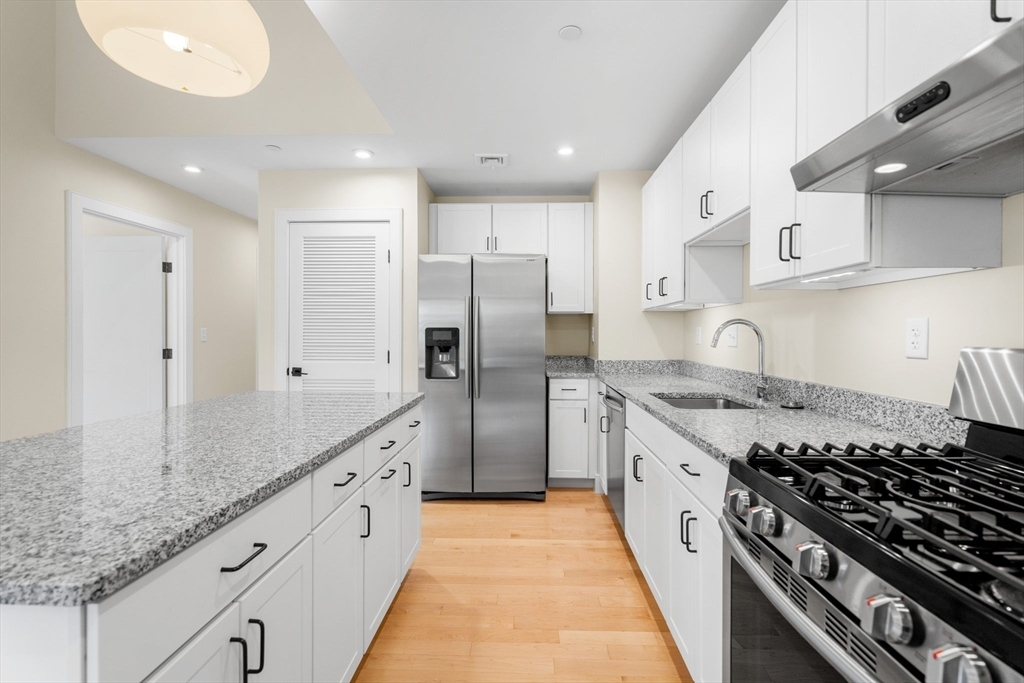
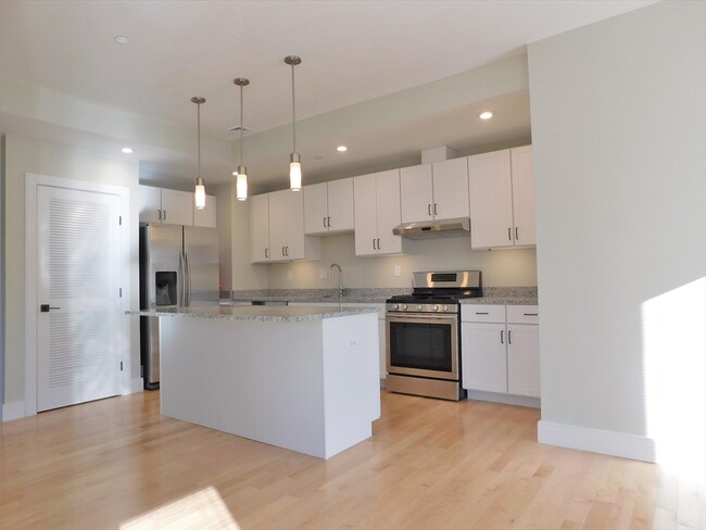
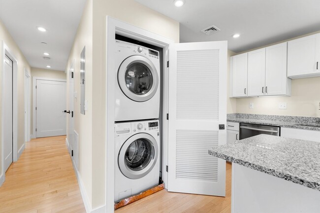
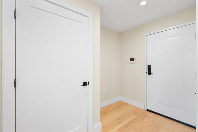
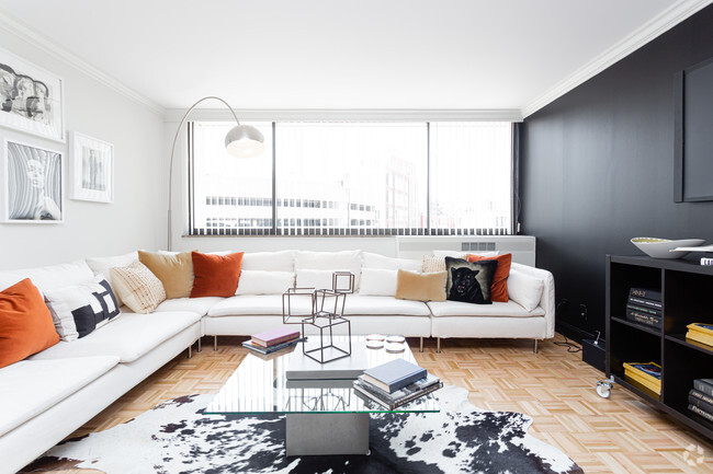
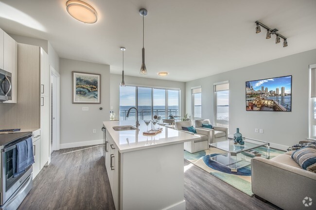
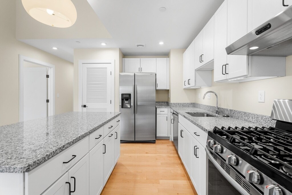
Introducing a 2 bedroom 2 bathroom modern apartment in a newer building equipped with a Dunkin Donuts-Bistro restaurant,an elevator,mini gym,and common roof deck with furniture,grill and planters! There's easy access to Dudley Square/Silver Line,Boston Medical Center,Northeastern University,Roxbury Crossing T Station (Orange Line),cafes,restaurants,South Bay Shopping Center and Downtown Boston. This spacious 2 bedroom 2 bath unit has hardwood flooring throughout,recessed and decorative lighting,a stylish kitchen with island,IN-UNIT laundry,a primary-ensuite and accommodating open-concept design. First month's rent,full month security deposit and broker fee required by tenant. No pets or smoking. No off-street parking included. Available June 1.
2489 Washington St is an apartment community located in Suffolk County and the 02119 ZIP Code.
* Price shown is base rent and may not include non-optional fees and utilities.
Price, availability, fees, and any applicable rent special are subject to change without notice.
* Square footage definitions vary. Displayed square footage is approximate.
Home Details
Year Built
Built in 2017
Accessible Home Design
Level Entry For Accessibility
Entry on the 2nd floor
Bedrooms and Bathrooms
2 Full Bathrooms
2 Bedrooms
Home Design
Apartment
Home Security
Intercom
Interior Spaces
1-Story Property
1,150 Sq Ft Home
Laundry
Laundry in unit
Listing and Financial Details
Security Deposit $3,300
Property Available on 8/1/25
Assessor Parcel Number 5009261
Rent includes water, sewer, trash collection, recreational facilities, gardener
Location
Property is near public transit
Property is near schools
Lot Details
9,700 Sq Ft Lot
Outdoor Features
Deck
Utilities
Cooling Available
Central Heating
Community Details
Amenities
Shops
Coin Laundry
Common Area
Overview
No Home Owners Association
Pet Policy
No Pets Allowed
Recreation
Park
Fees and Policies
The fees below are based on community-supplied data and may exclude additional fees and utilities.
Contact
- Listed by Terrance Moreau | Coldwell Banker Realty - Dorchester
- Phone Number
-
Source
 MLS Property Information Network
The property listing data and information set forth herein were provided to MLS Property Information Network, Inc. from third party sources, including sellers, lessors and public records, and were compiled by MLS Property Information Network, Inc. The property listing data and information are for the personal, non-commercial use of consumers having a good faith interest in purchasing or leasing listed properties of the type displayed to them and may not be used for any purpose other than to identify prospective properties which such consumers may have a good faith interest in purchasing or leasing. MLS Property Information Network, Inc. and its subscribers disclaim any and all representations and warranties as to the accuracy of the property listing data and information set forth herein. All properties are subject to prior sale, change or withdrawal. Copyright © 2025 MLS Property Information Network, Inc. All rights reserved.
Location
Get Directions
Amenities
- Elevator
- Deck
Situated between the South End and Dudley Square, Lower Roxbury is a predominantly residential neighborhood brimming with apartments and town houses available for rent. Residents enjoy a walkable urban environment filled with diverse historical architecture.
Warren Street and Washington Street are the neighborhood’s main commercial thoroughfares, touting rows of specialty shops, markets, and eateries in historic buildings. Northeastern University, Wentworth Institute of Technology, and Massachusetts College of Art and Design are all just northwest of Lower Roxbury, offering the community a bevy of cultural and educational amenities. Getting around from Lower Roxbury is easy with access to multiple T stops on the Orange Line.
Learn more about living in Lower Roxbury
Education
| Colleges & Universities | Distance | ||
|---|---|---|---|
| Colleges & Universities | Distance | ||
| Walk: | 18 min | 0.9 mi | |
| Drive: | 3 min | 1.3 mi | |
| Drive: | 3 min | 1.5 mi | |
| Drive: | 4 min | 1.7 mi |
2489 Washington St Unit 2A is within 18 minutes or 0.9 mile from Wentworth Inst. of Technology. It is also near Northeastern University and MCPHS University, Boston.
Transportation options available in Boston include Roxbury Crossing Station, located 0.6 mile from 2489 Washington St Unit 2A. 2489 Washington St Unit 2A is near General Edward Lawrence Logan International, located 5.9 miles or 11 minutes away.
| Transit / Subway | Distance | ||
|---|---|---|---|
| Transit / Subway | Distance | ||
|
|
Walk: | 12 min | 0.6 mi |
|
|
Walk: | 21 min | 1.1 mi |
|
|
Drive: | 3 min | 1.3 mi |
|
|
Drive: | 3 min | 1.3 mi |
|
|
Drive: | 4 min | 1.7 mi |
| Commuter Rail | Distance | ||
|---|---|---|---|
| Commuter Rail | Distance | ||
| Drive: | 3 min | 1.3 mi | |
|
|
Drive: | 2 min | 1.3 mi |
|
|
Drive: | 4 min | 1.6 mi |
|
|
Drive: | 7 min | 2.2 mi |
|
|
Drive: | 9 min | 5.0 mi |
| Airports | Distance | ||
|---|---|---|---|
| Airports | Distance | ||
|
General Edward Lawrence Logan International
|
Drive: | 11 min | 5.9 mi |
Time and distance from 2489 Washington St Unit 2A.
| Shopping Centers | Distance | ||
|---|---|---|---|
| Shopping Centers | Distance | ||
| Walk: | 15 min | 0.8 mi | |
| Drive: | 4 min | 1.6 mi | |
| Drive: | 3 min | 1.7 mi |
2489 Washington St Unit 2A has 3 shopping centers within 1.7 miles, which is about a 3-minute walk. The miles and minutes will be for the farthest away property.
| Parks and Recreation | Distance | ||
|---|---|---|---|
| Parks and Recreation | Distance | ||
|
Roxbury Heritage State Park
|
Walk: | 6 min | 0.3 mi |
|
Lower Neponset River Trail
|
Drive: | 3 min | 1.8 mi |
|
Franklin Park Zoo
|
Drive: | 4 min | 2.0 mi |
|
Charles River Reservation
|
Drive: | 6 min | 2.7 mi |
|
Coit Observatory
|
Drive: | 6 min | 3.1 mi |
2489 Washington St Unit 2A has 5 parks within 3.1 miles, including Roxbury Heritage State Park, Lower Neponset River Trail, and Franklin Park Zoo.
| Hospitals | Distance | ||
|---|---|---|---|
| Hospitals | Distance | ||
| Walk: | 16 min | 0.8 mi | |
| Drive: | 2 min | 1.1 mi | |
| Drive: | 3 min | 1.3 mi |
2489 Washington St Unit 2A has 3 hospitals within 1.3 miles, the nearest is Boston Medical Center which is 0.8 mile away and a 16 minute walk.
| Military Bases | Distance | ||
|---|---|---|---|
| Military Bases | Distance | ||
| Drive: | 32 min | 16.9 mi |
2489 Washington St Unit 2A is 16.9 miles and a 32 minute drive from Hanscom Air Force Base.
You May Also Like
Similar Rentals Nearby


What Are Walk Score®, Transit Score®, and Bike Score® Ratings?
Walk Score® measures the walkability of any address. Transit Score® measures access to public transit. Bike Score® measures the bikeability of any address.
What is a Sound Score Rating?
A Sound Score Rating aggregates noise caused by vehicle traffic, airplane traffic and local sources
2489 Washington St
Boston, MA 02119