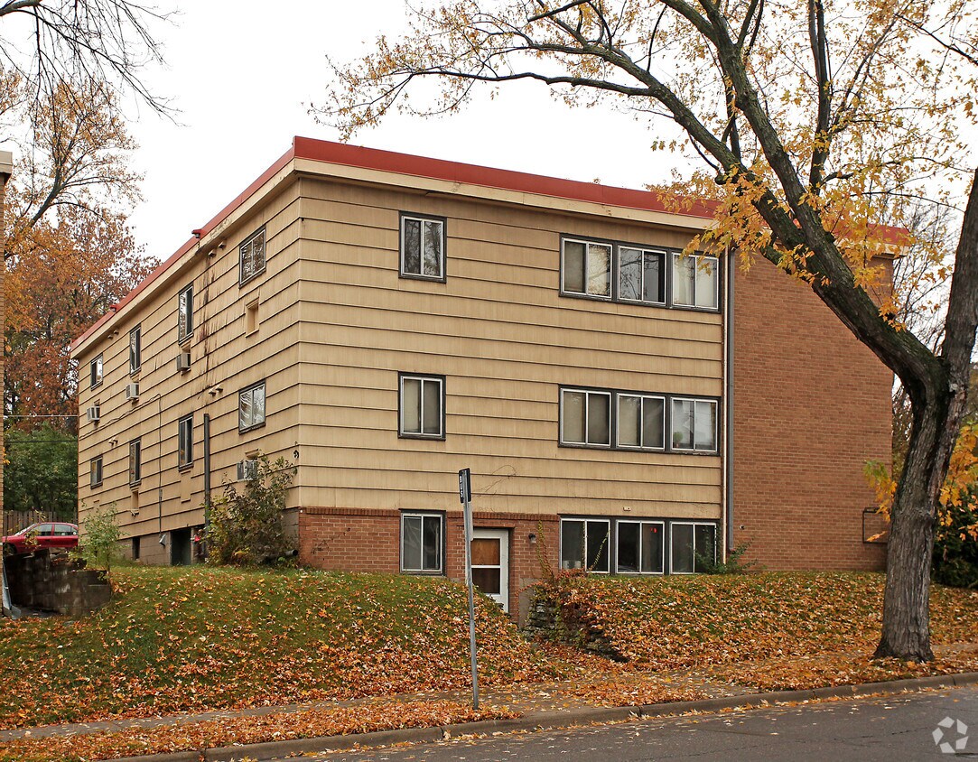
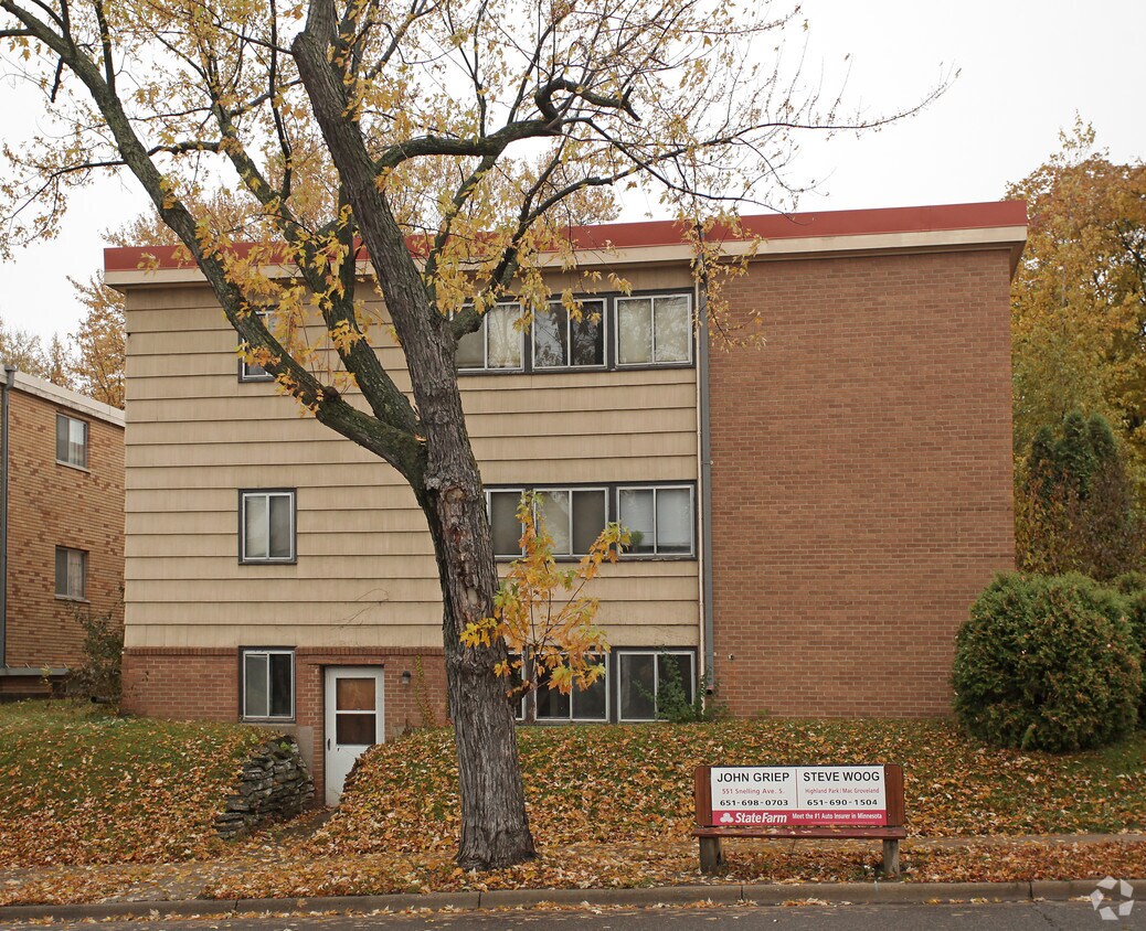
1298 Edgcumbe Rd
1298 Edgcumbe Rd,
Saint Paul,
MN
55105
2 Weeks Ago
Favorites
1298 Edgcumbe Rd
Favorites
Check Back Soon for Upcoming Availability
Fees and Policies
Details
Property Information
-
Built in 1957
-
9 units/3 stories
About 1298 Edgcumbe Rd Saint Paul, MN 55105
1298 Edgcumbe Rd offers a mixture of comfort, quality, and design. The 1298 Edgcumbe Rd. location in the Highland neighborhood of St. Paul has much to offer its residents. The professional leasing team is excited to help you find your dream apartment. Experience a new standard at 1298 Edgcumbe Rd.
1298 Edgcumbe Rd is an apartment community located in Ramsey County and the 55105 ZIP Code. This area is served by the St. Paul Public attendance zone.
Location
Get Directions
The Highland community lies in the southwestern corner of Saint Paul, just 10 miles from Downtown Minneapolis. Highland is to the north of Fort Snelling, adjacent to the Mississippi River.
A 50/50 blend of commercial and residential buildings, Highland residents enjoy plentiful shopping and restaurants near their apartments. Saint Catherine University resides here, and it’s in walking distance of local eateries at the corner of Cleveland Avenue South and Ford Parkway.
A predominantly residential neighborhood, there are tons of outdoor activities to do, like improving your game at the Highland National Golf Course or picnicking at Crosby Farm Park. For easy travel, residents are comforted by their proximity to Interstate 35E and the international airport. The amusement park and aquarium at Mall of America are a short 10-minute drive from Highland.
Learn more about living in HighlandBelow are rent ranges for similar nearby apartments
| Beds | Average Size | Lowest | Typical | Premium |
|---|---|---|---|---|
| Studio Studio Studio | 498 Sq Ft | $846 | $1,156 | $1,690 |
| 1 Bed 1 Bed 1 Bed | 717-723 Sq Ft | $962 | $1,459 | $3,300 |
| 2 Beds 2 Beds 2 Beds | 1091 Sq Ft | $1,107 | $1,892 | $4,295 |
| 3 Beds 3 Beds 3 Beds | 1586 Sq Ft | $1,750 | $2,417 | $3,250 |
| 4 Beds 4 Beds 4 Beds | 1979 Sq Ft | $2,750 | $3,303 | $5,016 |
Education
| Colleges & Universities | Distance | ||
|---|---|---|---|
| Colleges & Universities | Distance | ||
| Drive: | 4 min | 1.6 mi | |
| Drive: | 6 min | 1.8 mi | |
| Drive: | 4 min | 1.9 mi | |
| Drive: | 7 min | 3.1 mi |
1298 Edgcumbe Rd is within 4 minutes or 1.6 miles from Macalester College. It is also near St. Catherine University and Concordia Univ.-Saint Paul.
Schools


Public Elementary School
Grades PK-5
438 Students
Attendance Zone
Public Middle School
Grades 6-8
805 Students
Attendance Zone
Public High School
Grades 9-12
1,390 Students
Attendance Zone
Private Elementary School
Grades PK-3
19 Students
Nearby
Private Elementary & Middle School
Grades PK-8
308 Students
Nearby
Private High School
Grades 9-12
1,220 Students
Nearby
School data provided by
 The GreatSchools Rating helps parents compare schools within a state based on a variety of school quality indicators and provides a helpful picture of how effectively each school serves all of its students. Ratings are on a scale of 1 (below average) to 10 (above average) and can include test scores, college readiness, academic progress, advanced courses, equity, discipline and attendance data. We also advise parents to visit schools, consider other information on school performance and programs, and consider family needs as part of the school selection process.
View GreatSchools Rating Methodology
Data provided by GreatSchools.org © 2025. All rights reserved.
View GreatSchools Rating Methodology
Data provided by GreatSchools.org © 2025. All rights reserved.
Transportation options available in Saint Paul include Lexington Pkwy Station, located 2.2 miles from 1298 Edgcumbe Rd. 1298 Edgcumbe Rd is near Minneapolis-St Paul International/Wold-Chamberlain, located 6.3 miles or 12 minutes away.
| Transit / Subway | Distance | ||
|---|---|---|---|
| Transit / Subway | Distance | ||
| Drive: | 6 min | 2.2 mi | |
| Drive: | 6 min | 2.6 mi | |
| Drive: | 6 min | 2.8 mi | |
| Drive: | 6 min | 2.9 mi | |
| Drive: | 6 min | 3.1 mi |
| Commuter Rail | Distance | ||
|---|---|---|---|
| Commuter Rail | Distance | ||
|
|
Drive: | 8 min | 4.0 mi |
|
|
Drive: | 19 min | 9.5 mi |
|
|
Drive: | 27 min | 19.9 mi |
|
|
Drive: | 37 min | 26.9 mi |
|
|
Drive: | 38 min | 28.5 mi |
| Airports | Distance | ||
|---|---|---|---|
| Airports | Distance | ||
|
Minneapolis-St Paul International/Wold-Chamberlain
|
Drive: | 12 min | 6.3 mi |
Time and distance from 1298 Edgcumbe Rd.
| Shopping Centers | Distance | ||
|---|---|---|---|
| Shopping Centers | Distance | ||
| Drive: | 3 min | 1.6 mi | |
| Drive: | 3 min | 1.6 mi | |
| Drive: | 3 min | 1.6 mi |
1298 Edgcumbe Rd has 3 shopping centers within 1.6 miles, which is about a 3-minute drive. The miles and minutes will be for the farthest away property.
| Parks and Recreation | Distance | ||
|---|---|---|---|
| Parks and Recreation | Distance | ||
|
Highland Park and Golf Course
|
Drive: | 3 min | 1.4 mi |
|
Macalester College Observatory
|
Drive: | 4 min | 1.7 mi |
|
Crosby Farm Regional Park
|
Drive: | 6 min | 3.5 mi |
|
Hidden Falls Park
|
Drive: | 10 min | 3.7 mi |
|
Cherokee Regional Park
|
Drive: | 8 min | 4.0 mi |
1298 Edgcumbe Rd has 5 parks within 4.0 miles, including Highland Park and Golf Course, Macalester College Observatory, and Crosby Farm Regional Park.
| Hospitals | Distance | ||
|---|---|---|---|
| Hospitals | Distance | ||
| Drive: | 4 min | 2.5 mi | |
| Drive: | 6 min | 3.2 mi | |
| Drive: | 7 min | 3.7 mi |
1298 Edgcumbe Rd has 3 hospitals within 3.7 miles, the nearest is Allina United Hospital which is 2.5 miles away and a 4 minute drive.
| Military Bases | Distance | ||
|---|---|---|---|
| Military Bases | Distance | ||
| Drive: | 11 min | 5.0 mi |
1298 Edgcumbe Rd is 5.0 miles and a 11 minute drive from Fort Snelling Military Reservation.
You May Also Like
What neighborhood is the property located in?
1298 Edgcumbe Rd Saint Paul, MN 55105 is in Highland in the city of Saint Paul. Here you’ll find three shopping centers within 1.6 miles of the property. Five parks are within 4.0 miles, including Highland Park and Golf Course, Macalester College Observatory, and Crosby Farm Regional Park.
Similar Rentals Nearby


What Are Walk Score®, Transit Score®, and Bike Score® Ratings?
Walk Score® measures the walkability of any address. Transit Score® measures access to public transit. Bike Score® measures the bikeability of any address.
What is a Sound Score Rating?
A Sound Score Rating aggregates noise caused by vehicle traffic, airplane traffic and local sources
Responded To This Review