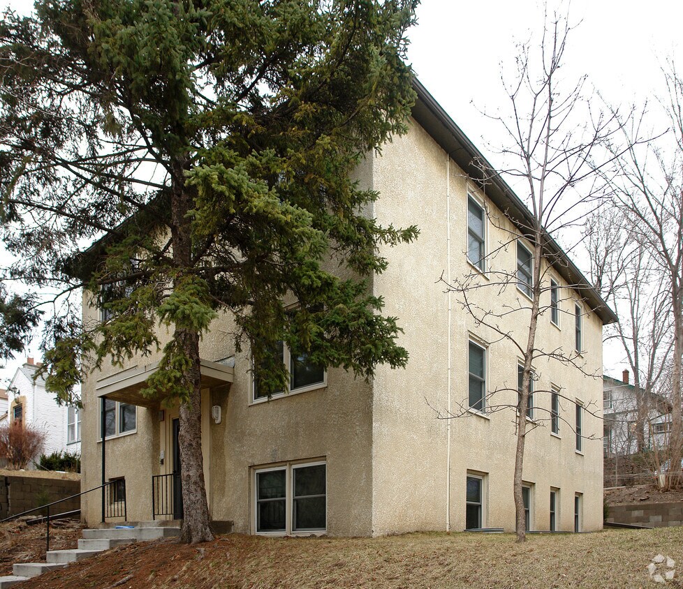
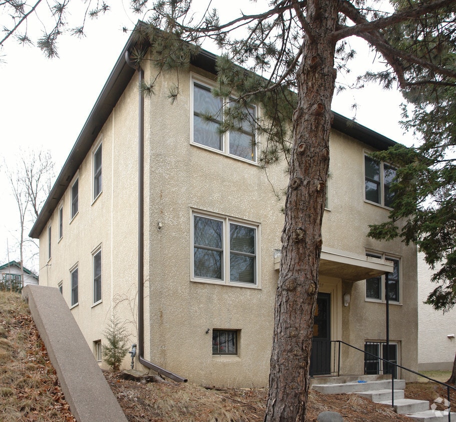
1237 St Clair Ave
1237 St Clair Ave,
Saint Paul,
MN
55105
2 Weeks Ago
Favorites
1237 St Clair Ave
Favorites
Check Back Soon for Upcoming Availability
Fees and Policies
The fees below are based on community-supplied data and may exclude additional fees and utilities.
- Parking
-
Surface Lot--1 Max
Details
Property Information
-
Built in 1953
-
5 units/2 stories
About 1237 St Clair Ave Saint Paul, MN 55105
Discover your new apartment at 1237 St Clair Ave in St. Paul, MN. You'll find this community in the Macalester-Groveland area of St. Paul. Let the leasing team show you everything this community has in store. So get a head start on your move. Contact or stop by 1237 St Clair Ave to learn more about our community!
1237 St Clair Ave is an apartment community located in Ramsey County and the 55105 ZIP Code. This area is served by the St. Paul Public attendance zone.
Location
Get Directions
Macalester-Groveland, sometimes shortened to Mac-Grove, stretches from the eastern banks of the Mississippi River to Summit Hill. Mac-Grove is a largely residential neighborhood, touting an array of apartments and single-family homes available for rent.
The neighborhood contains the picturesque Summit Avenue Historic District, which boasts an impressive collection of Victorian-era homes between dense canopies of lush trees. One block south of Summit Avenue is the vibrant Grand Avenue, which is teeming with specialty shops, independent coffeehouses, and eclectic eateries.
Mac-Grove is famously convenient to multiple private colleges, including the University of Saint Thomas, Saint Catherine University, and Macalester College, making the neighborhood a top choice for many students, faculty, and staff. The community celebrates the start of the summer season every year with the annual Grand Old Day Festival.
Learn more about living in Macalester-GrovelandBelow are rent ranges for similar nearby apartments
Education
| Colleges & Universities | Distance | ||
|---|---|---|---|
| Colleges & Universities | Distance | ||
| Walk: | 20 min | 1.1 mi | |
| Drive: | 3 min | 1.2 mi | |
| Drive: | 6 min | 2.2 mi | |
| Drive: | 5 min | 2.5 mi |
1237 St Clair Ave is within 20 minutes or 1.1 miles from Macalester College. It is also near Concordia Univ.-Saint Paul and St. Catherine University.
Schools


Public Elementary School
Grades PK-5
437 Students
Attendance Zone
Public Middle School
Grades 6-8
559 Students
Attendance Zone
Public High School
Grades 9-12
1,691 Students
Attendance Zone
Private Elementary & Middle School
Grades PK-8
261 Students
Nearby
Private Elementary School
Grades K-5
Nearby
Private High School
Grades 9-12
1,220 Students
Nearby
School data provided by
 The GreatSchools Rating helps parents compare schools within a state based on a variety of school quality indicators and provides a helpful picture of how effectively each school serves all of its students. Ratings are on a scale of 1 (below average) to 10 (above average) and can include test scores, college readiness, academic progress, advanced courses, equity, discipline and attendance data. We also advise parents to visit schools, consider other information on school performance and programs, and consider family needs as part of the school selection process.
View GreatSchools Rating Methodology
Data provided by GreatSchools.org © 2025. All rights reserved.
View GreatSchools Rating Methodology
Data provided by GreatSchools.org © 2025. All rights reserved.
Transportation options available in Saint Paul include Hamline Ave Station, located 2.1 miles from 1237 St Clair Ave. 1237 St Clair Ave is near Minneapolis-St Paul International/Wold-Chamberlain, located 6.8 miles or 13 minutes away.
| Transit / Subway | Distance | ||
|---|---|---|---|
| Transit / Subway | Distance | ||
| Drive: | 5 min | 2.1 mi | |
| Drive: | 4 min | 2.1 mi | |
| Drive: | 5 min | 2.2 mi | |
| Drive: | 4 min | 2.3 mi | |
| Drive: | 6 min | 2.7 mi |
| Commuter Rail | Distance | ||
|---|---|---|---|
| Commuter Rail | Distance | ||
|
|
Drive: | 8 min | 3.9 mi |
|
|
Drive: | 17 min | 8.5 mi |
|
|
Drive: | 25 min | 17.1 mi |
|
|
Drive: | 35 min | 25.9 mi |
|
|
Drive: | 36 min | 27.5 mi |
| Airports | Distance | ||
|---|---|---|---|
| Airports | Distance | ||
|
Minneapolis-St Paul International/Wold-Chamberlain
|
Drive: | 13 min | 6.8 mi |
Time and distance from 1237 St Clair Ave.
| Shopping Centers | Distance | ||
|---|---|---|---|
| Shopping Centers | Distance | ||
| Walk: | 19 min | 1.0 mi | |
| Drive: | 2 min | 1.2 mi | |
| Drive: | 3 min | 1.2 mi |
1237 St Clair Ave has 3 shopping centers within 1.2 miles, which is about a 3-minute walk. The miles and minutes will be for the farthest away property.
| Parks and Recreation | Distance | ||
|---|---|---|---|
| Parks and Recreation | Distance | ||
|
Macalester College Observatory
|
Walk: | 18 min | 0.9 mi |
|
Highland Park and Golf Course
|
Drive: | 3 min | 2.0 mi |
|
Irvine Park
|
Drive: | 6 min | 2.6 mi |
|
Western Park
|
Drive: | 7 min | 3.4 mi |
|
Cherokee Regional Park
|
Drive: | 8 min | 3.5 mi |
1237 St Clair Ave has 5 parks within 3.5 miles, including Macalester College Observatory, Highland Park and Golf Course, and Irvine Park.
| Hospitals | Distance | ||
|---|---|---|---|
| Hospitals | Distance | ||
| Drive: | 5 min | 2.4 mi | |
| Drive: | 6 min | 3.1 mi | |
| Drive: | 7 min | 3.6 mi |
1237 St Clair Ave has 3 hospitals within 3.6 miles, the nearest is Allina United Hospital which is 2.4 miles away and a 5 minute drive.
| Military Bases | Distance | ||
|---|---|---|---|
| Military Bases | Distance | ||
| Drive: | 12 min | 5.5 mi |
1237 St Clair Ave is 5.5 miles and a 12 minute drive from Fort Snelling Military Reservation.
You May Also Like
What neighborhood is the property located in?
1237 St Clair Ave Saint Paul, MN 55105 is in Macalester-Groveland in the city of Saint Paul. Here you’ll find three shopping centers within 1.2 miles of the property. Five parks are within 3.5 miles, including Macalester College Observatory, Highland Park and Golf Course, and Irvine Park.
Similar Rentals Nearby


What Are Walk Score®, Transit Score®, and Bike Score® Ratings?
Walk Score® measures the walkability of any address. Transit Score® measures access to public transit. Bike Score® measures the bikeability of any address.
What is a Sound Score Rating?
A Sound Score Rating aggregates noise caused by vehicle traffic, airplane traffic and local sources
Responded To This Review