The Byron
101 V St SW,
Washington, DC 20024
$1,843 - $17,574
Studio - 3 Beds

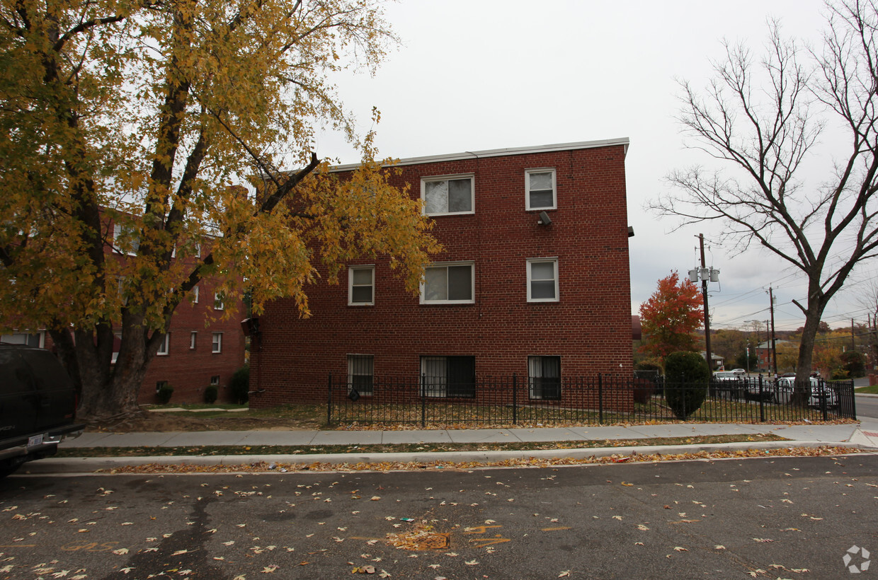
Experience Washington living at The Highpoint. The location of this community is on Division Ave Ne in the 20019 area of Washington. Be sure to come for a visit to check out the apartment floorplan options. From pricing to features, the leasing staff is ready and waiting to help you find your perfect home. Find your new home at The Highpoint. Contact or drop by to find out current pricing.
The Highpoint is an apartment community located in District of Columbia County and the 20019 ZIP Code. This area is served by the District Of Columbia Public Schools attendance zone.
A busy residential neighborhood in northeast Washington, DC, Deanwood sits on the District of Columbia-Maryland state line and is lined with affordable apartment communities and single-family homes. Good schools like Houston Elementary School are a major attraction for families, and there are several churches and recreation centers that help bring the community together. Deanwood is mainly residential, so most residents travel outside of the neighborhood for work. The heart of Washington, DC is only seven miles west of Deanwood. U.S. Highway 50 and the Deanwood subway station benefit residents who commute to and from the city. Deanwood offers easy access to Kenilworth Park and Aquatic Gardens, a tranquil preserve with nature trails and scenic picnic spots.
Learn more about living in Deanwood| Colleges & Universities | Distance | ||
|---|---|---|---|
| Colleges & Universities | Distance | ||
| Drive: | 10 min | 4.8 mi | |
| Drive: | 10 min | 5.0 mi | |
| Drive: | 10 min | 5.7 mi | |
| Drive: | 11 min | 6.1 mi |


Transportation options available in Washington include Deanwood, located 1.1 miles from The Highpoint. The Highpoint is near Ronald Reagan Washington Ntl, located 11.2 miles or 20 minutes away, and Baltimore/Washington International Thurgood Marshall, located 27.3 miles or 40 minutes away.
| Transit / Subway | Distance | ||
|---|---|---|---|
| Transit / Subway | Distance | ||
|
|
Walk: | 21 min | 1.1 mi |
|
|
Drive: | 3 min | 1.5 mi |
|
|
Drive: | 4 min | 1.6 mi |
|
Capitol Heights, Blue/Silver Line Center Platform
|
Drive: | 3 min | 1.8 mi |
|
|
Drive: | 5 min | 2.4 mi |
| Commuter Rail | Distance | ||
|---|---|---|---|
| Commuter Rail | Distance | ||
|
|
Drive: | 9 min | 5.0 mi |
|
|
Drive: | 10 min | 5.1 mi |
|
|
Drive: | 10 min | 5.2 mi |
| Drive: | 10 min | 6.4 mi | |
|
|
Drive: | 10 min | 6.4 mi |
| Airports | Distance | ||
|---|---|---|---|
| Airports | Distance | ||
|
Ronald Reagan Washington Ntl
|
Drive: | 20 min | 11.2 mi |
|
Baltimore/Washington International Thurgood Marshall
|
Drive: | 40 min | 27.3 mi |
Time and distance from The Highpoint.
| Shopping Centers | Distance | ||
|---|---|---|---|
| Shopping Centers | Distance | ||
| Drive: | 3 min | 1.2 mi | |
| Drive: | 4 min | 1.6 mi | |
| Drive: | 3 min | 1.7 mi |
| Parks and Recreation | Distance | ||
|---|---|---|---|
| Parks and Recreation | Distance | ||
|
Fort Dupont Park
|
Drive: | 7 min | 2.8 mi |
|
Kingman and Heritage Island Park
|
Drive: | 5 min | 3.0 mi |
|
Bladensburg Waterfront Park
|
Drive: | 5 min | 3.2 mi |
|
Dueling Creek Natural Area
|
Drive: | 7 min | 4.2 mi |
|
National Arboretum
|
Drive: | 9 min | 4.6 mi |
| Hospitals | Distance | ||
|---|---|---|---|
| Hospitals | Distance | ||
| Drive: | 5 min | 2.4 mi | |
| Drive: | 15 min | 7.0 mi | |
| Drive: | 12 min | 7.1 mi |
| Military Bases | Distance | ||
|---|---|---|---|
| Military Bases | Distance | ||
| Drive: | 11 min | 6.0 mi | |
| Drive: | 12 min | 6.9 mi |

What Are Walk Score®, Transit Score®, and Bike Score® Ratings?
Walk Score® measures the walkability of any address. Transit Score® measures access to public transit. Bike Score® measures the bikeability of any address.
What is a Sound Score Rating?
A Sound Score Rating aggregates noise caused by vehicle traffic, airplane traffic and local sources
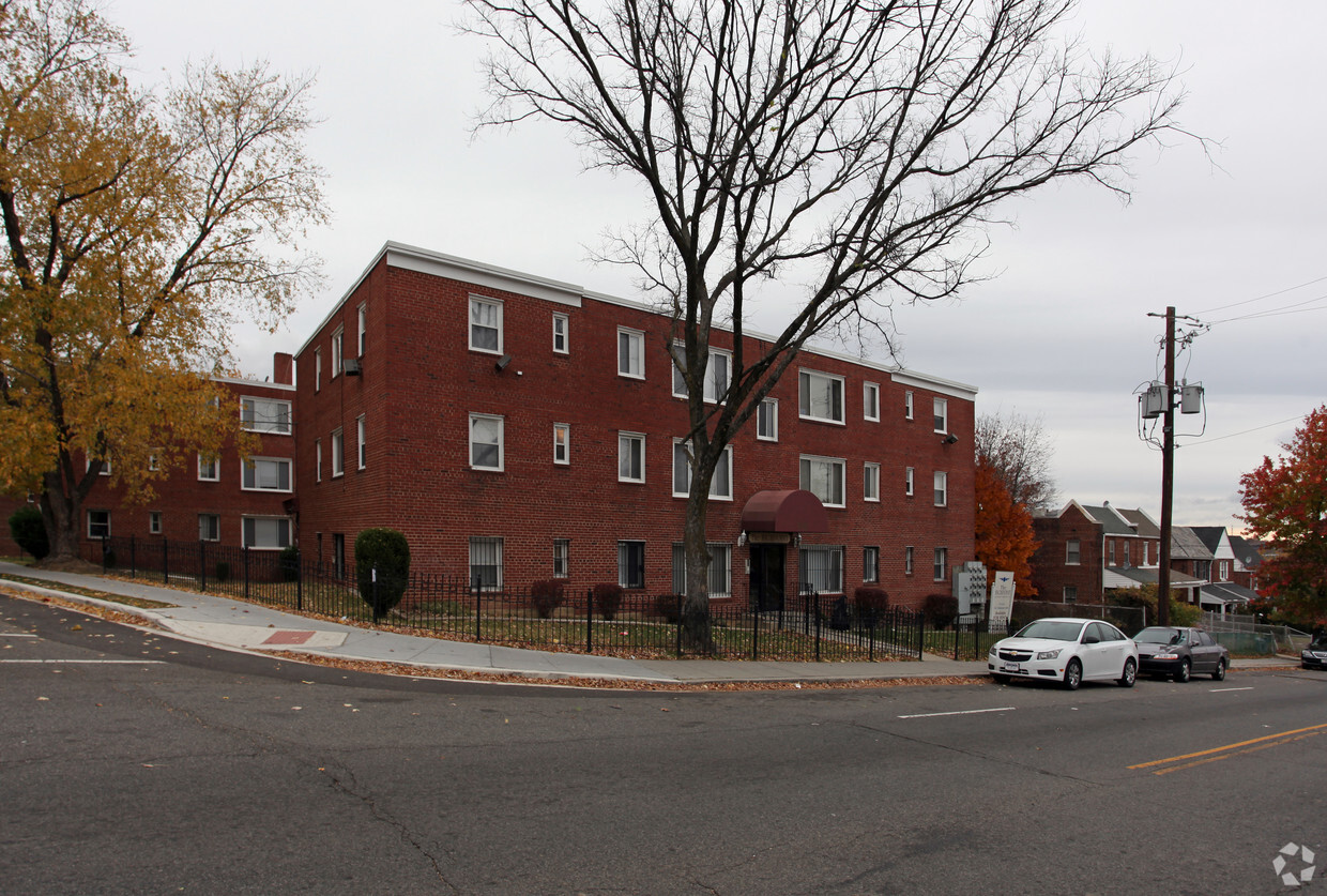
940 Division Ave NE
Washington, DC 20019


