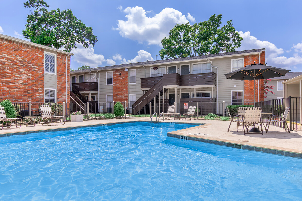
The Grove
8200 Sunbury Ln,
Houston, TX 77095
$775 - $1,349
1-2 Beds

Bedrooms
1 - 3 bd
Bathrooms
1 - 2 ba
Square Feet
504 - 1,240 sq ft

Welcome to Regal Pointe we are located within the desired Westbury/Meyerland area of Houston. Our apartment homes are well-located in a beautiful setting but also come with attractive perks and spacious modern interiors. Even better, we offer full utility package(s)! Utility Package(s) pays for Electricity, Water/WasteWater/Gas/Trash and Pest Control. Your apartment homes comes with fully equipped kitchen, Wood Style Flooring, Carpet in Bedrooms, Walk in Closets, 2 inch faux Blinds and a private patio/balcony. We considered every need, which is why we have laundry facilities, along with a 24 Hour Emergency Maintenance team and Metro Bus Stop. Call today and book a private tour! 281-800-5471
Welcome to Regal Pointe we are located within the desired Westbury/Meyerland area of Houston. Our apartment homes are well-located in a beautiful setting but also come with attractive perks and spacious modern interiors. Even better, we offer full utility package(s)! Utility Package(s) pays for Electricity, Water/WasteWater/Gas/Trash and Pest Control. Your apartment homes comes with fully equipped kitchen, Wood Style Flooring, Carpet in Bedrooms, Walk in Closets, 2 inch faux Blinds and a private patio/balcony. We considered every need, which is why we have laundry facilities, along with a 24 Hour Emergency Maintenance team and Metro Bus Stop. Call today and book a private tour! 281-800-5471
Regal Pointe Apartments is an apartment community located in Harris County and the 77096 ZIP Code. This area is served by the Houston Independent attendance zone.
Unique Features
Pool
Laundry Facilities
Clubhouse
Controlled Access
Washer/Dryer
Air Conditioning
Dishwasher
Washer/Dryer Hookup
High Speed Internet Access
Hardwood Floors
Walk-In Closets
Refrigerator
Founded in 1955, Meyerland Area is a 6,000-acre community southwest of Houston and encompassed by beautiful homes near the Interstate 610 Loop and Beltway 8. In addition to many houses of worship, Meyerland Area is also home to the Meyerland Plaza shopping center on Beechnut Street.
Residents of this community are served by the Houston Independent School District. After the school day, kids enjoy playtime on the jungle gyms at Meyerland Park and Herbert Godwin Park. Numerous restaurants surround the plaza, and the Brays Bayou Greenway provides locals a scenic jog along the bayou.
Learn more about living in Meyerland AreaCompare neighborhood and city base rent averages by bedroom.
| Meyerland Area | Houston, TX | |
|---|---|---|
| Studio | $789 | $1,064 |
| 1 Bedroom | $809 | $1,181 |
| 2 Bedrooms | $1,062 | $1,493 |
| 3 Bedrooms | $1,697 | $1,907 |
| Colleges & Universities | Distance | ||
|---|---|---|---|
| Colleges & Universities | Distance | ||
| Drive: | 7 min | 2.9 mi | |
| Drive: | 7 min | 3.1 mi | |
| Drive: | 13 min | 7.4 mi | |
| Drive: | 13 min | 7.7 mi |
 The GreatSchools Rating helps parents compare schools within a state based on a variety of school quality indicators and provides a helpful picture of how effectively each school serves all of its students. Ratings are on a scale of 1 (below average) to 10 (above average) and can include test scores, college readiness, academic progress, advanced courses, equity, discipline and attendance data. We also advise parents to visit schools, consider other information on school performance and programs, and consider family needs as part of the school selection process.
Transportation options available in Houston include Fannin South, located 6.8 miles from Regal Pointe Apartments. Regal Pointe Apartments is near William P Hobby, located 17.9 miles or 32 minutes away, and George Bush Intcntl/Houston, located 33.1 miles or 43 minutes away.
| Transit / Subway | Distance | ||
|---|---|---|---|
| Transit / Subway | Distance | ||
|
|
Drive: | 11 min | 6.8 mi |
|
|
Drive: | 11 min | 6.9 mi |
|
|
Drive: | 12 min | 6.9 mi |
| Drive: | 14 min | 7.7 mi | |
|
|
Drive: | 15 min | 8.0 mi |
| Commuter Rail | Distance | ||
|---|---|---|---|
| Commuter Rail | Distance | ||
|
|
Drive: | 23 min | 13.9 mi |
| Airports | Distance | ||
|---|---|---|---|
| Airports | Distance | ||
|
William P Hobby
|
Drive: | 32 min | 17.9 mi |
|
George Bush Intcntl/Houston
|
Drive: | 43 min | 33.1 mi |
Time and distance from Regal Pointe Apartments.
| Shopping Centers | Distance | ||
|---|---|---|---|
| Shopping Centers | Distance | ||
| Walk: | 18 min | 1.0 mi | |
| Walk: | 19 min | 1.0 mi | |
| Drive: | 2 min | 1.1 mi |
| Parks and Recreation | Distance | ||
|---|---|---|---|
| Parks and Recreation | Distance | ||
|
Club Creek Park and Vietnam Veterans Memorial
|
Drive: | 9 min | 4.3 mi |
|
Nature Discovery Center
|
Drive: | 10 min | 5.0 mi |
|
Buffalo Bayou Paddling Trail
|
Drive: | 13 min | 6.5 mi |
|
Arthur Storey Park
|
Drive: | 13 min | 6.8 mi |
|
Houston Maritime Museum
|
Drive: | 14 min | 7.5 mi |
| Hospitals | Distance | ||
|---|---|---|---|
| Hospitals | Distance | ||
| Drive: | 7 min | 3.8 mi | |
| Drive: | 8 min | 4.1 mi | |
| Drive: | 12 min | 6.8 mi |
| Military Bases | Distance | ||
|---|---|---|---|
| Military Bases | Distance | ||
| Drive: | 46 min | 32.3 mi | |
| Drive: | 75 min | 57.9 mi |
What Are Walk Score®, Transit Score®, and Bike Score® Ratings?
Walk Score® measures the walkability of any address. Transit Score® measures access to public transit. Bike Score® measures the bikeability of any address.
What is a Sound Score Rating?
A Sound Score Rating aggregates noise caused by vehicle traffic, airplane traffic and local sources