
Holden House
1554 Midway Pky,
Saint Paul, MN 55108
$1,449 - $2,150 Plus Fees
Studio - 1 Bed 12 Month Lease
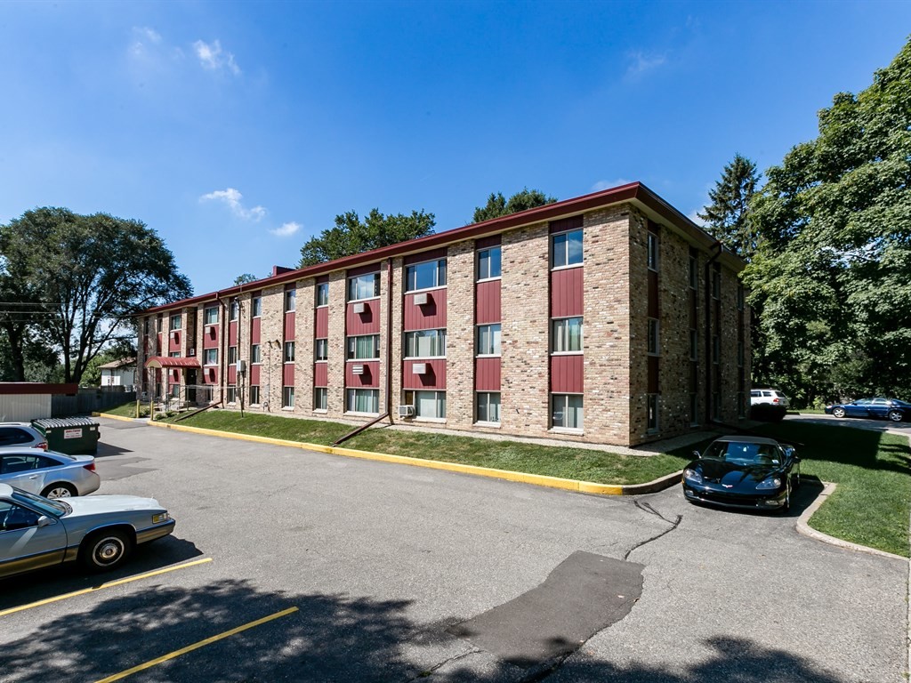
Amazing location in the West Seventh neighborhood of St. Paul! Minutes to downtown St. Paul, MSP Airport, Mississippi River Valley & Harriet Island Regional Park. West Seventh has no shortage of restaurants, and if you live in the neighborhood, you can find whatever you are craving within walking distance. Only a few blocks to 35E, Trader Joe's, Mississippi Market, Rusty Taco, Skinner's Eatery, Mojo Monkey Donuts, Shamrocks, Tavern on the Ave, and many other nearby conveniences! Our apartments feature beautiful updates throughout- new vinyl wood plank flooring and carpet, remodeled bathrooms with all new tile, tub surround, vanity, and fixtures, ALL new kitchen updates including counter tops, wood cabinets, appliances, sink and all fixtures. We take wonderful care of our buildings, inside and out! So please contact us today for a showing so you can call Peasant Avenue Villas your new home!
Pleasant Avenue Villas is an apartment community located in Ramsey County and the 55102 ZIP Code. This area is served by the St. Paul Public School District attendance zone.
Air Conditioning
Dishwasher
Refrigerator
Ceiling Fans
Often referred to as the “West End,” West Seventh is a convenient neighborhood located on the Riverview Corridor transit system, making travel to Downtown Saint Paul, the Minneapolis-Saint Paul Airport, and the Mall of America simple for locals.
Residents of West Seventh enjoy direct access to Interstate 35E and Xcel Energy Center. There are a plethora of amenities and attractions along the Mississippi River – from parks to historic landmarks and the High Bridge Dog Park.
Many of West Seventh’s restaurants are found along 7th Street West, like Bad Weather Brewing Company, Cossetta’s, and JR Mac’s Bar & Grill. Residents adore the proximity to the airport, and Saint Paul attractions and shopping.
Learn more about living in West SeventhCompare neighborhood and city base rent averages by bedroom.
| West Seventh | Saint Paul, MN | |
|---|---|---|
| Studio | $1,296 | $1,149 |
| 1 Bedroom | $1,569 | $1,298 |
| 2 Bedrooms | $2,184 | $1,656 |
| 3 Bedrooms | $2,861 | $2,195 |
| Colleges & Universities | Distance | ||
|---|---|---|---|
| Colleges & Universities | Distance | ||
| Drive: | 6 min | 2.3 mi | |
| Drive: | 8 min | 2.5 mi | |
| Drive: | 6 min | 2.6 mi | |
| Drive: | 8 min | 3.4 mi |


Transportation options available in Saint Paul include Lexington Pkwy Station, located 2.6 miles from Pleasant Avenue Villas. Pleasant Avenue Villas is near Minneapolis-St Paul International/Wold-Chamberlain, located 6.1 miles or 13 minutes away.
| Transit / Subway | Distance | ||
|---|---|---|---|
| Transit / Subway | Distance | ||
| Drive: | 7 min | 2.6 mi | |
| Drive: | 7 min | 3.0 mi | |
| Drive: | 8 min | 3.5 mi | |
| Drive: | 8 min | 3.5 mi | |
| Drive: | 8 min | 3.6 mi |
| Commuter Rail | Distance | ||
|---|---|---|---|
| Commuter Rail | Distance | ||
|
|
Drive: | 8 min | 3.9 mi |
|
|
Drive: | 20 min | 9.8 mi |
|
|
Drive: | 28 min | 20.0 mi |
|
|
Drive: | 38 min | 28.1 mi |
|
|
Drive: | 39 min | 29.8 mi |
| Airports | Distance | ||
|---|---|---|---|
| Airports | Distance | ||
|
Minneapolis-St Paul International/Wold-Chamberlain
|
Drive: | 13 min | 6.1 mi |
Scores provided by
Traffic
-Airport
-Businesses
-Scores provided by
HowLoud What is a Sound Score Rating? A Sound Score Rating aggregates noise caused by vehicle traffic, airplane traffic and local sources. How It WorksTime and distance from Pleasant Avenue Villas.
| Shopping Centers | Distance | ||
|---|---|---|---|
| Shopping Centers | Distance | ||
| Drive: | 5 min | 1.6 mi | |
| Drive: | 5 min | 1.9 mi |
| Parks and Recreation | Distance | ||
|---|---|---|---|
| Parks and Recreation | Distance | ||
|
Highland Park and Golf Course
|
Drive: | 4 min | 1.3 mi |
|
Macalester College Observatory
|
Drive: | 6 min | 2.3 mi |
|
Irvine Park
|
Drive: | 6 min | 2.8 mi |
|
Crosby Farm Regional Park
|
Drive: | 7 min | 4.0 mi |
|
Cherokee Regional Park
|
Drive: | 9 min | 4.1 mi |
| Hospitals | Distance | ||
|---|---|---|---|
| Hospitals | Distance | ||
| Drive: | 5 min | 2.6 mi | |
| Drive: | 7 min | 3.3 mi | |
| Drive: | 8 min | 3.8 mi |
| Military Bases | Distance | ||
|---|---|---|---|
| Military Bases | Distance | ||
| Drive: | 12 min | 4.8 mi |
Pets Allowed Fitness Center Pool Dishwasher Refrigerator Clubhouse Maintenance on site
Pets Allowed Fitness Center Pool Dishwasher Refrigerator Kitchen In Unit Washer & Dryer
Pets Allowed Fitness Center Pool Dishwasher Refrigerator Kitchen
Pets Allowed Pool Dishwasher Microwave Granite Countertops
Pets Allowed Fitness Center Pool Dishwasher Refrigerator Walk-In Closets
What Are Walk Score®, Transit Score®, and Bike Score® Ratings?
Walk Score® measures the walkability of any address. Transit Score® measures access to public transit. Bike Score® measures the bikeability of any address.
What is a Sound Score Rating?
A Sound Score Rating aggregates noise caused by vehicle traffic, airplane traffic and local sources.

1296 Pleasant Ave
Saint Paul, MN 55102


