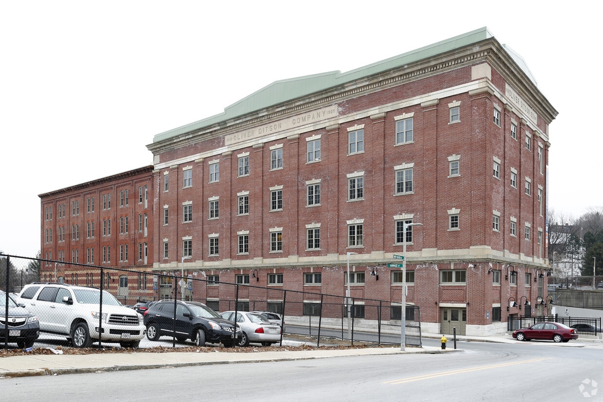
Oliver Lofts

166 Terrace, Boston, MA 02120

2 Weeks Ago
Share Listing
Favorites
Oliver Lofts
Share Listing
Favorites

Highlights

  • Premier Transit Location
  • Walk-In Closets
  • Balcony
  • Property Manager on Site
  • Views
  • Hardwood Floors

About Oliver Lofts

Come home to Oliver Lofts in Boston, MA. The 166 Terrace St location in the Highland Park neighborhood of Boston has much to offer its residents. Select from 1 to 2 bedroom floor plans. The professional leasing team is eager for your visit. Start living the good life at Oliver Lofts. Contact us or stop in to learn more about our community.

Oliver Lofts is an apartment community located in Suffolk County and the 02120 ZIP Code. This area is served by the Boston Public Schools attendance zone.

Community Amenities

  • Laundry Facilities
  • Property Manager on Site
  • Recycling

Apartment Features

Air Conditioning

High Speed Internet Access

Hardwood Floors

Walk-In Closets

  • High Speed Internet Access
  • Air Conditioning
  • Smoke Free
  • Granite Countertops
  • Hardwood Floors
  • Views
  • Walk-In Closets
  • Balcony
Location
166 Terrace, Boston,
MA 02120
Get Directions
Neighborhood

Twenty minutes southwest of downtown Boston sits Highland Park, a primarily- residential neighborhood full of beautiful historic homes and apartments along tree-lined streets. The community features over a dozen parks and public green spaces, giving all residents easy access to trails, playgrounds, and historic sites wherever they may live.

The local dining scene is quite unique, with several African and Middle Eastern restaurants and cafes around the neighborhood. MBTA rail service on the west side of the neighborhood makes it easy for folks to get around the city for or leisure.

Learn more about living in Highland Park 
Education
Colleges & Universities Distance
Walk: 15 min 0.8 mi
Walk: 17 min 0.9 mi
Drive: 2 min 1.4 mi
Drive: 5 min 2.2 mi
Oliver Lofts is within 15 minutes or 0.8 mile from Wentworth Inst. of Technology. It is also near MCPHS University, Boston and MassArt.
Schools
Public Elementary School
Grades PK-5
167 Students
Attendance Zone
Public Elementary, Middle & High School
Grades K-12
1,225 Students
Nearby
Public Elementary School
Grades PK-5
76 Students
Attendance Zone
Public Middle & High School
Grades 6-12
1,518 Students
Attendance Zone
Public Middle School
Grades 6-8
331 Students
Attendance Zone
Public High School
Grades 9-12
358 Students
Attendance Zone
Public High School
Grades 9-12
1,024 Students
Attendance Zone
Private Elementary School
Grades PK-5
104 Students
Nearby
Private Elementary & Middle School
Grades K-8
72 Students
Nearby
Private Elementary, Middle & High School
Grades K-12
Nearby
Private Middle & High School
Grades 6-12
77 Students
Nearby
Transportation

Transportation options available in Boston include Jackson Square Station, located 0.3 mile from Oliver Lofts. Oliver Lofts is near General Edward Lawrence Logan International, located 6.8 miles or 13 minutes away.

Transit / Subway Distance
Walk: 6 min 0.3 mi
Walk: 7 min 0.4 mi
Walk: 13 min 0.7 mi
Walk: 15 min 0.8 mi
Walk: 16 min 0.9 mi
Commuter Rail Distance
Drive: 3 min 1.3 mi
Drive: 5 min 2.2 mi
Drive: 4 min 2.2 mi
Drive: 6 min 2.6 mi
Drive: 10 min 5.1 mi
Airports Distance
Airports Distance
General Edward Lawrence Logan International
Drive: 13 min 6.8 mi

Walkability Near Oliver Lofts

Getting Around
Moderately Walkable
Walkability
70 / 100
Exceptional Public Transit
Transit
90 / 100
Fairly Drivable
Drivability
40 / 100
Moderately Bikeable
Bikeability
60 / 100

Scores provided by

What do Walkability, Transit, Drivability, and Bikeability mean? Walkability measures the walking distance to day-to-day needs. Transit measures access to public transportation. Drivability measures congestion, parking availability, and access to major roads. Bikeability measures the suitability for cycling. How It Works
-
Soundscore
- / 100

Traffic

-

Airport

-

Businesses

-

Scores provided by

HowLoud What is a Sound Score Rating? A Sound Score Rating aggregates noise caused by vehicle traffic, airplane traffic and local sources. How It Works
Points of Interest

Time and distance from Oliver Lofts.

Shopping Centers Distance
Drive: 3 min 1.3 mi
Drive: 3 min 1.8 mi
Drive: 4 min 2.1 mi
Oliver Lofts has 3 shopping centers within 2.1 miles, which is about a 4-minute drive. The miles and minutes will be for the farthest away property.
Parks and Recreation Distance
Roxbury Heritage State Park
Walk: 13 min 0.7 mi
Frederick Law Olmsted National Historic Site
Drive: 5 min 2.1 mi
Lower Neponset River Trail
Drive: 4 min 2.2 mi
Charles River Reservation
Drive: 5 min 2.4 mi
Coit Observatory
Drive: 6 min 2.8 mi
Oliver Lofts has 5 parks within 2.8 miles, including Roxbury Heritage State Park, Lower Neponset River Trail, and Frederick Law Olmsted National Historic Site.
Hospitals Distance
Hospitals Distance
Walk: 11 min 0.6 mi
Walk: 19 min 1.0 mi
Drive: 3 min 1.2 mi
Oliver Lofts has 3 hospitals within 1.2 miles, the nearest is New England Baptist Hospital which is 0.6 mile away and a 11 minute walk.
Military Bases Distance
Drive: 28 min 15.1 mi
Drive: 32 min 16.2 mi
Drive: 38 min 23.1 mi
Oliver Lofts has 3 military bases within 23.1 miles, the nearest is US Military Reservation which is 15.1 miles away and a 28 minute drive.

Explore Similar Rentals Nearby