Median Age
40 Years
Largest Age Group
15-24 Years
Approximately 19% of Residents
Under 20
27%
Over 65
18%


Avg Rent
$3,680
Population
28,921
Renter Mix
18% Rent
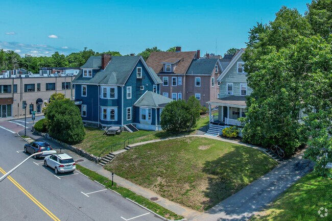
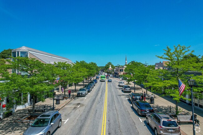
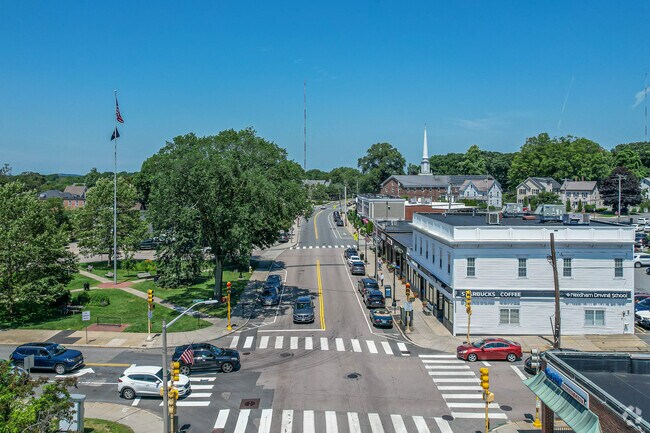
Wellesley, Massachusetts sits about 15 miles west of Boston in Norfolk County, making it one of the Greater Boston area's most well-connected suburban towns. The town is home to two respected colleges, Wellesley College and Babson College, which bring an academic presence and steady activity to the local area. Whether you are relocating from out of state or moving from within Massachusetts, apartments for rent in Wellesley place you close to a strong local economy, green open spaces, and easy access to everything Greater Boston has to offer. Renters in Wellesley will find a mix of apartment communities, condos, and rental homes spread across distinct neighborhoods, including Wellesley Square, Wellesley Hills, Poets' Corner, and Peirce Estates. Garden-style apartment communities and smaller residential buildings are common throughout the town, with many situated near local shopping and dining along Central Street and Linden Square. Outdoor options are plentiful, with parks and green spaces like the Elm Bank Reservation and the Wellesley College Botanic Gardens within easy reach for daily recreation. The town's walkable village centers make it easy to run errands, grab a meal, or pick up groceries without a long drive. Getting around from Wellesley is straightforward. Three MBTA commuter rail stops — Wellesley Square, Wellesley Hills, and Wellesley Farms — connect residents to Boston's South Station on the Framingham/Worcester Line, making a car-free commute into the city a realistic option. Drivers have access to Interstate 95 and Route 9 for reaching nearby employment centers in Newton, Needham, and downtown Boston. Logan International Airport is approximately 32 minutes away by car. With a strong academic and professional community, reliable transit connections, and a range of rental options, Wellesley is a solid choice for renters looking for suburban convenience with direct ties to Greater Boston.
Wellesley Square street parking in Morses Pond.
Brook Path pond in Dana Hall, Wellesley.
Downtown Needham overview in Babson College.
The Wellesley Hill train station helps get residents wherever they need to go.
Green space in Centennial Park in Wellesley Hills.
Passengers board the MBTA Commuter Rail at Wellesley Square station.
Median Household Income
$230,774
Average: $219,358
Education
16,262
Residents Have a Degree
Job Market
13,317
Workers Employed
Median Age
40 Years
Largest Age Group
15-24 Years
Approximately 19% of Residents
Under 20
27%
Over 65
18%
Housing Distribution
Wellesley has more homeowners than renters.

Education Distribution
Review this city's overall education levels.

As of July 2026, the average apartment rent in Wellesley, MA is $3,304 for a studio, $3,651 for one bedroom, $4,621 for two bedrooms, and $7,818 for three bedrooms. Apartment rent in Wellesley has decreased by -1.9% in the past year.
Explore how walkable, bikeable, drivable, and transit-friendly Wellesley, MA is for everyday living.
Fairly Walkable
Walkability
Limited Public Transit
Transit
Exceptionally Drivable
Drivability
Fairly Bikeable
Bikeability
John D. Hardy Elementary School
Public
Grades K-5
310 Students

Public
Grades K-5
307 Students
Public
Grades K-5
276 Students
Joseph E. Fiske Elementary School
Public
Grades K-5
263 Students
Public
Grades K-5
274 Students

Public
Grades 6-8
910 Students
Public
Grades 6-8
910 Students
Public
Grades 9-12
1,231 Students

† Our analysis of utilities, groceries, transportation, healthcare, home prices, and other goods and services is sourced from the Cost of Living Index, a respected benchmark published by the Council for Community and Economic Research (C2ER) that provides a thorough overview of living expenses across different regions.
Rent data is provided by CoStar Group’s Market Trend reports. As the industry leader in commercial real estate information, analytics, and news, CoStar conducts extensive research to produce and maintain a comprehensive database of commercial real estate information. We combine this data with public record to provide the most up-to-date rental information available.
Consumer goods, services, and home prices are sourced from the Cost of Living Index published by the Council for Community and Economic Research (C2ER). The data on this page is updated quarterly. It was last published in June 2026.
Demographic information comes from Neustar and combines detailed address data with U.S. Census and American Community Survey statistics to produce reliable local estimates.


