
$4,695
Total Monthly Price
12 Month Lease
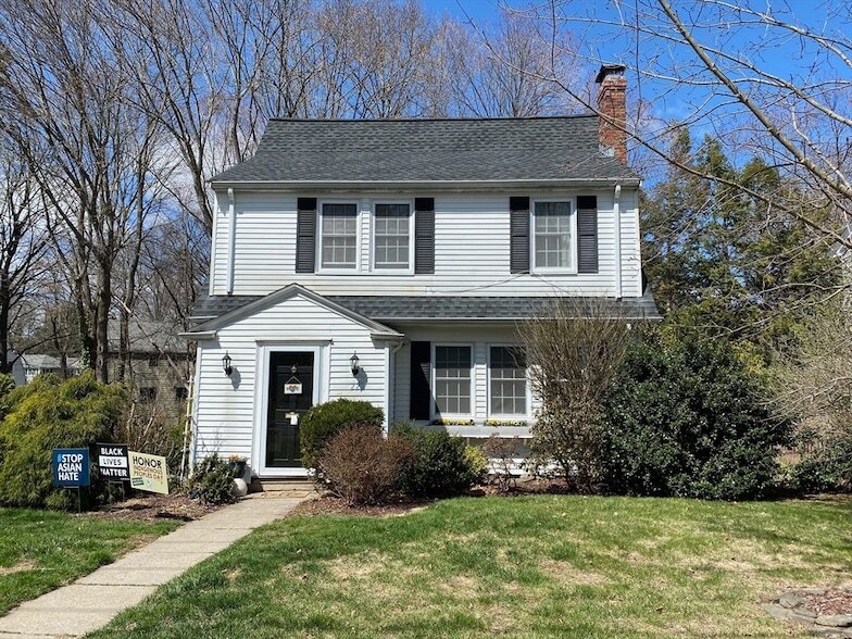
22 Cleveland Rd
Wellesley, MA 02481
Favorites
339-231-8721
-
Bedrooms
3
-
Bathrooms
2
-
Square Feet
1,625 sq ft
-
Available
Available Now
Highlights
- Deck
- Property is near golf course and public transit
- 1 Fireplace
- Jogging Path
- Crown Molding
- No Cooling
22 Cleveland Rd
Favorites
About This Home
12 Month Lease
,
Available Now
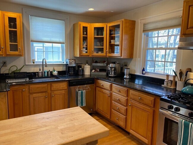
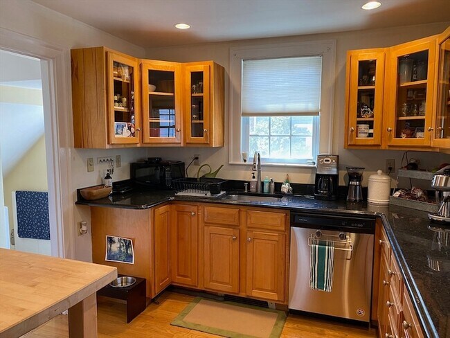
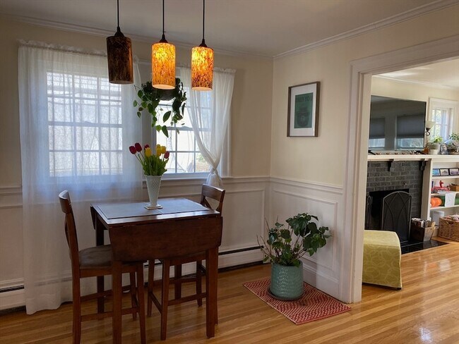
**AVAILABLE SEPTEMBER 1ST**This traditional colonial style house located in Wellesley Hills has old world charm all while enjoying the comforts of a modern day house. Beautiful hardwood floors throughout, a stainless chef's kitchen with granite, updated High Efficiency Water Heater, high ceilings with crown molding and a deck leading out to a landscaped backyard. All three bedrooms have ample closet space. Location Location Location, this house is 4 minutes away from the notable Katharine Lee Bates School; rated 10/10 on GreatSchools an independent public and private rating service for eduction. It is also 7 minutes away from Wellesley Middle and High Schools know for their outstanding and supportive education. Bordered by Natick, Needham, and Newton and close to I-90 Mass Pike, Rt 16 and I-95.
22 Cleveland Rd is a house located in Norfolk County and the 02481 ZIP Code. This area is served by the Needham School District attendance zone.
* Price shown is total price based on community-supplied monthly required fees. Excludes user-selected optional fees and variable or usage-based fees and required charges due at or prior to move-in or at move-out. Price, availability, fees, and any applicable rent special are subject to change without notice.
* Square footage definitions vary. Displayed square footage is approximate.
Home Details
Home Type
Single Family Detached Home
Year Built
Built in 1925
Basement
Laundry in Basement
Bedrooms and Bathrooms
Primary bedroom located on second floor
1.5 Bathrooms
3 Bedrooms
Home Design
Entry on the 1st floor
Interior Spaces
1 Fireplace
Crown Molding
Window Screens
1,625 Sq Ft Home
Kitchen
Range with Range Hood
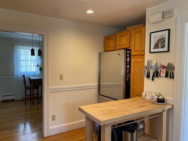
Freezer
Dishwasher
Laundry
Dryer
Washer
Listing and Financial Details
Security Deposit $4,695
Property Available on 9/1/26
12 Month Lease Term
Assessor Parcel Number 263890
Rent includes extra storage, garden area, parking
Location
Property is near golf course and public transit
Lot Details
7,000 Sq Ft Lot
Garden
Outdoor Features
Deck
Rain Gutters
Parking
5 Open Parking Spaces
5 Car Parking Spaces
Schools
Bates Elementary School
Wellesley Mid. Middle School
Wellesley High School
Utilities
No Cooling
Baseboard Heating
Community Details
Amenities
Shops
Overview
Near Conservation Area
No Home Owners Association
Pet Policy
Call for details about the types of pets allowed
Recreation
Jogging Path
Park
Location
Get Directions
Just west of Boston and East of Worcester sits Metro West, a region that houses a group of towns and cities with significant historical backgrounds. A total of 19 municipalities make up the core of this community, but other municipalities are considered to be a part of the Interstate 495/Metro West Corridor.
Learn more about living in Metro West
Amenities
- Washer/Dryer
- Air Conditioning
- Heating
- Fireplace
- Dishwasher
- Kitchen
- Range
- Refrigerator
- Freezer
- Basement
- Deck
- Garden
- Pool
Education
| Colleges & Universities | Distance | ||
|---|---|---|---|
| Colleges & Universities | Distance | ||
| Drive: | 6 min | 2.3 mi | |
| Drive: | 7 min | 3.2 mi | |
| Drive: | 12 min | 6.9 mi | |
| Drive: | 14 min | 7.0 mi |
22 Cleveland Rd is within 6 minutes or 2.3 miles from Wellesley College. It is also near Babson College and Brandeis University.
Schools


Public Elementary School
Grades PK-5
687 Students
Nearby
Public Middle School
Grades 6-8
910 Students
Attendance Zone
Private Elementary, Middle & High School
Grades PK-12
Nearby
Private Middle & High School
Grades 6-12
515 Students
Nearby
School data provided by
 The GreatSchools Rating helps parents compare schools within a state based on a variety of school quality indicators and provides a helpful picture of how effectively each school serves all of its students. Ratings are on a scale of 1 (below average) to 10 (above average) and can include test scores, college readiness, academic progress, advanced courses, equity, discipline and attendance data. We also advise parents to visit schools, consider other information on school performance and programs, and consider family needs as part of the school selection process.
View GreatSchools Rating Methodology
Data provided by GreatSchools.org © 2026. All rights reserved.
View GreatSchools Rating Methodology
Data provided by GreatSchools.org © 2026. All rights reserved.
Transportation options available in Wellesley include Woodland Station, located 4.7 miles from 22 Cleveland Rd. 22 Cleveland Rd is near General Edward Lawrence Logan International, located 18.7 miles or 31 minutes away, and Worcester Regional, located 30.9 miles or 52 minutes away.
| Transit / Subway | Distance | ||
|---|---|---|---|
| Transit / Subway | Distance | ||
|
|
Drive: | 9 min | 4.7 mi |
|
|
Drive: | 10 min | 4.8 mi |
|
|
Drive: | 10 min | 5.4 mi |
|
|
Drive: | 11 min | 6.0 mi |
|
|
Drive: | 11 min | 6.2 mi |
| Commuter Rail | Distance | ||
|---|---|---|---|
| Commuter Rail | Distance | ||
|
|
Drive: | 3 min | 1.5 mi |
|
|
Drive: | 5 min | 2.7 mi |
|
|
Drive: | 7 min | 3.5 mi |
|
|
Drive: | 7 min | 4.2 mi |
|
|
Drive: | 10 min | 4.9 mi |
| Airports | Distance | ||
|---|---|---|---|
| Airports | Distance | ||
|
General Edward Lawrence Logan International
|
Drive: | 31 min | 18.7 mi |
|
Worcester Regional
|
Drive: | 52 min | 30.9 mi |
Getting Around
 What do Walkability, Transit, Drivability, and Bikeability mean?
Walkability measures the walking distance to day-to-day needs.
Transit measures access to public transportation.
Drivability measures congestion, parking availability, and access to major roads.
Bikeability measures the suitability for cycling.
How It Works
What do Walkability, Transit, Drivability, and Bikeability mean?
Walkability measures the walking distance to day-to-day needs.
Transit measures access to public transportation.
Drivability measures congestion, parking availability, and access to major roads.
Bikeability measures the suitability for cycling.
How It Works
Moderately Walkable
Walkability
70
/ 100
Limited Public Transit
Transit
30
/ 100
Moderately Drivable
Drivability
70
/ 100
Fairly Bikeable
Bikeability
50
/ 100
Scores provided by
Active
Soundscore™
68
/ 100
Traffic
BusyAirport
CalmBusinesses
ActiveScores provided by
HowLoud What is a Sound Score Rating? A Sound Score Rating aggregates noise caused by vehicle traffic, airplane traffic and local sources. How It WorksTime and distance from 22 Cleveland Rd.
| Shopping Centers | Distance | ||
|---|---|---|---|
| Shopping Centers | Distance | ||
| Drive: | 2 min | 1.4 mi | |
| Drive: | 3 min | 1.5 mi | |
| Drive: | 4 min | 1.7 mi |
22 Cleveland Rd has 3 shopping centers within 1.7 miles, which is about a 4-minute drive. The miles and minutes will be for the farthest away property.
| Parks and Recreation | Distance | ||
|---|---|---|---|
| Parks and Recreation | Distance | ||
|
Whitin Observatory
|
Drive: | 4 min | 1.4 mi |
|
Wellesley College Botanic Gardens
|
Drive: | 3 min | 1.7 mi |
|
Weezie's Garden for Children
|
Drive: | 9 min | 3.5 mi |
|
Elm Bank Reservation
|
Drive: | 9 min | 3.5 mi |
|
Horticultural Society at Elm Bank
|
Drive: | 10 min | 3.7 mi |
22 Cleveland Rd has 5 parks within 3.7 miles, including Whitin Observatory, Wellesley College Botanic Gardens, and Horticultural Society at Elm Bank.
| Hospitals | Distance | ||
|---|---|---|---|
| Hospitals | Distance | ||
| Drive: | 8 min | 4.5 mi | |
| Drive: | 9 min | 5.1 mi | |
| Drive: | 14 min | 7.5 mi |
22 Cleveland Rd has 3 hospitals within 7.5 miles, the nearest is Newton - Wellesley Hospital which is 4.5 miles away and a 8 minute drive.
| Military Bases | Distance | ||
|---|---|---|---|
| Military Bases | Distance | ||
| Drive: | 7 min | 3.8 mi | |
| Drive: | 26 min | 13.2 mi | |
| Drive: | 55 min | 33.4 mi |
22 Cleveland Rd has 3 military bases within 33.4 miles, the nearest is US Military Reservation which is 3.8 miles away and a 7 minute drive.
22 Cleveland Rd Photos
About the Listing Agent

Kyle Cabral
Southpaw Residential
MLS Number: 9000
22 Cleveland Rd
Wellesley, MA 02481