
Risor of Bloomington 55+
8131 34th Ave S,
Bloomington, MN 55425
1-2 Beds $1,791 - $3,826
Stunning views, lavish amenities and distinctive layouts make CityVue stand out. As the tallest building south of the metro, CityVue towers above the heart of Eagan. Residents can relax in the sky lounge, socialize on the rooftop and get motivated in the fitness room with 180-degree views. CityVue offers a variety of one and two-bedroom floor plan options with an all-inclusive monthly payment that includes rent and utilities (excludes cable and internet), so there will never be surprises. Feel metropolitan while enjoying the convenience of the suburbs. CityVue is surrounded by 130 miles of walking trails, tons of shopping and restaurants, and just a quick car ride away from the MSP airport.
CityVue Apartments is an apartment community located in Dakota County and the 55121 ZIP Code. This area is served by the Rosemount-Apple Valley-Eagan attendance zone.
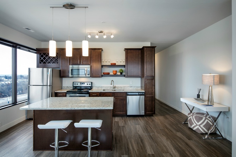
Fitness Center
Elevator
Clubhouse
Roof Terrace
Washer/Dryer
Air Conditioning
Dishwasher
High Speed Internet Access
Hardwood Floors
Walk-In Closets
Granite Countertops
Microwave
Green spaces and recreation areas are all over Eagan, and the southern border of the city is formed by Lebanon Hills Regional Park, which incorporates the Minnesota Zoo and Valleywood Golf Course. Eagan is home to Rasmussen College and Argosy University, with a branch campus of the University of Minnesota just south of town as well.
Eagan is right across the river from the Mall of America and Minneapolis -Saint Paul International Airport, and roughly 15 minutes away from downtown St. Paul and Minneapolis by car (rail service is also available via Minnesota Valley Transit). The close proximity to the Twin Cities combined with the excellent public schools and low crime rate make apartment s in Eagan great for commuters and families.
Learn more about living in Eagan| Colleges & Universities | Distance | ||
|---|---|---|---|
| Colleges & Universities | Distance | ||
| Drive: | 3 min | 1.5 mi | |
| Drive: | 12 min | 6.3 mi | |
| Drive: | 17 min | 8.4 mi | |
| Drive: | 14 min | 9.5 mi |


Transportation options available in Eagan include American Boulevard, located 6.0 miles from CityVue Apartments. CityVue Apartments is near Minneapolis-St Paul International/Wold-Chamberlain, located 7.2 miles or 14 minutes away.
| Transit / Subway | Distance | ||
|---|---|---|---|
| Transit / Subway | Distance | ||
|
|
Drive: | 10 min | 6.0 mi |
|
John P Humphrey Interlocking
|
Drive: | 11 min | 6.2 mi |
|
|
Drive: | 11 min | 6.3 mi |
|
|
Drive: | 12 min | 6.6 mi |
|
|
Drive: | 12 min | 7.3 mi |
| Commuter Rail | Distance | ||
|---|---|---|---|
| Commuter Rail | Distance | ||
|
|
Drive: | 15 min | 10.6 mi |
|
|
Drive: | 27 min | 13.8 mi |
|
|
Drive: | 35 min | 22.3 mi |
|
|
Drive: | 47 min | 33.9 mi |
|
|
Drive: | 48 min | 35.5 mi |
| Airports | Distance | ||
|---|---|---|---|
| Airports | Distance | ||
|
Minneapolis-St Paul International/Wold-Chamberlain
|
Drive: | 14 min | 7.2 mi |
Time and distance from CityVue Apartments.
| Shopping Centers | Distance | ||
|---|---|---|---|
| Shopping Centers | Distance | ||
| Walk: | 5 min | 0.3 mi | |
| Walk: | 7 min | 0.4 mi | |
| Walk: | 7 min | 0.4 mi |
| Parks and Recreation | Distance | ||
|---|---|---|---|
| Parks and Recreation | Distance | ||
|
Minnesota Valley Wetland Management District
|
Drive: | 12 min | 6.5 mi |
|
Crosby Farm Regional Park
|
Drive: | 11 min | 6.7 mi |
|
Sea Life Minnesota
|
Drive: | 11 min | 7.2 mi |
|
Fort Snelling State Park
|
Drive: | 14 min | 7.2 mi |
|
Minnesota Zoo
|
Drive: | 15 min | 8.1 mi |
| Hospitals | Distance | ||
|---|---|---|---|
| Hospitals | Distance | ||
| Drive: | 13 min | 10.0 mi | |
| Drive: | 14 min | 10.0 mi | |
| Drive: | 15 min | 10.3 mi |
| Military Bases | Distance | ||
|---|---|---|---|
| Military Bases | Distance | ||
| Drive: | 12 min | 7.1 mi |
What Are Walk Score®, Transit Score®, and Bike Score® Ratings?
Walk Score® measures the walkability of any address. Transit Score® measures access to public transit. Bike Score® measures the bikeability of any address.
What is a Sound Score Rating?
A Sound Score Rating aggregates noise caused by vehicle traffic, airplane traffic and local sources


