
$2,800 / Month
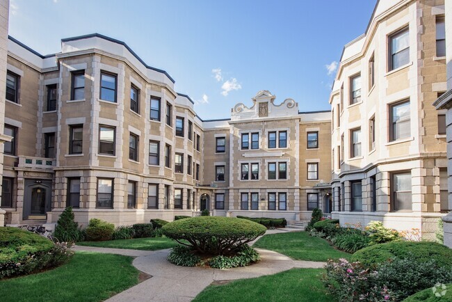
68 Foster St Unit 2
Boston, MA 02135
2 Weeks Ago
Favorites
68 Foster St Unit 2

Favorites
Check Back Soon for Upcoming Availability
| Beds | Baths | Average SF |
|---|---|---|
| 4 Bedrooms 4 Bedrooms 4 Br | 1.5 Baths 1.5 Baths 1.5 Ba | 9,999 SF |
Fees and Policies
Details
Property Information
-
4 units
About This Property
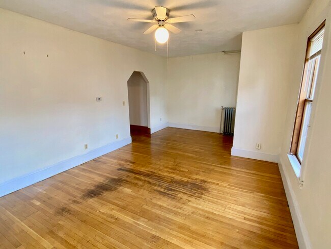
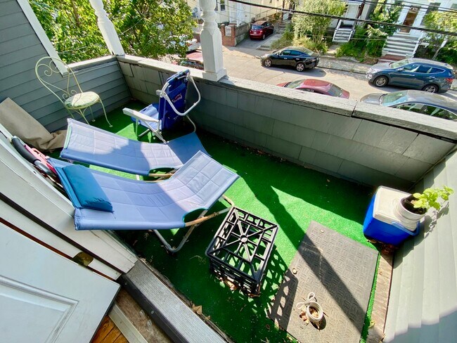
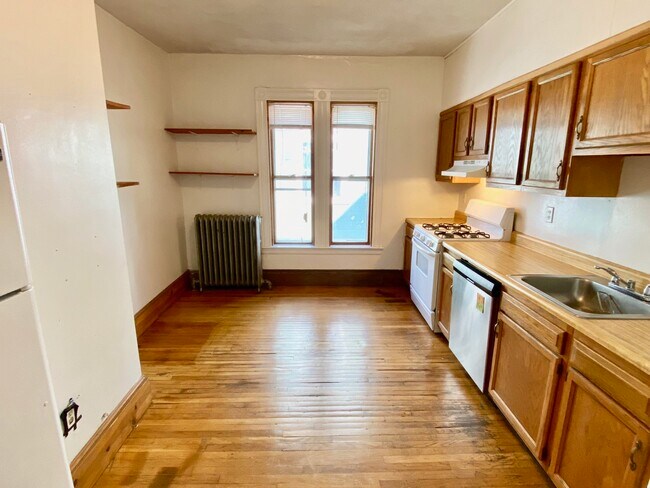
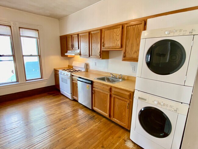
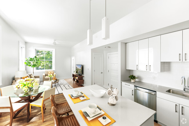
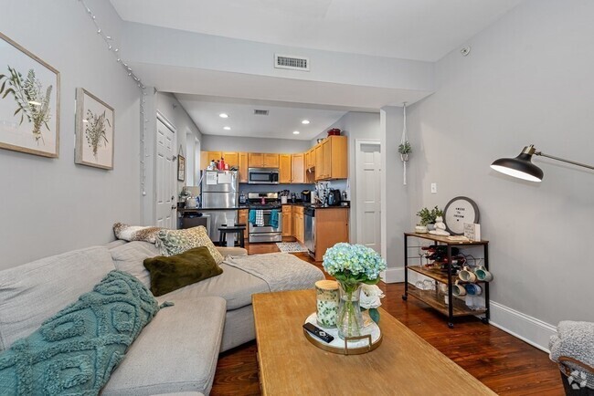
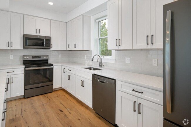
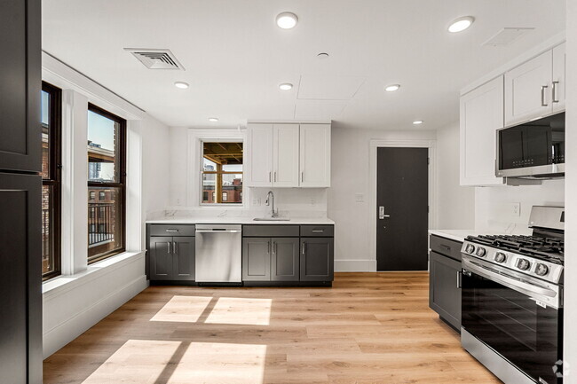
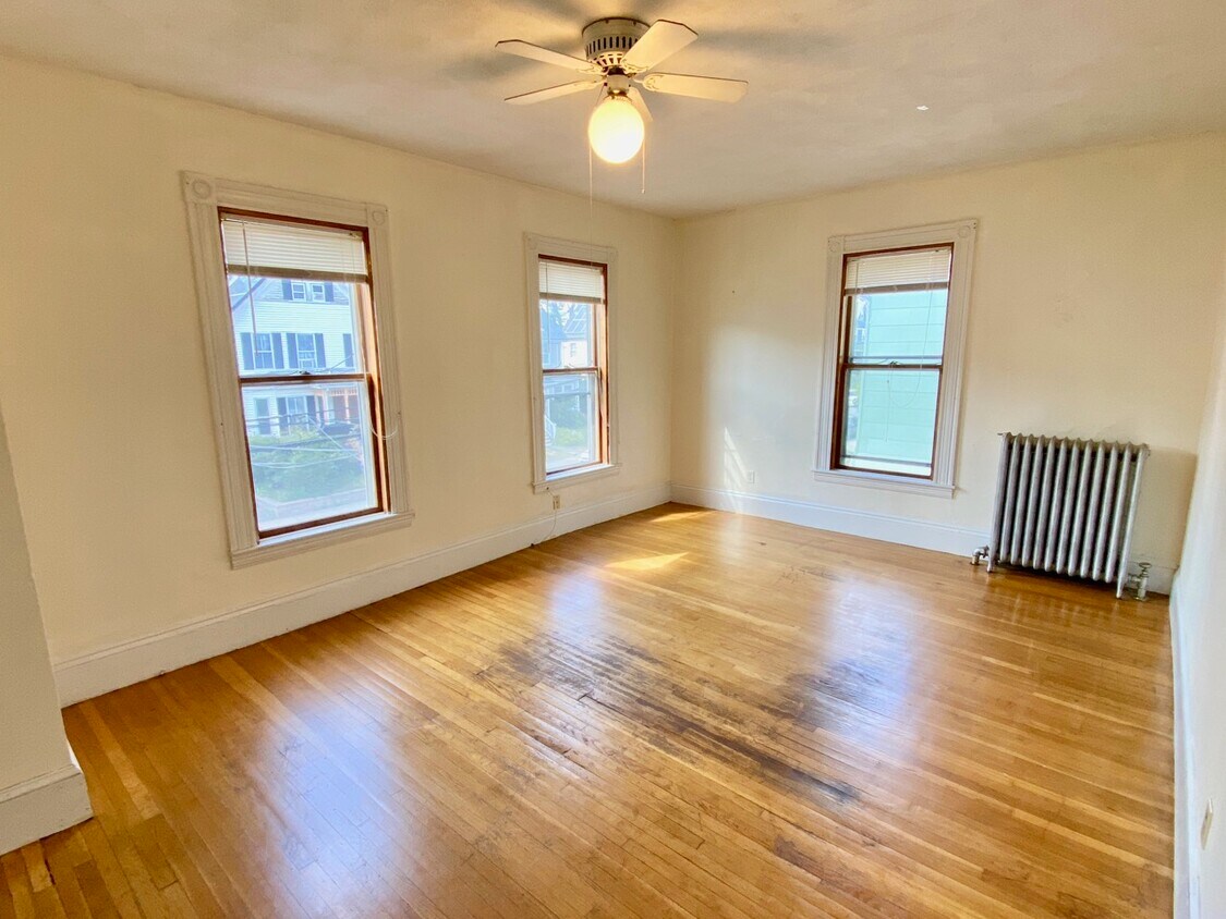
This beautiful 4 bed gem is close to Bank of America and United States Postal Service. Near to Rogers Park Playground and Winship Elementary School. Shops and restaurants are just a few blocks away. Large spacious apartment on the second floor of a multi-family home with a cozy balcony. This large duplex apartment is on the second floor. Unit has four cozy bedrooms and 1.5 bathroom. Its interior is bright and has hardwood flooring. Unit features eat-in kitchen, fire place, in-unit laundry, dishwasher, gas range, porch and a separate kitchen. Sorry, no parking and no pets allowed.
68 Foster St is an apartment community located in Suffolk County and the 02135 ZIP Code.
Apartment Features
- Washer/Dryer
Location
Get Directions
Saint Elizabeth’s is a Brighton neighborhood situated about 10 miles away from Boston. Thanks to Saint Elizabeth’s top border sitting on Highway 20, commuting in and out of Brighton is easy. Some residents travel by car, but buses and railways make commuting via public transportation a breeze.
The neighborhood’s best amenities are two world-renowned hospitals, Saint Elizabeth’s Medical Center and Franciscan Children’s, that sit on the edge of town. Other great amenities of Saint Elizabeth’s include many local parks like Ringer Playground and Chestnut Hill Reservoir, which has great trails and greenspace. This neighborhood is also equipped with cozy coffee shops, restaurants serving international and American classics, and shopping plazas with grocers and convenience stores.
Saint Elizabeth’s has several rental options ranging from apartments to single-family homes.
Learn more about living in St Elizabeth'sBelow are rent ranges for similar nearby apartments
| Beds | Average Size | Lowest | Typical | Premium |
|---|---|---|---|---|
| Studio Studio Studio | 4346 Sq Ft | $1,700 | $2,257 | $5,650 |
| 1 Bed 1 Bed 1 Bed | 3417-3418 Sq Ft | $1,220 | $2,609 | $10,000 |
| 2 Beds 2 Beds 2 Beds | 3376-3377 Sq Ft | $1,200 | $3,321 | $6,800 |
| 3 Beds 3 Beds 3 Beds | 5343 Sq Ft | $1,300 | $3,865 | $7,043 |
| 4 Beds 4 Beds 4 Beds | 5534 Sq Ft | $900 | $5,491 | $50,000 |
Amenities
- Washer/Dryer
Education
| Colleges & Universities | Distance | ||
|---|---|---|---|
| Colleges & Universities | Distance | ||
| Walk: | 11 min | 0.6 mi | |
| Drive: | 3 min | 1.2 mi | |
| Drive: | 6 min | 2.7 mi | |
| Drive: | 7 min | 2.8 mi |
68 Foster St Unit 2 is within 11 minutes or 0.6 mile from Boston College, Brighton. It is also near Boston College and Boston University.
Transportation options available in Boston include South Street, located 0.8 mile from 68 Foster St Unit 2. 68 Foster St Unit 2 is near General Edward Lawrence Logan International, located 9.3 miles or 18 minutes away.
| Transit / Subway | Distance | ||
|---|---|---|---|
| Transit / Subway | Distance | ||
|
|
Walk: | 14 min | 0.8 mi |
|
|
Walk: | 16 min | 0.9 mi |
|
|
Walk: | 17 min | 0.9 mi |
|
|
Drive: | 3 min | 1.2 mi |
|
|
Drive: | 3 min | 1.2 mi |
| Commuter Rail | Distance | ||
|---|---|---|---|
| Commuter Rail | Distance | ||
|
|
Drive: | 6 min | 2.8 mi |
|
|
Drive: | 7 min | 3.5 mi |
| Drive: | 7 min | 3.6 mi | |
|
|
Drive: | 9 min | 4.0 mi |
|
|
Drive: | 10 min | 4.5 mi |
| Airports | Distance | ||
|---|---|---|---|
| Airports | Distance | ||
|
General Edward Lawrence Logan International
|
Drive: | 18 min | 9.3 mi |
Time and distance from 68 Foster St Unit 2.
| Shopping Centers | Distance | ||
|---|---|---|---|
| Shopping Centers | Distance | ||
| Walk: | 21 min | 1.1 mi | |
| Drive: | 3 min | 1.1 mi | |
| Drive: | 4 min | 1.3 mi |
68 Foster St Unit 2 has 3 shopping centers within 1.3 miles, which is about a 4-minute walk. The miles and minutes will be for the farthest away property.
| Parks and Recreation | Distance | ||
|---|---|---|---|
| Parks and Recreation | Distance | ||
|
Chestnut Hill Reservation
|
Drive: | 3 min | 1.1 mi |
|
John Fitzgerald Kennedy National Historic Site
|
Drive: | 4 min | 2.1 mi |
|
Hammond Pond Reservation
|
Drive: | 5 min | 2.3 mi |
|
Frederick Law Olmsted National Historic Site
|
Drive: | 6 min | 2.7 mi |
|
Coit Observatory
|
Drive: | 7 min | 3.1 mi |
68 Foster St Unit 2 has 5 parks within 3.1 miles, including Chestnut Hill Reservation, John Fitzgerald Kennedy National Historic Site, and Hammond Pond Reservation.
| Hospitals | Distance | ||
|---|---|---|---|
| Hospitals | Distance | ||
| Walk: | 10 min | 0.5 mi | |
| Walk: | 13 min | 0.7 mi | |
| Drive: | 4 min | 2.1 mi |
68 Foster St Unit 2 has 3 hospitals within 2.1 miles, the nearest is St. Elizabeth's Medical Center which is 0.5 mile away and a 10 minute walk.
| Military Bases | Distance | ||
|---|---|---|---|
| Military Bases | Distance | ||
| Drive: | 26 min | 12.3 mi | |
| Drive: | 22 min | 13.0 mi |
68 Foster St Unit 2 is 12.3 miles from Hanscom Air Force Base, and is convenient to other military bases, including US Military Reservation.
You May Also Like
Similar Rentals Nearby
-
-
-
-
-
-
-
-
1 / 8
-
-


What Are Walk Score®, Transit Score®, and Bike Score® Ratings?
Walk Score® measures the walkability of any address. Transit Score® measures access to public transit. Bike Score® measures the bikeability of any address.
What is a Sound Score Rating?
A Sound Score Rating aggregates noise caused by vehicle traffic, airplane traffic and local sources
68 Foster St
Boston, MA 02135