670 Pelham Blvd
670 Pelham Blvd,
Saint Paul,
MN
55114
2 Weeks Ago
Favorites
670 Pelham Blvd

Favorites
Check Back Soon for Upcoming Availability
Fees and Policies
The fees below are based on community-supplied data and may exclude additional fees and utilities.
- Parking
-
Surface Lot--
Details
Lease Options
-
12 Months
About 670 Pelham Blvd Saint Paul, MN 55114
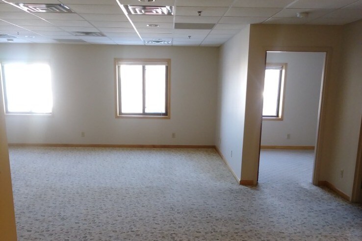
Large 2 bedroom apartment located close to University Avenue and the Light Rail. Utilities are included in the rent as well as 2 off street parking spots. The apartment has a huge kitchen with beautiful hardwood cabinets and granite counter tops. The flooring in the kitchen and dining area is hardwood. The bathroom has a double vanity and granite counter top. The washer and dryer are located in the bathroom. In addition to the 2 closets in each bedroom, there are 2 large closets in the apartment for your storage needs. There is a $ 30 application fee PER PERSON to cover the background/rental history checks.
670 Pelham Blvd is an apartment community located in Ramsey County and the 55114 ZIP Code.
Apartment Features
Washer/Dryer
Granite Countertops
Smoke Free
Dining Room
- Washer/Dryer
- Smoke Free
- Double Vanities
- Granite Countertops
- Kitchen
- Dining Room
Location
Get Directions
Situated in the northwestern corner of Saint Paul, Saint Anthony Park is a charming neighborhood between the downtowns of Saint Paul and Minneapolis. Saint Anthony Park’s small business district exudes the feel of an urban village, with plenty of quaint shops and local restaurants in Tudor-style buildings stretched along Como Avenue.
Outside of the business district, Saint Anthony Park is predominantly residential. The neighborhood is teeming with apartments and single-family homes covered in lush trees and landscaping. Langford Park offers residents numerous opportunities for outdoor recreation while the sprawling Como Regional Park lies just outside the neighborhood’s boundaries.
Saint Anthony Park is convenient to an array of notable amenities, including the University of Minnesota’s Saint Paul Campus, the Minnesota State Fair, and Rosedale Center. Convenience to I-94 and multiple light rail stations makes getting around from Saint Anthony Park simple.
Learn more about living in St AnthonyBelow are rent ranges for similar nearby apartments
| Beds | Average Size | Lowest | Typical | Premium |
|---|---|---|---|---|
| Studio Studio Studio | 468 Sq Ft | $1,109 | $1,384 | $3,331 |
| 1 Bed 1 Bed 1 Bed | 691-694 Sq Ft | $909 | $1,606 | $3,610 |
| 2 Beds 2 Beds 2 Beds | 1061-1064 Sq Ft | $805 | $2,027 | $5,833 |
| 3 Beds 3 Beds 3 Beds | 1414 Sq Ft | $1,895 | $2,382 | $3,289 |
| 4 Beds 4 Beds 4 Beds | 1783 Sq Ft | $515 | $1,688 | $3,000 |
Amenities
- Washer/Dryer
- Smoke Free
- Double Vanities
- Granite Countertops
- Kitchen
- Dining Room
Education
| Colleges & Universities | Distance | ||
|---|---|---|---|
| Colleges & Universities | Distance | ||
| Drive: | 4 min | 1.6 mi | |
| Drive: | 5 min | 2.0 mi | |
| Drive: | 7 min | 2.5 mi | |
| Drive: | 8 min | 3.1 mi |
670 Pelham Blvd is within 4 minutes or 1.6 miles from Univ. of St Thomas, St. Paul. It is also near University of Minnesota and Univ. of Minnesota, Saint Paul.
Transportation options available in Saint Paul include Raymond Ave Station, located 0.4 mile from 670 Pelham Blvd. 670 Pelham Blvd is near Minneapolis-St Paul International/Wold-Chamberlain, located 8.2 miles or 19 minutes away.
| Transit / Subway | Distance | ||
|---|---|---|---|
| Transit / Subway | Distance | ||
| Walk: | 7 min | 0.4 mi | |
| Walk: | 12 min | 0.7 mi | |
| Drive: | 4 min | 1.3 mi | |
| Drive: | 4 min | 1.6 mi | |
| Drive: | 5 min | 1.7 mi |
| Commuter Rail | Distance | ||
|---|---|---|---|
| Commuter Rail | Distance | ||
| Drive: | 13 min | 5.4 mi | |
|
|
Drive: | 11 min | 6.4 mi |
| Drive: | 19 min | 13.2 mi | |
| Drive: | 29 min | 22.1 mi | |
| Drive: | 30 min | 23.8 mi |
| Airports | Distance | ||
|---|---|---|---|
| Airports | Distance | ||
|
Minneapolis-St Paul International/Wold-Chamberlain
|
Drive: | 19 min | 8.2 mi |
Time and distance from 670 Pelham Blvd.
| Shopping Centers | Distance | ||
|---|---|---|---|
| Shopping Centers | Distance | ||
| Drive: | 3 min | 1.2 mi | |
| Drive: | 5 min | 1.8 mi | |
| Drive: | 5 min | 1.9 mi |
670 Pelham Blvd has 3 shopping centers within 1.9 miles, which is about a 5-minute drive. The miles and minutes will be for the farthest away property.
| Parks and Recreation | Distance | ||
|---|---|---|---|
| Parks and Recreation | Distance | ||
|
Tower Hill Park
|
Drive: | 3 min | 1.1 mi |
|
Luxton Park
|
Drive: | 4 min | 1.6 mi |
|
Newell Park
|
Drive: | 4 min | 2.0 mi |
|
Brackett Park
|
Drive: | 6 min | 2.1 mi |
|
Matthews Park
|
Drive: | 6 min | 3.0 mi |
670 Pelham Blvd has 5 parks within 3.0 miles, including Tower Hill Park, Luxton Park, and Newell Park.
| Hospitals | Distance | ||
|---|---|---|---|
| Hospitals | Distance | ||
| Drive: | 5 min | 2.7 mi | |
| Drive: | 7 min | 4.1 mi | |
| Drive: | 10 min | 4.7 mi |
670 Pelham Blvd has 3 hospitals within 4.7 miles, the nearest is University of Minnesota Medical Center, Fairview which is 2.7 miles away and a 5 minute drive.
| Military Bases | Distance | ||
|---|---|---|---|
| Military Bases | Distance | ||
| Drive: | 17 min | 7.2 mi |
670 Pelham Blvd is 7.2 miles and a 17 minute drive from Fort Snelling Military Reservation.
You May Also Like
Similar Rentals Nearby


What Are Walk Score®, Transit Score®, and Bike Score® Ratings?
Walk Score® measures the walkability of any address. Transit Score® measures access to public transit. Bike Score® measures the bikeability of any address.
What is a Sound Score Rating?
A Sound Score Rating aggregates noise caused by vehicle traffic, airplane traffic and local sources