$3,495
Total Monthly Price5 Beds, 3 Baths, 3,647 sq ft


Bedrooms
4
Bathrooms
3
Square Feet
1,841 sq ft
Available
Available Sep 26

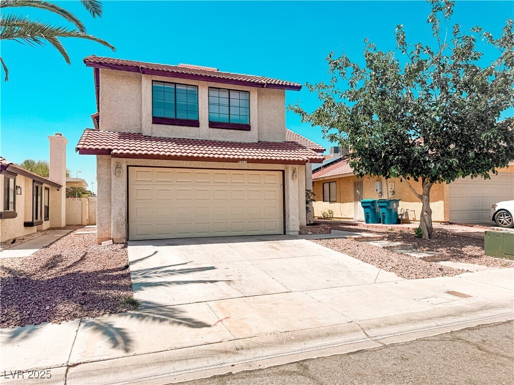
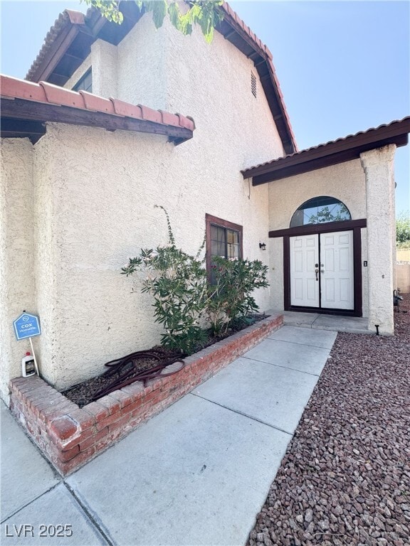
New A/C replaced in 2022, New piping for all bathrooms and kitchen, A new toilet downstairs replaced. Charming Two-Story Home in the Heart of Las Vegas! This 1,840 sq ft, 4 bedrooms and 2.5 bathrooms home offers a perfect blend of comfort and functionality with a spacious open floor plan, ideal for both everyday living and entertaining. Step into a bright living area with vaulted ceilings, tile and laminate flooring throughout (no carpet!), and a cozy fireplace for relaxing evenings. The kitchen features ample cabinetry. The primary bedroom boasts an ensuite bath with dual sinks and a walk-in closet. Outside, enjoy a low-maintenance backyard — perfect for gatherings or a peaceful morning coffee. The property sits on a 3,920 sq ft lot.
6437 Peachwood Rd is a house located in Clark County and the 89108 ZIP Code. This area is served by the Clark County attendance zone.
Home Type
Year Built
Bedrooms and Bathrooms
Home Design
Interior Spaces
Kitchen
Laundry
Listing and Financial Details
Lot Details
Parking
Schools
Utilities
Overview
Pet Policy
The fees below are based on community-supplied data and may exclude additional fees and utilities.
Tucked between Rancho Drive and the 95, Michael Way encompasses a number of prime suburban hotspots, all of them just six miles from the famous Las Vegas Strip. The area is classic Vegas with its towering palm trees, succulent gardens, and stucco homes. Three parks and the Las Vegas Golf Club round out Michael Way’s green space access, making for plenty of recreational escape from the desert landscape.
Chain restaurants and well-known retailers cater to most needs, but with the Strip so close there’s more unique fare and shopping to experience in just a matter of minutes. Domestic travelers will get plenty of use out of the North Las Vegas Airport that sits just across the 95, and those who commute for work by car are right next to the 15 and 95 junction.
Learn more about living in Michael Way| Colleges & Universities | Distance | ||
|---|---|---|---|
| Colleges & Universities | Distance | ||
| Drive: | 10 min | 3.8 mi | |
| Drive: | 11 min | 6.1 mi | |
| Drive: | 16 min | 8.7 mi | |
| Drive: | 21 min | 11.1 mi |
 The GreatSchools Rating helps parents compare schools within a state based on a variety of school quality indicators and provides a helpful picture of how effectively each school serves all of its students. Ratings are on a scale of 1 (below average) to 10 (above average) and can include test scores, college readiness, academic progress, advanced courses, equity, discipline and attendance data. We also advise parents to visit schools, consider other information on school performance and programs, and consider family needs as part of the school selection process.
Transportation options available in Las Vegas include Sahara Station, located 8.0 miles from 6437 Peachwood Rd. 6437 Peachwood Rd is near Harry Reid International, located 12.3 miles or 23 minutes away, and Boulder City Municipal, located 32.2 miles or 43 minutes away.
| Transit / Subway | Distance | ||
|---|---|---|---|
| Transit / Subway | Distance | ||
|
|
Drive: | 14 min | 8.0 mi |
|
|
Drive: | 16 min | 8.4 mi |
|
|
Drive: | 15 min | 8.6 mi |
|
|
Drive: | 18 min | 9.3 mi |
|
|
Drive: | 17 min | 9.8 mi |
| Airports | Distance | ||
|---|---|---|---|
| Airports | Distance | ||
|
Harry Reid International
|
Drive: | 23 min | 12.3 mi |
|
Boulder City Municipal
|
Drive: | 43 min | 32.2 mi |
Time and distance from 6437 Peachwood Rd.
| Shopping Centers | Distance | ||
|---|---|---|---|
| Shopping Centers | Distance | ||
| Walk: | 9 min | 0.5 mi | |
| Walk: | 11 min | 0.6 mi | |
| Walk: | 13 min | 0.7 mi |
| Parks and Recreation | Distance | ||
|---|---|---|---|
| Parks and Recreation | Distance | ||
|
Spring Mountains National Recreation Area
|
Drive: | 8 min | 3.9 mi |
|
Springs Preserve
|
Drive: | 10 min | 4.9 mi |
|
DISCOVERY Children's Museum
|
Drive: | 12 min | 7.0 mi |
|
Las Vegas Natural History Museum
|
Drive: | 11 min | 7.0 mi |
|
Craig Ranch Regional Park
|
Drive: | 15 min | 7.4 mi |
| Hospitals | Distance | ||
|---|---|---|---|
| Hospitals | Distance | ||
| Drive: | 4 min | 1.9 mi | |
| Drive: | 7 min | 3.9 mi | |
| Drive: | 10 min | 5.5 mi |
| Military Bases | Distance | ||
|---|---|---|---|
| Military Bases | Distance | ||
| Drive: | 30 min | 16.0 mi |
$3,495
Total Monthly Price5 Beds, 3 Baths, 3,647 sq ft
$1,755
Total Monthly Price Total Monthly Price New4 Beds, 2.5 Baths, 1,335 sq ft
$2,313 - $2,544
Plus Fees4 Beds
What Are Walk Score®, Transit Score®, and Bike Score® Ratings?
Walk Score® measures the walkability of any address. Transit Score® measures access to public transit. Bike Score® measures the bikeability of any address.
What is a Sound Score Rating?
A Sound Score Rating aggregates noise caused by vehicle traffic, airplane traffic and local sources