$3,500 / Month
42 Mt Pleasant Ave Unit 3
Boston, MA 02119
Today
Favorites
617-686-9959
-
Bedrooms
3
-
Bathrooms
1
-
Square Feet
1,400 sq ft
-
Available
Available Now
Highlights
- Medical Services
- City View
- Deck
- Property is near public transit
- Porch
- No Cooling
42 Mt Pleasant Ave Unit 3

Favorites
About This Home
$3,500 deposit,
Available Now
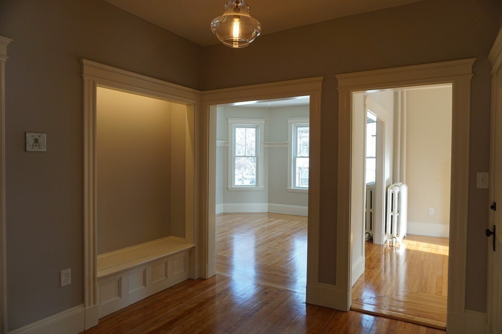
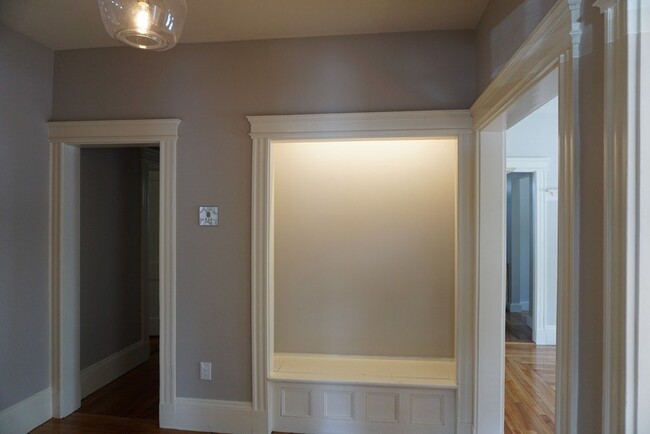
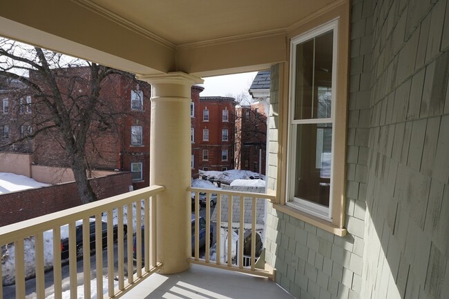
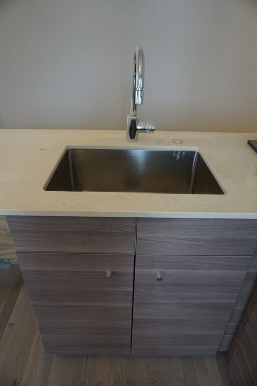
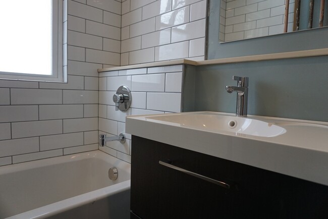
Major Universities & Hospitals minutes away from this South End/Jamaica Plain adjacent neighborhood in burgeoning Nubian Square! Rent includes CLEANING SERVICE monthly for this RENOVATED Floor-Thru W/High Efficiency Systems & Condo Quality Finishes plus 2 OFF-STREET PARKING,private DECK as well as bonus storage and oversized shared yard! This bright free standing 3BD/1BA home offers hardwood floors throughout with classic detail and grand proportions adorned with stained glass. The sprawling layout features original built-ins spanning separate living & dining areas plus a gracious hallway doubling as an office area. Front facing bay window & some city views from the rear deck. In unit W/D & butler's pantry add convenience. Sleek Stainless Appliances & Muted Wood Grained Cabinets grace the modern kitchen & Espresso Vanity & Over-Sized Subway Tiles are stunning in the bath including Thermador & Hans Grohe brands. Sorry no pets or smokers! Walking Score 89/Transit Score 82/Bike Score 76.
42 Mt Pleasant Ave is an apartment community located in Suffolk County and the 02119 ZIP Code.
* Price shown is base rent and may not include non-optional fees and utilities.
Price, availability, fees, and any applicable rent special are subject to change without notice.
* Square footage definitions vary. Displayed square footage is approximate.
Home Details
Accessible Home Design
Entry on the 3rd floor
Bedrooms and Bathrooms
1 Full Bathroom
3 Bedrooms
Home Design
Apartment
Interior Spaces
1-Story Property
1,400 Sq Ft Home
Kitchen
Range with Range Hood
Freezer
Dishwasher
Laundry
Dryer
Laundry in unit
Washer
Listing and Financial Details
Security Deposit $3,500
Property Available on 6/1/25
12 Month Lease Term
Rent includes water, sewer, trash collection, snow removal, gardener, extra storage, garden area, laundry facilities, parking
Location
Property is near public transit
Property is near schools
Lot Details
Garden
Outdoor Features
Deck
Porch
Parking
2 Car Parking Spaces
Utilities
No Cooling
Hot Water Heating System
Heating System Uses Natural Gas
Individual Controls for Heating
Internet Available
Views
City Views
Community Details
Amenities
Medical Services
Shops
Overview
No Home Owners Association
Pet Policy
No Pets Allowed
Recreation
Park
Bike Trail
Fees and Policies
The fees below are based on community-supplied data and may exclude additional fees and utilities.
Contact
- Listed by Jane C. Hoffmann | Haven Realty
- Phone Number
-
Source
 MLS Property Information Network
The property listing data and information set forth herein were provided to MLS Property Information Network, Inc. from third party sources, including sellers, lessors and public records, and were compiled by MLS Property Information Network, Inc. The property listing data and information are for the personal, non-commercial use of consumers having a good faith interest in purchasing or leasing listed properties of the type displayed to them and may not be used for any purpose other than to identify prospective properties which such consumers may have a good faith interest in purchasing or leasing. MLS Property Information Network, Inc. and its subscribers disclaim any and all representations and warranties as to the accuracy of the property listing data and information set forth herein. All properties are subject to prior sale, change or withdrawal. Copyright © 2025 MLS Property Information Network, Inc. All rights reserved.
Location
Get Directions
Amenities
- Dishwasher
- Range
- Refrigerator
- Freezer
- Views
- Porch
- Deck
Situated between the South End and Dudley Square, Lower Roxbury is a predominantly residential neighborhood brimming with apartments and town houses available for rent. Residents enjoy a walkable urban environment filled with diverse historical architecture.
Warren Street and Washington Street are the neighborhood’s main commercial thoroughfares, touting rows of specialty shops, markets, and eateries in historic buildings. Northeastern University, Wentworth Institute of Technology, and Massachusetts College of Art and Design are all just northwest of Lower Roxbury, offering the community a bevy of cultural and educational amenities. Getting around from Lower Roxbury is easy with access to multiple T stops on the Orange Line.
Learn more about living in Lower Roxbury
Education
| Colleges & Universities | Distance | ||
|---|---|---|---|
| Colleges & Universities | Distance | ||
| Drive: | 3 min | 1.4 mi | |
| Drive: | 3 min | 1.6 mi | |
| Drive: | 5 min | 1.7 mi | |
| Drive: | 4 min | 1.7 mi |
42 Mt Pleasant Ave Unit 3 is within 5 minutes or 1.7 miles from Northeastern University. It is also near Wentworth Inst. of Technology and MCPHS University, Boston.
Transportation options available in Boston include Roxbury Crossing Station, located 1.0 miles from 42 Mt Pleasant Ave Unit 3. 42 Mt Pleasant Ave Unit 3 is near General Edward Lawrence Logan International, located 5.6 miles or 11 minutes away.
| Transit / Subway | Distance | ||
|---|---|---|---|
| Transit / Subway | Distance | ||
|
|
Walk: | 20 min | 1.0 mi |
|
|
Drive: | 3 min | 1.4 mi |
|
|
Drive: | 3 min | 1.5 mi |
|
|
Drive: | 4 min | 1.6 mi |
|
|
Drive: | 4 min | 1.7 mi |
| Commuter Rail | Distance | ||
|---|---|---|---|
| Commuter Rail | Distance | ||
| Walk: | 17 min | 0.9 mi | |
|
|
Walk: | 20 min | 1.0 mi |
|
|
Drive: | 4 min | 1.8 mi |
|
|
Drive: | 7 min | 2.2 mi |
|
|
Drive: | 6 min | 2.6 mi |
| Airports | Distance | ||
|---|---|---|---|
| Airports | Distance | ||
|
General Edward Lawrence Logan International
|
Drive: | 11 min | 5.6 mi |
Time and distance from 42 Mt Pleasant Ave Unit 3.
| Shopping Centers | Distance | ||
|---|---|---|---|
| Shopping Centers | Distance | ||
| Walk: | 13 min | 0.7 mi | |
| Drive: | 3 min | 1.4 mi | |
| Drive: | 4 min | 1.8 mi |
42 Mt Pleasant Ave Unit 3 has 3 shopping centers within 1.8 miles, which is about a 4-minute walk. The miles and minutes will be for the farthest away property.
| Parks and Recreation | Distance | ||
|---|---|---|---|
| Parks and Recreation | Distance | ||
|
Roxbury Heritage State Park
|
Walk: | 14 min | 0.7 mi |
|
Lower Neponset River Trail
|
Drive: | 4 min | 2.0 mi |
|
Franklin Park Zoo
|
Drive: | 4 min | 2.2 mi |
|
Boston Public Garden
|
Drive: | 6 min | 2.5 mi |
|
Charles River Reservation
|
Drive: | 6 min | 2.9 mi |
42 Mt Pleasant Ave Unit 3 has 5 parks within 2.9 miles, including Roxbury Heritage State Park, Lower Neponset River Trail, and Franklin Park Zoo.
| Hospitals | Distance | ||
|---|---|---|---|
| Hospitals | Distance | ||
| Walk: | 13 min | 0.7 mi | |
| Walk: | 17 min | 0.9 mi | |
| Drive: | 4 min | 1.7 mi |
42 Mt Pleasant Ave Unit 3 has 3 hospitals within 1.7 miles, the nearest is Boston Medical Center which is 0.7 mile away and a 13 minute walk.
| Military Bases | Distance | ||
|---|---|---|---|
| Military Bases | Distance | ||
| Drive: | 32 min | 16.9 mi |
42 Mt Pleasant Ave Unit 3 is 16.9 miles and a 32 minute drive from Hanscom Air Force Base.
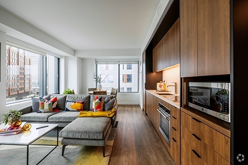
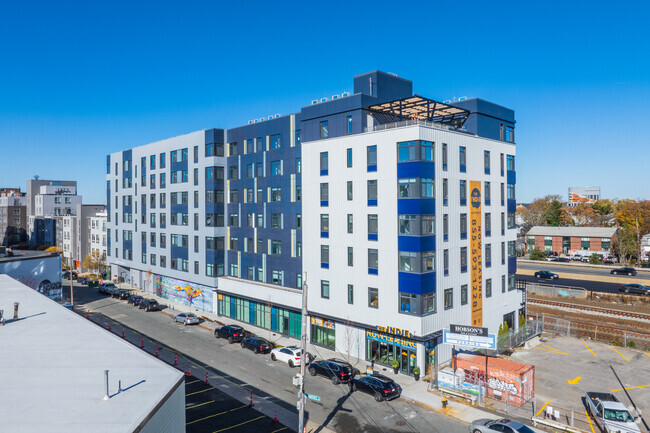
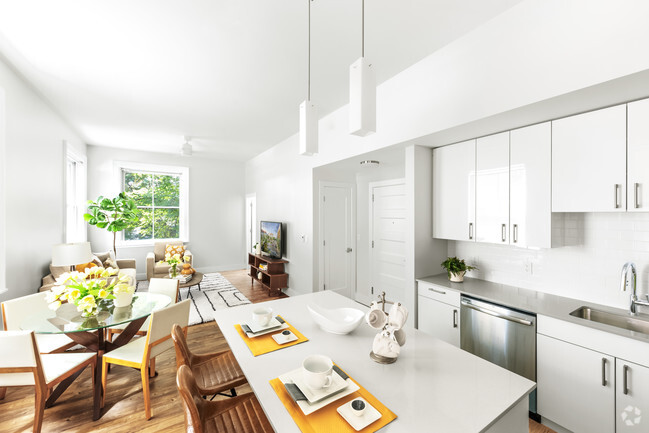
You May Also Like
Similar Rentals Nearby


What Are Walk Score®, Transit Score®, and Bike Score® Ratings?
Walk Score® measures the walkability of any address. Transit Score® measures access to public transit. Bike Score® measures the bikeability of any address.
What is a Sound Score Rating?
A Sound Score Rating aggregates noise caused by vehicle traffic, airplane traffic and local sources

42 Mt Pleasant Ave
Boston, MA 02119