$4,290 - $9,340
Total Monthly Price1-3 Beds
Pets Allowed Fitness Center Dishwasher Refrigerator Kitchen In Unit Washer & Dryer


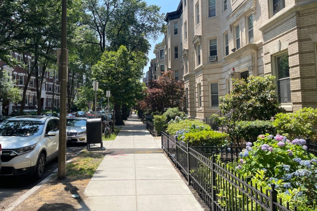
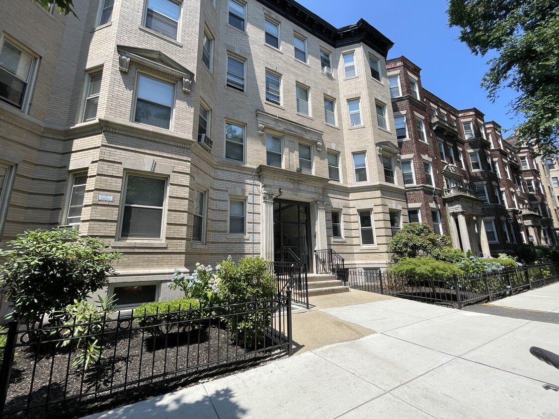
Professionally Managed building on Queensberry Street. Many September 1st apartment rentals available. Northeastern University, Berklee College of Music, Simmons, Mass Art, New England Conservatory all within close proximity. As the Fall semester for Universities is rapidly approaching, these apartments are sure to be rented up quickly. Contact our knowledgeable leasing staff who will be able to guide you through the rental process with ease. No Broker fees!!! Heat and hot water is included in the monthly rent! 24 Hour emergency maintenance staff! The Fenway area may be best known as home to the Boston Red Sox and Fenway Park, but it is also one of Boston's academic and cultural hubs! Officially named Fenway-Kenmore, this neighborhood is located between the Back Bay and Longwood Medical area. Fenway houses nearly one dozen of the 100+ colleges & universities located in the Greater Boston area! Northeastern University, Simmons College, Berklee School of Music & Harvard Medical School are just to name a few. The Longwood Medical area is just a few blocks away from this charming neighborhood making it easy for those working or attending programs in its world renowned hospitals and medical facilities. With Fenway/Kenmore accessible to Back Bay, Brookline, the South End, and such attractions as The Museum of Fine Arts and iconic Fenway Park, this area is sure to have something for everyone!
25 Queensberry St is an apartment community located in Suffolk County and the 02215 ZIP Code. This area is served by the Boston Public Schools attendance zone.
Dishwasher
High Speed Internet Access
Hardwood Floors
Granite Countertops
Tree-filled, historic, and packed with educational opportunity, there's no other neighborhood quite like Fenway. The neighborhood may be most well-known for its titular attraction, Fenway Park, home of the Boston Red Sox. However, the area is also renowned for its sprawling greenspace. The name "Fenway" refers to the neighborhood’s lush parkway and tree-filled paths that wind lazily through the area, forming part of Frederick Law Olmsted’s “Emerald Necklace Plan” (a chain of parks throughout Boston). The Fenway opened in 1876, and its route includes the Museum of Fine Arts and the Isabella Steward Gardner Museum.
Learn more about living in Fenway| Colleges & Universities | Distance | ||
|---|---|---|---|
| Colleges & Universities | Distance | ||
| Walk: | 10 min | 0.5 mi | |
| Walk: | 12 min | 0.7 mi | |
| Walk: | 13 min | 0.7 mi | |
| Drive: | 3 min | 1.4 mi |
 The GreatSchools Rating helps parents compare schools within a state based on a variety of school quality indicators and provides a helpful picture of how effectively each school serves all of its students. Ratings are on a scale of 1 (below average) to 10 (above average) and can include test scores, college readiness, academic progress, advanced courses, equity, discipline and attendance data. We also advise parents to visit schools, consider other information on school performance and programs, and consider family needs as part of the school selection process.
Transportation options available in Boston include Kenmore Station, located 0.5 mile from 25 Queensberry St. 25 Queensberry St is near General Edward Lawrence Logan International, located 6.2 miles or 14 minutes away.
| Transit / Subway | Distance | ||
|---|---|---|---|
| Transit / Subway | Distance | ||
|
|
Walk: | 10 min | 0.5 mi |
|
|
Walk: | 11 min | 0.6 mi |
|
|
Walk: | 11 min | 0.6 mi |
|
|
Walk: | 12 min | 0.6 mi |
|
|
Drive: | 3 min | 1.2 mi |
| Commuter Rail | Distance | ||
|---|---|---|---|
| Commuter Rail | Distance | ||
|
|
Walk: | 16 min | 0.8 mi |
|
|
Drive: | 7 min | 1.7 mi |
| Drive: | 6 min | 2.3 mi | |
|
|
Drive: | 7 min | 2.9 mi |
|
|
Drive: | 7 min | 4.0 mi |
| Airports | Distance | ||
|---|---|---|---|
| Airports | Distance | ||
|
General Edward Lawrence Logan International
|
Drive: | 14 min | 6.2 mi |
Time and distance from 25 Queensberry St.
| Shopping Centers | Distance | ||
|---|---|---|---|
| Shopping Centers | Distance | ||
| Walk: | 6 min | 0.4 mi | |
| Walk: | 15 min | 0.8 mi | |
| Drive: | 9 min | 5.0 mi |
| Parks and Recreation | Distance | ||
|---|---|---|---|
| Parks and Recreation | Distance | ||
|
Charles River Reservation
|
Drive: | 3 min | 1.2 mi |
|
Coit Observatory
|
Drive: | 3 min | 1.4 mi |
|
John Fitzgerald Kennedy National Historic Site
|
Drive: | 5 min | 2.0 mi |
|
Boston Public Garden
|
Drive: | 6 min | 2.0 mi |
|
Roxbury Heritage State Park
|
Drive: | 5 min | 2.3 mi |
| Hospitals | Distance | ||
|---|---|---|---|
| Hospitals | Distance | ||
| Walk: | 11 min | 0.6 mi | |
| Walk: | 14 min | 0.8 mi | |
| Drive: | 3 min | 1.3 mi |
| Military Bases | Distance | ||
|---|---|---|---|
| Military Bases | Distance | ||
| Drive: | 29 min | 14.8 mi | |
| Drive: | 28 min | 15.8 mi |
$4,290 - $9,340
Total Monthly Price1-3 Beds
Pets Allowed Fitness Center Dishwasher Refrigerator Kitchen In Unit Washer & Dryer
$4,007 - $7,842
Total Monthly Price1-3 Beds
Pets Allowed Fitness Center In Unit Washer & Dryer Balcony High-Speed Internet Stainless Steel Appliances
What Are Walk Score®, Transit Score®, and Bike Score® Ratings?
Walk Score® measures the walkability of any address. Transit Score® measures access to public transit. Bike Score® measures the bikeability of any address.
What is a Sound Score Rating?
A Sound Score Rating aggregates noise caused by vehicle traffic, airplane traffic and local sources