
Pioneer Endicott
141 4th St E,
Saint Paul, MN 55101
$1,137 - $2,425 Total Monthly Price
Studio - 2 Beds
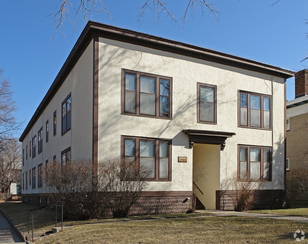
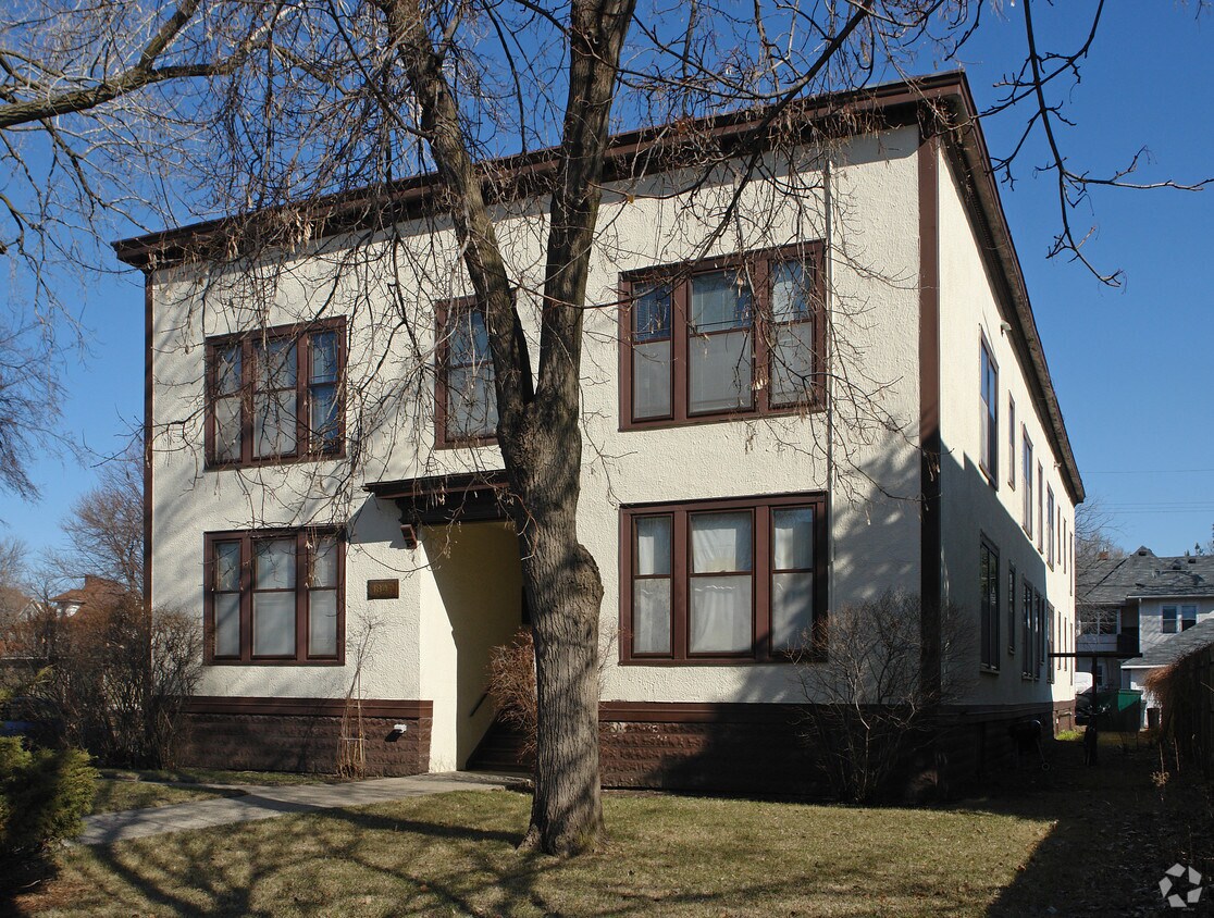

Thanks for your interest in 1847 Laurel Ave in St. Paul, MN. This community is located in the Merriam Park West area of St. Paul. The professional leasing team is available to help you find the best floor plan for your lifestyle. Contact us today to learn more about our community and make your move to 1847 Laurel Ave.
1847 Laurel Ave is an apartment community located in Ramsey County and the 55104 ZIP Code. This area is served by the St. Paul Public School District attendance zone.
Along the shore of the Mississippi River, Merriam Park West offers riverfront parks, a large golf course, and quaint local restaurants just minutes from downtown Saint Paul, Minnesota. Stop on in at Izzy’s Ice Cream Café, or grab a treat at Black Coffee and Waffle Bar. Local businesses thrive alongside riverfront community spaces like Shadow Falls Park, a picturesque nature preserve.
The University of Saint Thomas resides on the south end of town, and the neighborhood offers a blend of private and public schools, churches, and every day conveniences. Situated just five miles southeast of Minneapolis and seven miles northeast of the Minneapolis-Saint Paul International Airport, this neighborhood is in a premier location for commuting, shopping, dining, and entertainment.
Learn more about living in Merriam Park WestCompare neighborhood and city base rent averages by bedroom.
| Merriam Park West | Saint Paul, MN | |
|---|---|---|
| Studio | $985 | $1,149 |
| 1 Bedroom | $1,271 | $1,298 |
| 2 Bedrooms | $1,844 | $1,656 |
| 3 Bedrooms | $2,360 | $2,195 |
| Colleges & Universities | Distance | ||
|---|---|---|---|
| Colleges & Universities | Distance | ||
| Walk: | 17 min | 0.9 mi | |
| Drive: | 2 min | 1.1 mi | |
| Drive: | 3 min | 1.3 mi | |
| Drive: | 5 min | 1.8 mi |


Transportation options available in Saint Paul include Fairview Ave Station, located 0.9 mile from 1847 Laurel Ave. 1847 Laurel Ave is near Minneapolis-St Paul International/Wold-Chamberlain, located 6.9 miles or 14 minutes away.
| Transit / Subway | Distance | ||
|---|---|---|---|
| Transit / Subway | Distance | ||
| Walk: | 17 min | 0.9 mi | |
| Drive: | 3 min | 1.4 mi | |
| Drive: | 3 min | 1.7 mi | |
| Drive: | 5 min | 2.1 mi | |
| Drive: | 4 min | 2.2 mi |
| Commuter Rail | Distance | ||
|---|---|---|---|
| Commuter Rail | Distance | ||
|
|
Drive: | 9 min | 5.4 mi |
|
|
Drive: | 14 min | 6.7 mi |
|
|
Drive: | 23 min | 15.3 mi |
|
|
Drive: | 32 min | 24.1 mi |
|
|
Drive: | 34 min | 25.7 mi |
| Airports | Distance | ||
|---|---|---|---|
| Airports | Distance | ||
|
Minneapolis-St Paul International/Wold-Chamberlain
|
Drive: | 14 min | 6.9 mi |
Scores provided by
Traffic
-Airport
-Businesses
-Scores provided by
HowLoud What is a Sound Score Rating? A Sound Score Rating aggregates noise caused by vehicle traffic, airplane traffic and local sources. How It WorksTime and distance from 1847 Laurel Ave.
| Shopping Centers | Distance | ||
|---|---|---|---|
| Shopping Centers | Distance | ||
| Walk: | 19 min | 1.0 mi | |
| Drive: | 3 min | 1.5 mi |
| Parks and Recreation | Distance | ||
|---|---|---|---|
| Parks and Recreation | Distance | ||
|
Macalester College Observatory
|
Drive: | 2 min | 1.1 mi |
|
Newell Park
|
Drive: | 4 min | 1.7 mi |
|
Brackett Park
|
Drive: | 6 min | 2.4 mi |
|
Longfellow Park
|
Drive: | 7 min | 2.8 mi |
|
Hiawatha School Park
|
Drive: | 9 min | 3.4 mi |
| Hospitals | Distance | ||
|---|---|---|---|
| Hospitals | Distance | ||
| Drive: | 8 min | 3.9 mi | |
| Drive: | 7 min | 4.0 mi | |
| Drive: | 8 min | 4.1 mi |
| Military Bases | Distance | ||
|---|---|---|---|
| Military Bases | Distance | ||
| Drive: | 13 min | 5.6 mi |
Pets Allowed Fitness Center Pool Dishwasher Refrigerator Clubhouse Maintenance on site
High-Speed Internet Laundry Facilities
Pets Allowed Fitness Center Pool Dishwasher Refrigerator Kitchen In Unit Washer & Dryer
Pets Allowed Fitness Center Pool Dishwasher Refrigerator Kitchen
Pets Allowed Pool Dishwasher Microwave Granite Countertops
What Are Walk Score®, Transit Score®, and Bike Score® Ratings?
Walk Score® measures the walkability of any address. Transit Score® measures access to public transit. Bike Score® measures the bikeability of any address.
What is a Sound Score Rating?
A Sound Score Rating aggregates noise caused by vehicle traffic, airplane traffic and local sources.

1847 Laurel Ave
Saint Paul, MN 55104


