
Ten Essex
2-12 Essex St,
Cambridge, MA 02139
Studio - 3 Beds $2,995 - $6,300

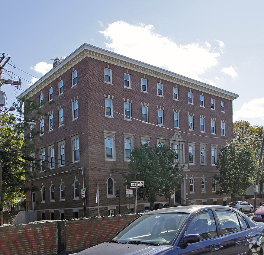
At 116 Norfolk St in Cambridge, MA, find your new home. The location in Cambridge's 02139 area is an ideal place to move. Be sure to see the available floorplan options. The professional leasing staff is waiting to show you all that this community has in store. Stop by the leasing office to check current floorplan availability.
116 Norfolk St is an apartment community located in Middlesex County and the 02139 ZIP Code. This area is served by the Prospect Hill Academy Charter (District) attendance zone.
Located right next to the renowned Central Square, The Port is a small urban neighborhood perfect for artists, hipsters, tech geeks, college students, or anyone looking to rent an apartment in a diverse, exciting community. The Port is filled with city landscapes, but Clement Morgan Park and Greene-Rose Heritage Park provide lush greenery in this urban jungle. The Community Art Center and the Cambridge Graffiti Wall (in Central Square) are just two examples of the works fueled by inspired local artists. The Port is within walking distance of the renowned Massachusetts Institute of Technology and a short drive to Harvard University and Boston University.
The Port is right on the border of Central Square, giving access to a plethora of old-school record stores, quirky shops, trendy bars, indie music venues, and low-key pubs. This unique culture feeds into The Port as well. Hot spots like the Miracle of Science Bar & Grill and The Automatic mold a thrilling, fascinating nightlife.
Learn more about living in The Port| Colleges & Universities | Distance | ||
|---|---|---|---|
| Colleges & Universities | Distance | ||
| Walk: | 13 min | 0.7 mi | |
| Walk: | 13 min | 0.7 mi | |
| Drive: | 4 min | 1.8 mi | |
| Drive: | 4 min | 1.9 mi |


Transportation options available in Cambridge include Central Square Station, located 0.3 mile from 116 Norfolk St. 116 Norfolk St is near General Edward Lawrence Logan International, located 5.8 miles or 14 minutes away.
| Transit / Subway | Distance | ||
|---|---|---|---|
| Transit / Subway | Distance | ||
|
|
Walk: | 5 min | 0.3 mi |
|
|
Walk: | 16 min | 0.9 mi |
| Walk: | 17 min | 0.9 mi | |
|
|
Drive: | 3 min | 1.3 mi |
| Drive: | 8 min | 2.8 mi |
| Commuter Rail | Distance | ||
|---|---|---|---|
| Commuter Rail | Distance | ||
|
|
Drive: | 5 min | 2.3 mi |
|
|
Drive: | 10 min | 2.6 mi |
|
|
Drive: | 8 min | 2.7 mi |
|
|
Drive: | 5 min | 3.0 mi |
| Drive: | 13 min | 7.6 mi |
| Airports | Distance | ||
|---|---|---|---|
| Airports | Distance | ||
|
General Edward Lawrence Logan International
|
Drive: | 14 min | 5.8 mi |
Time and distance from 116 Norfolk St.
| Shopping Centers | Distance | ||
|---|---|---|---|
| Shopping Centers | Distance | ||
| Walk: | 9 min | 0.5 mi | |
| Drive: | 3 min | 1.1 mi | |
| Drive: | 4 min | 1.3 mi |
| Parks and Recreation | Distance | ||
|---|---|---|---|
| Parks and Recreation | Distance | ||
|
Harvard Museum of Natural History
|
Drive: | 4 min | 1.7 mi |
|
Mineralogical and Geological Museum
|
Drive: | 4 min | 1.7 mi |
|
Longfellow National Historic Site
|
Drive: | 5 min | 1.9 mi |
|
Charles River Reservation
|
Drive: | 5 min | 2.0 mi |
|
Coit Observatory
|
Drive: | 5 min | 2.2 mi |
| Hospitals | Distance | ||
|---|---|---|---|
| Hospitals | Distance | ||
| Walk: | 15 min | 0.8 mi | |
| Drive: | 5 min | 1.9 mi | |
| Drive: | 5 min | 1.9 mi |
| Military Bases | Distance | ||
|---|---|---|---|
| Military Bases | Distance | ||
| Drive: | 25 min | 13.0 mi | |
| Drive: | 29 min | 16.8 mi |
What Are Walk Score®, Transit Score®, and Bike Score® Ratings?
Walk Score® measures the walkability of any address. Transit Score® measures access to public transit. Bike Score® measures the bikeability of any address.
What is a Sound Score Rating?
A Sound Score Rating aggregates noise caused by vehicle traffic, airplane traffic and local sources
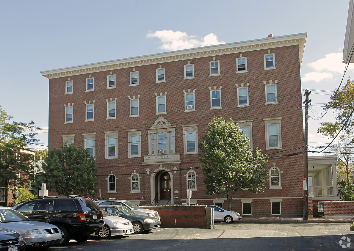
116 Norfolk St
Cambridge, MA 02139


")


