
The Grove
8200 Sunbury Ln,
Houston, TX 77095
$785 - $1,359
1-2 Beds
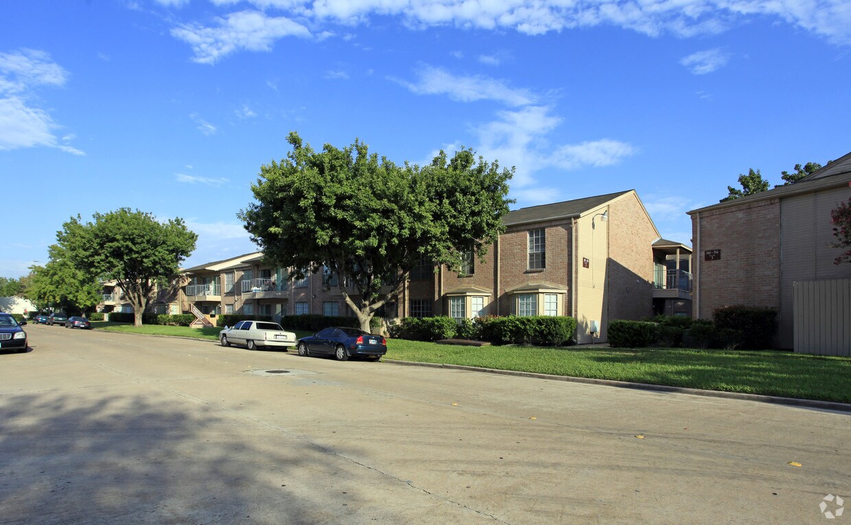
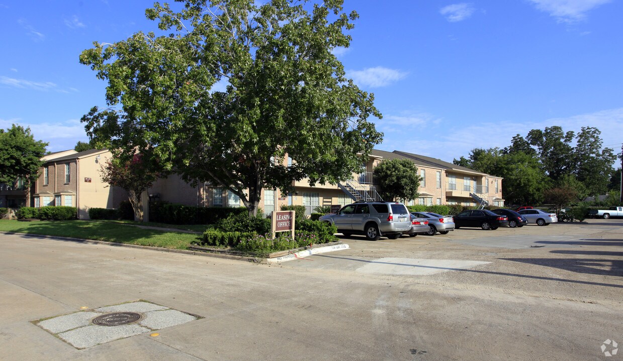

Westwood Triangle Apartments offers a mixture of comfort, quality, and design. This property is situated in the 77036 area of Houston. This community has a unique selection of amenities and features including: ice makers, balconies, and smoke-free options. Stop by the leasing office to learn more about our community.
Westwood Triangle Apartments is an apartment community located in Harris County and the 77036 ZIP Code. This area is served by the Alief Independent attendance zone.
Laundry Facilities
Controlled Access
24 Hour Access
Maintenance on site
Air Conditioning
Dishwasher
High Speed Internet Access
Refrigerator
Sharpstown is a diverse urban neighborhood located about 12 miles southwest of Downtown Houston. As one of the first communities in Houston, this historic neighborhood features affordable post-World War II bungalows, modern houses, and chic apartments available for rent. Houston is one of the nation’s most diverse cities and Sharpstown reflects that. As you travel around the neighborhood, you’ll see a variety of street signs and billboards in both English and another foreign language. Sharpstown is also home to Chinatown and the Mahatma Gandhi District, providing residents with a plethora of authentic eateries and international grocery stores. Houston Baptist University and Memorial Herman Southwest Hospital are located in Sharpstown as well. Residents enjoy access to several shopping centers, parks, and small entertainment spots within the community but Sharpstown is also convenient to the Galleria/Uptown Houston, the Texas Medical Center, and Downtown Houston.
Learn more about living in Sharpstown| Colleges & Universities | Distance | ||
|---|---|---|---|
| Colleges & Universities | Distance | ||
| Drive: | 6 min | 2.1 mi | |
| Drive: | 6 min | 2.5 mi | |
| Drive: | 12 min | 7.7 mi | |
| Drive: | 19 min | 11.6 mi |


Transportation options available in Houston include Fannin South, located 9.9 miles from Westwood Triangle Apartments. Westwood Triangle Apartments is near William P Hobby, located 24.7 miles or 38 minutes away, and George Bush Intcntl/Houston, located 34.7 miles or 43 minutes away.
| Transit / Subway | Distance | ||
|---|---|---|---|
| Transit / Subway | Distance | ||
|
|
Drive: | 19 min | 9.9 mi |
|
|
Drive: | 19 min | 10.0 mi |
|
|
Drive: | 19 min | 11.5 mi |
| Drive: | 19 min | 11.6 mi | |
|
|
Drive: | 19 min | 11.9 mi |
| Commuter Rail | Distance | ||
|---|---|---|---|
| Commuter Rail | Distance | ||
|
|
Drive: | 22 min | 13.7 mi |
| Airports | Distance | ||
|---|---|---|---|
| Airports | Distance | ||
|
William P Hobby
|
Drive: | 38 min | 24.7 mi |
|
George Bush Intcntl/Houston
|
Drive: | 43 min | 34.7 mi |
Time and distance from Westwood Triangle Apartments.
| Shopping Centers | Distance | ||
|---|---|---|---|
| Shopping Centers | Distance | ||
| Walk: | 15 min | 0.8 mi | |
| Walk: | 15 min | 0.8 mi | |
| Walk: | 17 min | 0.9 mi |
| Parks and Recreation | Distance | ||
|---|---|---|---|
| Parks and Recreation | Distance | ||
|
Club Creek Park and Vietnam Veterans Memorial
|
Drive: | 5 min | 1.8 mi |
|
Arthur Storey Park
|
Drive: | 6 min | 2.7 mi |
|
Buffalo Bayou Paddling Trail
|
Drive: | 12 min | 6.1 mi |
|
Nature Discovery Center
|
Drive: | 14 min | 6.5 mi |
|
Edith L. Moore Nature Sanctuary
|
Drive: | 11 min | 7.6 mi |
| Hospitals | Distance | ||
|---|---|---|---|
| Hospitals | Distance | ||
| Drive: | 7 min | 3.6 mi | |
| Drive: | 11 min | 5.0 mi | |
| Drive: | 11 min | 5.5 mi |
| Military Bases | Distance | ||
|---|---|---|---|
| Military Bases | Distance | ||
| Drive: | 50 min | 36.8 mi | |
| Drive: | 79 min | 62.4 mi |
What Are Walk Score®, Transit Score®, and Bike Score® Ratings?
Walk Score® measures the walkability of any address. Transit Score® measures access to public transit. Bike Score® measures the bikeability of any address.
What is a Sound Score Rating?
A Sound Score Rating aggregates noise caused by vehicle traffic, airplane traffic and local sources

9292 Imogene St
Houston, TX 77036


