
110 Roy Apartments
110 Roy St,
Seattle, WA 98119
$1,945 - $5,495
Studio - 2 Beds

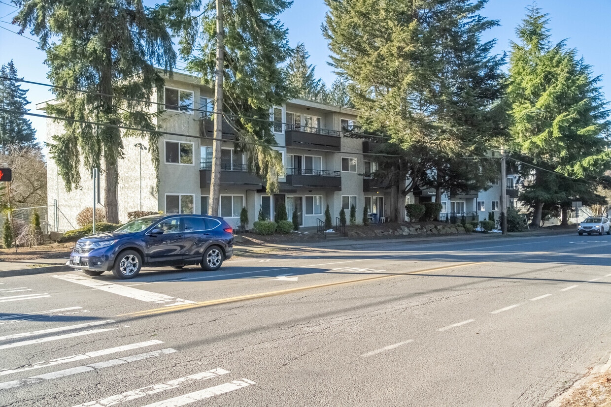
Sterling Manor Apartments 811 N 130TH ST, SEATTLE, WA, 98133 Neighborhood: Bitter Lake Manager: | The Sterling Manor was built in 1976 and is situated adjacent to Bitter Lake Park and along the Burke Gilman Trail. This 21-unit complex offers one, two and three bedroom units with spacious decks and territorial views. Amenities include controlled access, carport parking, elevator, smart-app laundry machines on each floor and storage. It is located near grocery stores, shops, restaurants, major banks, schools, and the library is within walking distance. Great location with off-street parking available and near the bus line. On-Site Laundry Facilities Controlled Access Building Elevator Near Bus Line Walk Score 79
Spacious unit nestled across from Bitterla... is an apartment community located in King County and the 98133 ZIP Code. This area is served by the Seattle Public Schools attendance zone.
Unique Features
Dishwasher
Refrigerator
Disposal
Intercom
Located about nine miles north of Downtown Seattle, Bitter Lake is a lush neighborhood centered on its namesake lake. Bitter Lake serves as a quiet respite from city life, offering a broad range of affordable apartments, condos, townhomes, and houses available for rent in a park-like locale.
Residents enjoy access to an array of restaurants, shops, markets, and gyms strewn along Aurora Avenue, the neighborhood’s main commercial thoroughfare. Additional shopping and dining options abound at the nearby Northgate Mall. North Seattle College lies just southeast of the neighborhood, making Bitter Lake a convenient choice for many students, faculty, and staff.
Learn more about living in Bitter LakeCompare neighborhood and city base rent averages by bedroom.
| Bitter Lake | Seattle, WA | |
|---|---|---|
| Studio | $1,102 | $1,490 |
| 1 Bedroom | $1,514 | $2,083 |
| 2 Bedrooms | $1,772 | $2,779 |
| 3 Bedrooms | $2,357 | $3,825 |
| Colleges & Universities | Distance | ||
|---|---|---|---|
| Colleges & Universities | Distance | ||
| Drive: | 6 min | 2.3 mi | |
| Drive: | 8 min | 2.7 mi | |
| Drive: | 13 min | 6.7 mi | |
| Drive: | 21 min | 8.9 mi |


Transportation options available in Seattle include Shoreline South/148Th, located 2.1 miles from Spacious unit nestled across from Bitterla.... Spacious unit nestled across from Bitterla... is near Seattle Paine Field International, located 16.5 miles or 27 minutes away, and Seattle-Tacoma International, located 23.5 miles or 35 minutes away.
| Transit / Subway | Distance | ||
|---|---|---|---|
| Transit / Subway | Distance | ||
| Drive: | 5 min | 2.1 mi | |
| Drive: | 6 min | 2.3 mi | |
| Drive: | 8 min | 4.2 mi | |
| Drive: | 9 min | 4.8 mi | |
| Drive: | 10 min | 5.7 mi |
| Commuter Rail | Distance | ||
|---|---|---|---|
| Commuter Rail | Distance | ||
|
|
Drive: | 16 min | 7.6 mi |
|
|
Drive: | 16 min | 10.2 mi |
|
|
Drive: | 32 min | 19.3 mi |
|
|
Drive: | 32 min | 21.5 mi |
|
|
Drive: | 31 min | 21.9 mi |
| Airports | Distance | ||
|---|---|---|---|
| Airports | Distance | ||
|
Seattle Paine Field International
|
Drive: | 27 min | 16.5 mi |
|
Seattle-Tacoma International
|
Drive: | 35 min | 23.5 mi |
Time and distance from Spacious unit nestled across from Bitterla....
| Shopping Centers | Distance | ||
|---|---|---|---|
| Shopping Centers | Distance | ||
| Walk: | 4 min | 0.3 mi | |
| Walk: | 7 min | 0.4 mi | |
| Walk: | 9 min | 0.5 mi |
| Parks and Recreation | Distance | ||
|---|---|---|---|
| Parks and Recreation | Distance | ||
|
Northacres Park
|
Walk: | 18 min | 1.0 mi |
|
Licton Springs Park
|
Drive: | 5 min | 2.1 mi |
|
Twin Ponds Park
|
Drive: | 5 min | 2.2 mi |
|
Paramount Park Open Space
|
Drive: | 5 min | 2.3 mi |
|
Carkeek Park
|
Drive: | 9 min | 2.5 mi |
| Hospitals | Distance | ||
|---|---|---|---|
| Hospitals | Distance | ||
| Drive: | 3 min | 1.4 mi | |
| Drive: | 12 min | 5.9 mi | |
| Drive: | 13 min | 8.3 mi |
| Military Bases | Distance | ||
|---|---|---|---|
| Military Bases | Distance | ||
| Drive: | 22 min | 7.9 mi | |
| Drive: | 74 min | 29.0 mi |
What Are Walk Score®, Transit Score®, and Bike Score® Ratings?
Walk Score® measures the walkability of any address. Transit Score® measures access to public transit. Bike Score® measures the bikeability of any address.
What is a Sound Score Rating?
A Sound Score Rating aggregates noise caused by vehicle traffic, airplane traffic and local sources
811 N 130th St
Seattle, WA 98133


