
Harbor Point
24 Oyster Bay Rd,
Boston, MA 02125
$2,130 - $5,910 Total Monthly Price
1-3 Beds

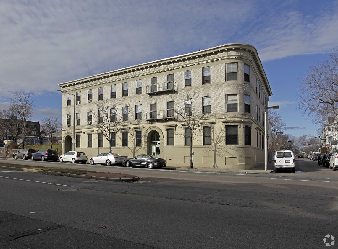
Experience Boston living at Columbia Wood. This community is located at 200-204 Columbia Rd in Boston. From amenities to floor plan options, the leasing team is ready to help you find your dream apartment. Drop by the leasing office to discuss your new apartment and make your move to Columbia Wood.
Columbia Wood is an apartment community located in Suffolk County and the 02121 ZIP Code. This area is served by the Boston Public Schools attendance zone.
Washer/Dryer Hookup
High Speed Internet Access
Hardwood Floors
Smoke Free
Less than four miles outside of Downtown Boston sits Dudley-Brunswick King. Full of non-profit organizations committed to advancing the community, Dudley-Brunswick King is home to the Food Project, CommonWealth Kitchen, Project Hope, and the Dudley Street Neighborhood Initiative.
Dudley-Brunswick King residents enjoy access to cultural and educational venues such as the Boston Public Library and Oodua African Movie Center. There are a number of parks and green spaces in Dudley-Brunswick King including Clifford Playground, Mary Hannon Park, Ceylon Park, Brunswick-King Play Area, Dacia/Woodcliff Streets Garden, and multiple community gardens sponsored by the Food Project. Boston’s biggest park, Franklin Park, is also nearby and contains numerous amenities.
Convenient to the MBTA Commuter Rail, bus routes, and major highways as well as Boston Logan International Airport, Dudley-Brunswick King allows for easy commutes and travels.
Learn more about living in Dudley-Brunswick KingCompare neighborhood and city base rent averages by bedroom.
| Dudley-Brunswick King | Boston, MA | |
|---|---|---|
| Studio | $2,226 | $2,856 |
| 1 Bedroom | $2,273 | $3,405 |
| 2 Bedrooms | $2,715 | $4,317 |
| 3 Bedrooms | $2,693 | $5,776 |
| Colleges & Universities | Distance | ||
|---|---|---|---|
| Colleges & Universities | Distance | ||
| Drive: | 6 min | 2.9 mi | |
| Drive: | 7 min | 3.0 mi | |
| Drive: | 6 min | 3.1 mi | |
| Drive: | 8 min | 3.2 mi |


Transportation options available in Boston include Fields Corner Station, located 1.8 miles from Columbia Wood. Columbia Wood is near General Edward Lawrence Logan International, located 7.0 miles or 14 minutes away.
| Transit / Subway | Distance | ||
|---|---|---|---|
| Transit / Subway | Distance | ||
|
|
Drive: | 4 min | 1.8 mi |
|
|
Drive: | 5 min | 2.3 mi |
|
|
Drive: | 5 min | 2.5 mi |
|
|
Drive: | 6 min | 2.5 mi |
|
|
Drive: | 5 min | 2.6 mi |
| Commuter Rail | Distance | ||
|---|---|---|---|
| Commuter Rail | Distance | ||
| Walk: | 6 min | 0.3 mi | |
|
|
Drive: | 3 min | 1.4 mi |
| Drive: | 4 min | 2.0 mi | |
| Drive: | 4 min | 2.0 mi | |
|
|
Drive: | 6 min | 2.4 mi |
| Airports | Distance | ||
|---|---|---|---|
| Airports | Distance | ||
|
General Edward Lawrence Logan International
|
Drive: | 14 min | 7.0 mi |
Time and distance from Columbia Wood.
| Shopping Centers | Distance | ||
|---|---|---|---|
| Shopping Centers | Distance | ||
| Walk: | 8 min | 0.4 mi | |
| Drive: | 3 min | 1.3 mi | |
| Drive: | 4 min | 2.1 mi |
| Parks and Recreation | Distance | ||
|---|---|---|---|
| Parks and Recreation | Distance | ||
|
Lower Neponset River Trail
|
Walk: | 10 min | 0.5 mi |
|
Franklin Park Zoo
|
Walk: | 11 min | 0.6 mi |
|
Roxbury Heritage State Park
|
Drive: | 5 min | 2.1 mi |
|
Mass Audubon's Boston Nature Center and Wildlife Sanctuary
|
Drive: | 6 min | 2.7 mi |
|
Dorchester Shores Reservation
|
Drive: | 6 min | 2.7 mi |
| Hospitals | Distance | ||
|---|---|---|---|
| Hospitals | Distance | ||
| Drive: | 6 min | 2.6 mi | |
| Drive: | 5 min | 2.8 mi | |
| Drive: | 7 min | 2.8 mi |
Pets Allowed Fitness Center Pool Dishwasher Kitchen In Unit Washer & Dryer
Pets Allowed Fitness Center In Unit Washer & Dryer Balcony High-Speed Internet Stainless Steel Appliances
Pets Allowed Fitness Center Pool Kitchen In Unit Washer & Dryer Walk-In Closets
Pets Allowed Fitness Center Granite Countertops Smoke Free
What Are Walk Score®, Transit Score®, and Bike Score® Ratings?
Walk Score® measures the walkability of any address. Transit Score® measures access to public transit. Bike Score® measures the bikeability of any address.
What is a Sound Score Rating?
A Sound Score Rating aggregates noise caused by vehicle traffic, airplane traffic and local sources
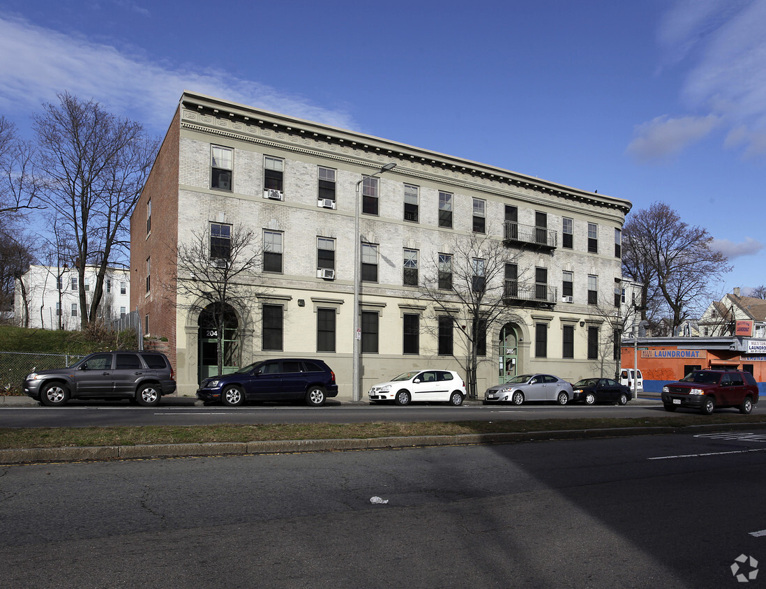
200-204 Columbia Rd
Boston, MA 02121


