
The Grove
8200 Sunbury Ln,
Houston, TX 77095
$785 - $1,359
1-2 Beds

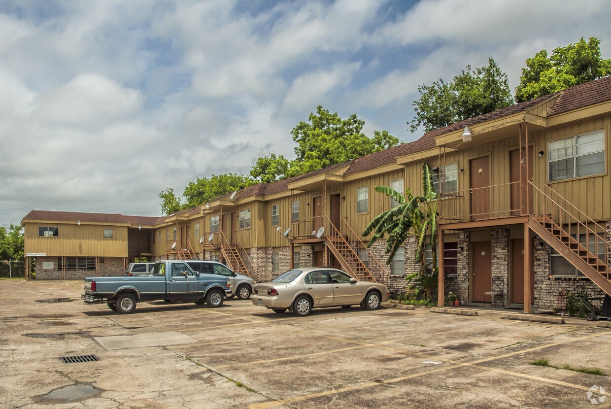

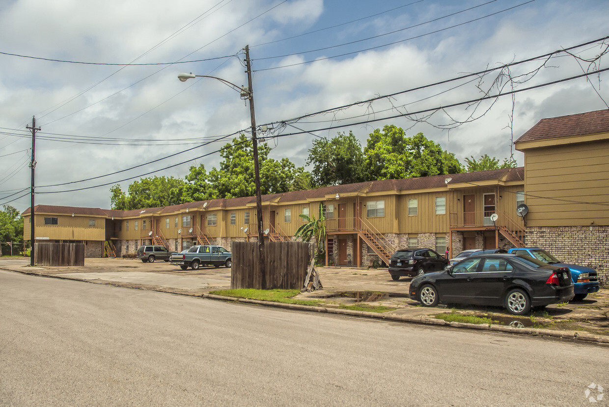
Mt. Hebron Village Apartments in Houston, TX is ready for you to move in. Be sure to come for a visit to check out the current floorplan options. This community offers a competitive amenity package including: smoke free options, convenient on-site parking options, and high-speed internet access. From amenities to floorplan options, the leasing team is ready to help you find your perfect fit. Visit Mt. Hebron Village Apartments today.
Mt. Hebron Village Apartments is an apartment community located in Harris County and the 77033 ZIP Code. This area is served by the Houston Independent School District attendance zone.
High Speed Internet Access
Refrigerator
Smoke Free
Heating
Nestled just eight miles south of Downtown Houston, residents of Sunnyside find its close proximity to city attractions and low cost of living attractive. The community borders the 610 Loop and is inside the Beltway 8, making it simple for locals to commute to work.
There’s definitely a suburban vibe to the area. Students of Sunnyside are zoned to the Houston Independent School District. Residents look forward to the amenities at Sunnyside Park, including the playground, sports courts, walking/biking trails, and the gym that’s located in the community center.
Cullen Boulevard and Reed Road house many local restaurants and quick-bite establishments. It’s only a short ride to Houston attractions like the zoo, aquarium, and the Children’s Museum of Houston. Need to get to William P. Hobby Airport? You’re only a 15-minute drive away.
Learn more about living in SunnysideCompare neighborhood and city base rent averages by bedroom.
| Sunnyside | Houston, TX | |
|---|---|---|
| Studio | - | $1,079 |
| 1 Bedroom | $922 | $1,182 |
| 2 Bedrooms | $1,023 | $1,502 |
| 3 Bedrooms | $1,738 | $1,931 |
| Colleges & Universities | Distance | ||
|---|---|---|---|
| Colleges & Universities | Distance | ||
| Drive: | 9 min | 4.0 mi | |
| Drive: | 9 min | 4.3 mi | |
| Drive: | 10 min | 5.0 mi | |
| Drive: | 9 min | 5.2 mi |


Transportation options available in Houston include Palm Center Transit Center Sb, located 3.0 miles from Mt. Hebron Village Apartments. Mt. Hebron Village Apartments is near William P Hobby, located 9.1 miles or 20 minutes away, and George Bush Intcntl/Houston, located 26.0 miles or 35 minutes away.
| Transit / Subway | Distance | ||
|---|---|---|---|
| Transit / Subway | Distance | ||
| Drive: | 5 min | 3.0 mi | |
| Drive: | 6 min | 3.3 mi | |
| Drive: | 6 min | 3.6 mi | |
|
|
Drive: | 6 min | 3.8 mi |
| Drive: | 6 min | 3.8 mi |
| Commuter Rail | Distance | ||
|---|---|---|---|
| Commuter Rail | Distance | ||
|
|
Drive: | 14 min | 8.7 mi |
| Airports | Distance | ||
|---|---|---|---|
| Airports | Distance | ||
|
William P Hobby
|
Drive: | 20 min | 9.1 mi |
|
George Bush Intcntl/Houston
|
Drive: | 35 min | 26.0 mi |
Time and distance from Mt. Hebron Village Apartments.
| Shopping Centers | Distance | ||
|---|---|---|---|
| Shopping Centers | Distance | ||
| Walk: | 2 min | 0.1 mi | |
| Walk: | 5 min | 0.3 mi | |
| Walk: | 17 min | 0.9 mi |
| Parks and Recreation | Distance | ||
|---|---|---|---|
| Parks and Recreation | Distance | ||
|
Houston Zoo
|
Drive: | 9 min | 4.8 mi |
|
Children's Museum of Houston
|
Drive: | 8 min | 5.1 mi |
|
Hermann Park
|
Drive: | 10 min | 5.1 mi |
|
Cockrell Butterfly Center
|
Drive: | 10 min | 5.5 mi |
|
Houston Museum of Natural Science
|
Drive: | 10 min | 5.6 mi |
| Hospitals | Distance | ||
|---|---|---|---|
| Hospitals | Distance | ||
| Drive: | 5 min | 2.7 mi | |
| Drive: | 7 min | 4.1 mi | |
| Drive: | 7 min | 4.2 mi |
| Military Bases | Distance | ||
|---|---|---|---|
| Military Bases | Distance | ||
| Drive: | 34 min | 23.5 mi | |
| Drive: | 62 min | 49.0 mi |
Pets Allowed Fitness Center Dishwasher Refrigerator Kitchen In Unit Washer & Dryer
What Are Walk Score®, Transit Score®, and Bike Score® Ratings?
Walk Score® measures the walkability of any address. Transit Score® measures access to public transit. Bike Score® measures the bikeability of any address.
What is a Sound Score Rating?
A Sound Score Rating aggregates noise caused by vehicle traffic, airplane traffic and local sources.
4617 Edfield St
Houston, TX 77033


