Background Image

Point Richmond, CA Area Guide

A coastal hideaway in southeastern Richmond

Coastal Picturesque Charming

Point Richmond occupies the western waterfront tip of Richmond, pressing right up against the San Francisco Bay with sweeping views of the Golden Gate Bridge and the Marin headlands. The neighborhood carries a small-town rhythm all its own: walkable streets in the village core, independent cafes and shops along Washington Avenue and Park Place, hilly terrain that frames the bay at nearly every turn, and easy access to the Miller/Knox Regional Shoreline just steps from residential blocks.

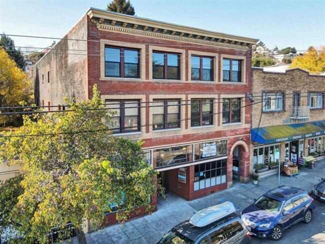
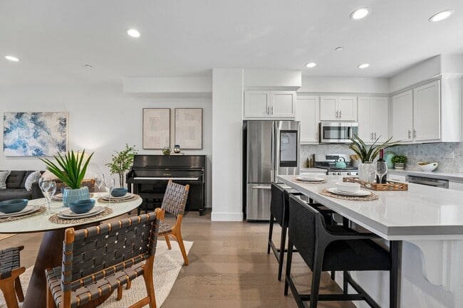
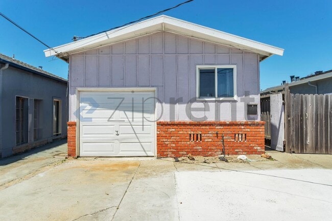
With the Miller/Knox Regional Shoreline taking up a large swathe of space, rentals are clustered in the north part of the area. Options here lean toward older, character-rich stock, including Victorian-era homes, classic California bungalows, and smaller apartment communities that reflect the neighborhood's early 20th-century roots. The architecture matches the unhurried, village-like atmosphere of the area.

The Richmond Ferry Terminal is about seven minutes away, connecting directly to San Francisco, while BART's Richmond Station sits roughly the same distance in the other direction. Richmond was also designated a WWII Heritage City by the National Park Service, a distinction tied to the massive shipyard operations that once defined the entire waterfront.

Demographics

Median Household Income

$73,195

Average: $99,220

Education

6,315

Residents Have a Degree

Job Market

16,917

Workers Employed

Age Distribution
Get a sense of this area's population profile.

Median Age

36 Years

Largest Age Group

30-39 Years

Approximately 15% of Residents

Under 20

27%

Over 65

12%

Housing Distribution

Point Richmond has more renters than homeowners.

Renters
58%
Non-Renters
42%

Education Distribution

Review this city's overall education levels.

Bachelor's or Higher
12%
Other Education
88%

Learn More About Point Richmond

Getting Around

Somewhat Walkable

Walkability

20 / 100

Exceptionally Drivable

Drivability

100 / 100

Moderately Bikeable

Bikeability

60 / 100

Points of Interest

Parks and Recreation

  • Miller/Knox Regional Shoreline
  • Brooks Island Regional Preserve
  • Rosie the Riveter WWII Home Front National Historical Park
  • Marina Park & Green
  • Shimada Friendship Park

Airports

  • Metro Oakland International
  • San Francisco International

Top Apartments in Point Richmond

Living in Point Richmond

History

-

Point Richmond is one of Richmond's oldest neighborhoods, predating much of the city's industrial expansion and retaining Victorian and early 20th-century architecture throughout its village core. The neighborhood originally developed as a terminus for the Santa Fe Railroad, giving it an identity rooted in transit and commerce before the broader city took shape around it.

The area's wartime chapter is commemorated nearby at the Rosie the Riveter WWII Home Front National Historical Park, about three miles away, which honors the home-front contributions made during World War II. Closer still, the Masquers Playhouse, an 89-seat community theater whose performing group has been active since 1955, remains a living piece of the neighborhood's cultural past.

Restaurants

-

Dining in Point Richmond centers on the Washington Avenue and Park Place corridor, where the scene favors coffeehouses, cafes, and locally owned restaurants over national chains. The atmosphere stays consistent with the neighborhood's village character: low-key, personal, and a noticeable step away from the high-volume dining strips found in larger Bay Area corridors.

City-wide, Richmond offers a broader spread of options, including Mexican cuisine, waterfront restaurants, and casual neighborhood spots, giving residents a wider range to explore just a short drive from the village core.

Transportation

-

Getting around from Point Richmond leans on the car for most trips beyond the walkable village core, though several regional transit options are close. The Richmond Ferry Terminal, about seven minutes away, runs service directly to San Francisco. BART's Richmond Station sits roughly three miles east, connecting riders to Oakland, San Francisco, and the broader East Bay network. Amtrak also stops at Richmond Station, with trips to San Francisco taking around 40 minutes.

For drivers, the Richmond-San Rafael Bridge via I-580 provides a direct route into Marin County, while I-80 connects east toward Oakland and beyond. Oakland International Airport is about 32 minutes away, and San Francisco International is approximately 45 minutes by car.

Parks

-

Miller/Knox Regional Shoreline borders the neighborhood directly, offering bay access, hiking trails, and Keller Beach, a swimming beach right on the water. The park is right on the village's south end and serves as the main outdoor anchor.

Brooks Island Regional Preserve, reachable by boat about nine minutes away, protects native coastal habitat. The Bay Trail runs along the waterfront for hiking and biking, while Wildcat Canyon Regional Park, Richmond's largest green space at over 2,000 acres, offers open fields and extensive trail networks.

Cost

-

Renting in Richmond runs well below the California state average, with one-bedroom apartments averaging around $1,800 per month compared to the state-wide average of about $2,266. Studios and larger units follow a similar pattern, keeping overall housing costs more accessible than nearby cities like El Cerrito or San Francisco, where rents can run significantly higher.

Shopping

-

The village shopping district along Washington Avenue and Park Place keeps things small and independent, with local boutiques and specialty stores suited to the neighborhood's scale. Large-format retail is not part of the immediate area, but Richmond City Center and Harbor Gate are both reachable within six minutes by car, bringing national chains and everyday essentials within easy reach.

San Pablo Avenue and Richmond Parkway extend the city-wide retail corridor further, covering big-box stores and a full range of local businesses.

Highlights

-

Point Richmond offers bayfront living with panoramic views of the Golden Gate Bridge and Marin headlands, a walkable historic village along Washington Avenue, direct ferry service to San Francisco, immediate access to Miller/Knox Regional Shoreline and Keller Beach, and rents that fall well below the California state average.

Search Nearby Rentals

Methodology

† Our analysis of utilities, groceries, transportation, healthcare, home prices, and other goods and services is sourced from the Cost of Living Index, a respected benchmark published by the Council for Community and Economic Research (C2ER) that provides a thorough overview of living expenses across different regions.

Rent data is provided by CoStar Group’s Market Trend reports. As the industry leader in commercial real estate information, analytics, and news, CoStar conducts extensive research to produce and maintain a comprehensive database of commercial real estate information. We combine this data with public record to provide the most up-to-date rental information available.

Consumer goods, services, and home prices are sourced from the Cost of Living Index published by the Council for Community and Economic Research (C2ER). The data on this page is updated quarterly. It was last published in September 2026.

Demographic information comes from Neustar and combines detailed address data with U.S. Census and American Community Survey statistics to produce reliable local estimates.