
AdMo Heights
1777 Columbia Rd NW,
Washington, DC 20009
$1,901 - $2,472
Studio - 1 Bed
Bedrooms
Studio - 1 bd
Bathrooms
1 ba
Square Feet
456 - 635 sq ft
There’s a new community on the block in Washington, DC’s vibrant Mount Vernon Triangle neighborhood. Liberty Place is a brand-new, affordable community of high-end studio, one- and two-bedroom, affordable apartments crafted with stylish interior finishes and complemented by cosmopolitan amenities. Within easy walking distance of four Metro stations, countless restaurants at Union Market, and the District’s most noteworthy landmarks, this is the ultimate Northwest DC address – at a price you didn’t think was possible.
Liberty Place is an apartment community located in District of Columbia County and the 20001 ZIP Code. This area is served by the District Of Columbia Public Schools attendance zone.
Unique Features
Fitness Center
Elevator
Concierge
Clubhouse
Washer/Dryer
Air Conditioning
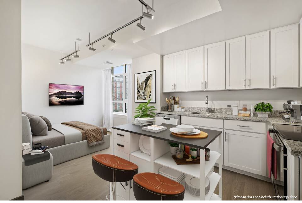
Dishwasher
Granite Countertops
With small and curvy historic buildings flanked by soaring, modern skyscrapers, Mount Vernon Triangle provides an intriguing mix of old and new. This trendy neighborhood sits in the "triangle" formed by New York Avenue to the north, Massachusetts Avenue to the south, and the small, one-block section of 7th Street at the triangle's point. The Carnegie Library sits just outside the neighborhood on the west side.
The apartments in Mount Vernon Triangle reflect the neighborhood itself -- a fantastic blend of historic and modern. Choose from lofts, soaring apartment towers, or traditional brick buildings. No matter where you choose, rest assured that you won't need a car -- Mount Vernon Triangle is one of DC's most walkable neighborhoods with easy access to the Metro. And with a wide variety of shops, restaurants, and entertainment venues just outside your door, life in Mt. Vernon Triangle is sure to be an adventure.
Learn more about living in Mount Vernon TriangleCompare neighborhood and city base rent averages by bedroom.
| Mount Vernon Triangle | Washington, DC | |
|---|---|---|
| Studio | $2,078 | $1,809 |
| 1 Bedroom | $2,611 | $2,234 |
| 2 Bedrooms | $3,881 | $3,065 |
| 3 Bedrooms | $6,226 | $3,926 |
| Colleges & Universities | Distance | ||
|---|---|---|---|
| Colleges & Universities | Distance | ||
| Walk: | 7 min | 0.4 mi | |
| Walk: | 7 min | 0.4 mi | |
| Walk: | 11 min | 0.6 mi | |
| Walk: | 11 min | 0.6 mi |


Transportation options available in Washington include Judiciary Square, located 0.6 mile from Liberty Place. Liberty Place is near Ronald Reagan Washington Ntl, located 5.9 miles or 11 minutes away, and Washington Dulles International, located 28.5 miles or 45 minutes away.
| Transit / Subway | Distance | ||
|---|---|---|---|
| Transit / Subway | Distance | ||
|
|
Walk: | 12 min | 0.6 mi |
| Walk: | 12 min | 0.6 mi | |
|
|
Walk: | 13 min | 0.7 mi |
|
|
Walk: | 14 min | 0.8 mi |
|
|
Walk: | 19 min | 1.0 mi |
| Commuter Rail | Distance | ||
|---|---|---|---|
| Commuter Rail | Distance | ||
|
|
Walk: | 13 min | 0.7 mi |
|
|
Walk: | 17 min | 0.9 mi |
|
|
Drive: | 3 min | 1.5 mi |
|
|
Drive: | 3 min | 1.5 mi |
|
|
Drive: | 8 min | 4.6 mi |
| Airports | Distance | ||
|---|---|---|---|
| Airports | Distance | ||
|
Ronald Reagan Washington Ntl
|
Drive: | 11 min | 5.9 mi |
|
Washington Dulles International
|
Drive: | 45 min | 28.5 mi |
Time and distance from Liberty Place.
| Shopping Centers | Distance | ||
|---|---|---|---|
| Shopping Centers | Distance | ||
| Walk: | 13 min | 0.7 mi | |
| Walk: | 13 min | 0.7 mi |
| Parks and Recreation | Distance | ||
|---|---|---|---|
| Parks and Recreation | Distance | ||
|
Marian Koshland Science Museum
|
Walk: | 13 min | 0.7 mi |
|
Carter G. Woodson Home National Historic Site
|
Drive: | 2 min | 1.1 mi |
|
Pennsylvania Avenue National Historic Site
|
Drive: | 2 min | 1.2 mi |
|
National Gallery of Art Sculpture Garden
|
Drive: | 2 min | 1.2 mi |
|
Smithsonian Butterfly Habitat Garden
|
Drive: | 3 min | 1.4 mi |
| Hospitals | Distance | ||
|---|---|---|---|
| Hospitals | Distance | ||
| Drive: | 4 min | 1.3 mi | |
| Drive: | 4 min | 2.1 mi | |
| Drive: | 5 min | 2.4 mi |
| Military Bases | Distance | ||
|---|---|---|---|
| Military Bases | Distance | ||
| Drive: | 8 min | 2.6 mi | |
| Drive: | 5 min | 2.8 mi |
Pets Allowed Fitness Center Pool Dishwasher Refrigerator Kitchen

Pets Allowed Fitness Center In Unit Washer & Dryer Balcony Courtyard Concierge EV Charging
What Are Walk Score®, Transit Score®, and Bike Score® Ratings?
Walk Score® measures the walkability of any address. Transit Score® measures access to public transit. Bike Score® measures the bikeability of any address.
What is a Sound Score Rating?
A Sound Score Rating aggregates noise caused by vehicle traffic, airplane traffic and local sources

881 3rd St
Washington, DC 20001


