
Douglas Enclave
61 NW 37th Ave,
Miami, FL 33125
$2,070 - $3,095
Studio - 2 Beds
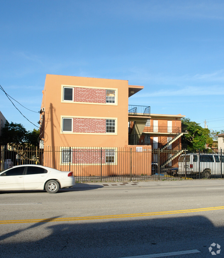

Visit Liberty City - 12th St in Miami, FL. This community is located on NW 12th Ave in Miami. Compare 1 to 2 bedroom floor plans. From amenities to floor plan options, the leasing staff is ready to help you find your perfect new place. Start living the good life at Liberty City - 12th St. Contact us or stop by the leasing office to learn more about our community.
Liberty City - 12th St is an apartment community located in Miami/Dade County and the 33127 ZIP Code. This area is served by the Miami-Dade County Public Schools attendance zone.
Air Conditioning
Refrigerator
Tub/Shower
Heating
Liberty City is a Miami neighborhood on the rise that’s just six miles north of downtown. Here, you’ll find a hardworking, close-knit community that enjoys a slightly lower cost of living than the rest of the Miami area to the south. The neighborhood’s location directly west of Interstate 95 makes it convenient for the commuting crowd. A vibrant dining scene can be found in Liberty City. Creole food, Jamaican food, seafood, Thai, and so much more makes this area an unsung foodie’s hotspot. With Downtown Miami so close, living in Liberty City puts you close to all the action without the bigger price tags of living closer to the dazzling beaches.
Learn more about living in Liberty City| Colleges & Universities | Distance | ||
|---|---|---|---|
| Colleges & Universities | Distance | ||
| Drive: | 7 min | 2.8 mi | |
| Drive: | 7 min | 2.9 mi | |
| Drive: | 9 min | 4.6 mi | |
| Drive: | 9 min | 5.1 mi |


Transportation options available in Miami include School Board, located 4.4 miles from Liberty City - 12th St. Liberty City - 12th St is near Miami International, located 9.1 miles or 21 minutes away, and Fort Lauderdale/Hollywood International, located 19.7 miles or 28 minutes away.
| Transit / Subway | Distance | ||
|---|---|---|---|
| Transit / Subway | Distance | ||
|
|
Drive: | 8 min | 4.4 mi |
|
|
Drive: | 8 min | 4.7 mi |
|
|
Drive: | 9 min | 4.9 mi |
|
|
Drive: | 9 min | 5.1 mi |
|
Airport Station
|
Drive: | 15 min | 6.1 mi |
| Commuter Rail | Distance | ||
|---|---|---|---|
| Commuter Rail | Distance | ||
|
|
Drive: | 4 min | 1.7 mi |
|
|
Drive: | 4 min | 1.9 mi |
|
|
Drive: | 5 min | 2.5 mi |
|
|
Drive: | 6 min | 3.2 mi |
|
|
Drive: | 6 min | 3.4 mi |
| Airports | Distance | ||
|---|---|---|---|
| Airports | Distance | ||
|
Miami International
|
Drive: | 21 min | 9.1 mi |
|
Fort Lauderdale/Hollywood International
|
Drive: | 28 min | 19.7 mi |
Time and distance from Liberty City - 12th St.
| Shopping Centers | Distance | ||
|---|---|---|---|
| Shopping Centers | Distance | ||
| Walk: | 10 min | 0.5 mi | |
| Walk: | 12 min | 0.6 mi | |
| Walk: | 13 min | 0.7 mi |
| Parks and Recreation | Distance | ||
|---|---|---|---|
| Parks and Recreation | Distance | ||
|
Miami Children's Museum
|
Drive: | 10 min | 6.2 mi |
|
Jungle Island
|
Drive: | 11 min | 6.5 mi |
|
Miami Science Museum - Closed
|
Drive: | 11 min | 7.1 mi |
|
Enchanted Forest Elaine Gordon Park
|
Drive: | 14 min | 7.9 mi |
|
Arch Creek Park & Nature Center
|
Drive: | 14 min | 8.0 mi |
| Hospitals | Distance | ||
|---|---|---|---|
| Hospitals | Distance | ||
| Drive: | 4 min | 2.1 mi | |
| Drive: | 7 min | 2.8 mi | |
| Drive: | 6 min | 3.3 mi |
What Are Walk Score®, Transit Score®, and Bike Score® Ratings?
Walk Score® measures the walkability of any address. Transit Score® measures access to public transit. Bike Score® measures the bikeability of any address.
What is a Sound Score Rating?
A Sound Score Rating aggregates noise caused by vehicle traffic, airplane traffic and local sources

6040 NW 12th Ave
Miami, FL 33127


