
Xenia Apartments
770 Xenia Ave S,
Minneapolis, MN 55416
$1,550 - $3,390
1-2 Beds
Bedrooms
2 bd
Bathrooms
2 ba
Square Feet
1,292 sq ft
Experience the epitome of opulent living at Laurel East End and Laurel West End, two distinguished apartment communities situated in the picturesque locale of Golden Valley, MN. These premier residences, conveniently managed from the same office at 250 Tuners Crossroad, set a new standard for contemporary comfort and style.Golden Valley, known for its perfect fusion of urban convenience and suburban charm, provides residents with access to an array of parks, shopping centers, and dining options. Nestled in the heart of this vibrant area, Laurel East End and Laurel West End offer an unparalleled lifestyle that goes beyond mere accommodation.Immerse yourself in the allure of this community by exploring the exceptional features and amenities that await you at Laurel West End and Laurel East. Pay us a visit for a personalized tour, and you'll uncover a world of unparalleled comfort and convenience. Make the vibrant and dynamic community of Golden Valley your home, and discover a lifestyle that seamlessly blends luxury and convenience.
Laurel West End is an apartment community located in Hennepin County and the 55416 ZIP Code. This area is served by the Hopkins Public attendance zone.
Pool
Fitness Center
Laundry Facilities
Clubhouse
Air Conditioning
Patio
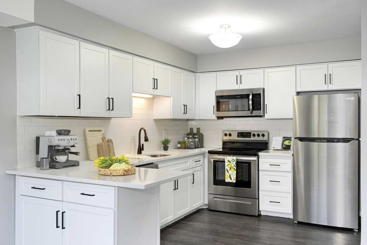
Stainless Steel Appliances
Office
Located just a few miles west of Minneapolis, West End offers residents a suburban atmosphere in a naturally beautiful environment. West End locals enjoy a broad selection of apartments and condos available for rent along tranquil, tree-lined streets.
West End is also convenient to the vibrant Shops at West End, an upscale shopping center boasting numerous boutiques, restaurants, and a movie theater. The West End Office Park sits directly south of the Shops at West End, affording many residents the feel of a true live-work-play community.
This area is proximate to several revered outdoor destinations, including Cedar Lake Point Beach, Lake of the Isles Park, Eloise Butler Wildflower Garden, and Theodore Wirth Regional Park. Commuting and traveling from West End is a breeze with access to I-394 as well as Highways 55 and 100.
Learn more about living in West End| Colleges & Universities | Distance | ||
|---|---|---|---|
| Colleges & Universities | Distance | ||
| Drive: | 7 min | 3.9 mi | |
| Drive: | 8 min | 4.4 mi | |
| Drive: | 11 min | 5.2 mi | |
| Drive: | 12 min | 7.2 mi |


Transportation options available in Golden Valley include Target Field Station, located 4.6 miles from Laurel West End. Laurel West End is near Minneapolis-St Paul International/Wold-Chamberlain, located 16.6 miles or 25 minutes away.
| Transit / Subway | Distance | ||
|---|---|---|---|
| Transit / Subway | Distance | ||
|
|
Drive: | 8 min | 4.6 mi |
|
|
Drive: | 8 min | 4.7 mi |
| Drive: | 9 min | 4.8 mi | |
|
|
Drive: | 9 min | 4.9 mi |
|
|
Drive: | 9 min | 5.2 mi |
| Commuter Rail | Distance | ||
|---|---|---|---|
| Commuter Rail | Distance | ||
|
|
Drive: | 9 min | 4.8 mi |
|
|
Drive: | 16 min | 10.3 mi |
|
|
Drive: | 22 min | 15.0 mi |
|
|
Drive: | 29 min | 18.4 mi |
|
|
Drive: | 30 min | 21.5 mi |
| Airports | Distance | ||
|---|---|---|---|
| Airports | Distance | ||
|
Minneapolis-St Paul International/Wold-Chamberlain
|
Drive: | 25 min | 16.6 mi |
Time and distance from Laurel West End.
| Shopping Centers | Distance | ||
|---|---|---|---|
| Shopping Centers | Distance | ||
| Walk: | 14 min | 0.7 mi | |
| Walk: | 19 min | 1.0 mi | |
| Drive: | 5 min | 1.9 mi |
| Parks and Recreation | Distance | ||
|---|---|---|---|
| Parks and Recreation | Distance | ||
|
Quaking Bog
|
Drive: | 4 min | 1.6 mi |
|
Eloise Butler Wildflower Garden and Bird Sanctuary
|
Drive: | 6 min | 1.9 mi |
|
Brownie Lake
|
Drive: | 7 min | 2.3 mi |
|
Westwood Hills Nature Center
|
Drive: | 7 min | 2.6 mi |
|
Cedar Lake Park
|
Drive: | 8 min | 3.1 mi |
| Hospitals | Distance | ||
|---|---|---|---|
| Hospitals | Distance | ||
| Drive: | 8 min | 4.3 mi | |
| Drive: | 11 min | 5.4 mi | |
| Drive: | 10 min | 5.5 mi |
| Military Bases | Distance | ||
|---|---|---|---|
| Military Bases | Distance | ||
| Drive: | 21 min | 12.1 mi |
What Are Walk Score®, Transit Score®, and Bike Score® Ratings?
Walk Score® measures the walkability of any address. Transit Score® measures access to public transit. Bike Score® measures the bikeability of any address.
What is a Sound Score Rating?
A Sound Score Rating aggregates noise caused by vehicle traffic, airplane traffic and local sources

250 Turners S
Golden Valley, MN 55416


