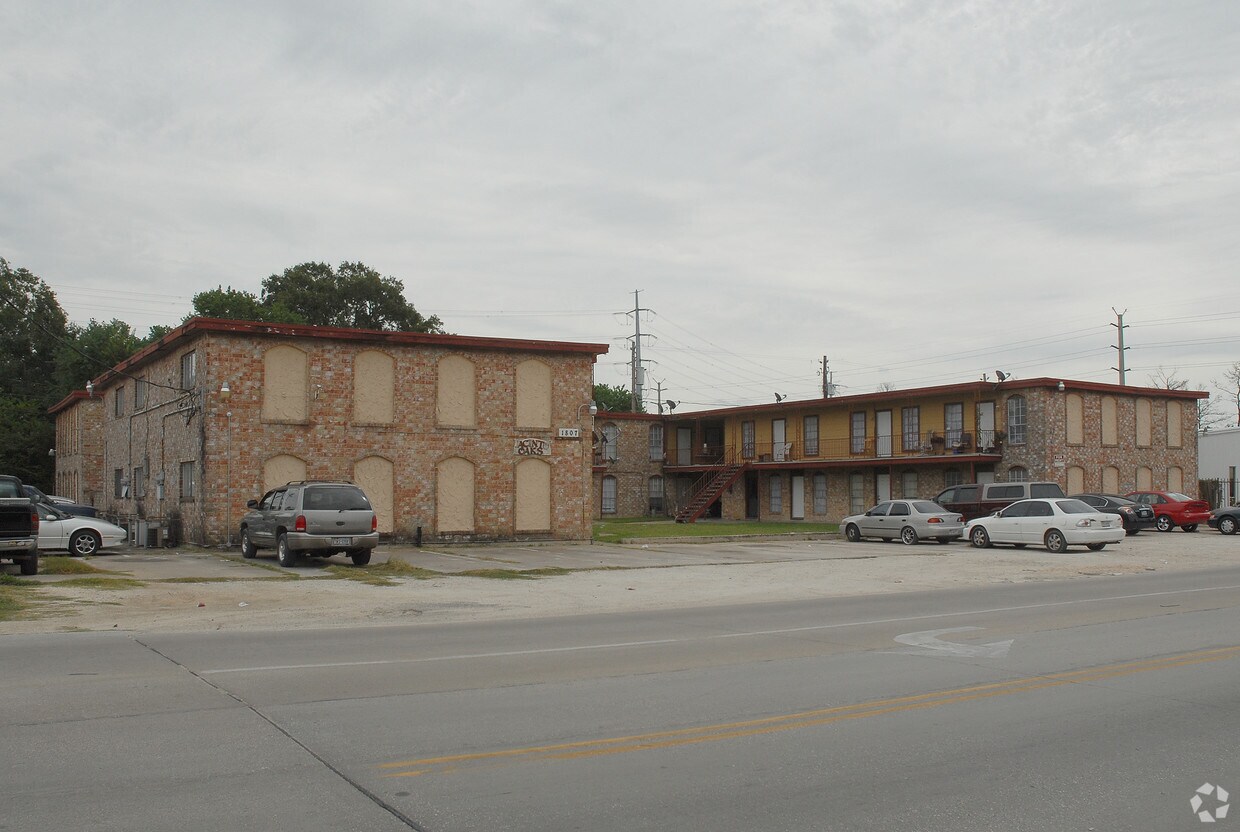
The Grove
8200 Sunbury Ln,
Houston, TX 77095
$825 - $1,325
1-2 Beds


Jacinto Oaks in Houston is ready for your visit. The address for this community is at 1807 Holland St. in Houston. Here at this community, the community staff is ready to help you find your perfect place. Come for a visit to see the current floorplan options. Experience a new standard at Jacinto Oaks.
Jacinto Oaks is an apartment community located in Harris County and the 77029 ZIP Code. This area is served by the Galena Park Independent attendance zone.
Southeast Houston was once known as the "Coney Island of the South," and the area still whispers of a time gone-by. Only 20-25 miles southeast of Downtown Houston, this charming small town, steeped in rich history and updated with all the desired modern amenities, is the perfect place to live. Known for its restored beaches, quaint shopping areas, and convenient distance from the Houston Cruise Port makes it ideal for tourists as well. A variety of apartment communities and single-family home rentals have made Southeast Houston fit for every renter, regardless of style or budget.
Learn more about living in Southeast Houston| Colleges & Universities | Distance | ||
|---|---|---|---|
| Colleges & Universities | Distance | ||
| Drive: | 13 min | 6.8 mi | |
| Drive: | 13 min | 9.0 mi | |
| Drive: | 19 min | 10.9 mi | |
| Drive: | 19 min | 11.3 mi |
 The GreatSchools Rating helps parents compare schools within a state based on a variety of school quality indicators and provides a helpful picture of how effectively each school serves all of its students. Ratings are on a scale of 1 (below average) to 10 (above average) and can include test scores, college readiness, academic progress, advanced courses, equity, discipline and attendance data. We also advise parents to visit schools, consider other information on school performance and programs, and consider family needs as part of the school selection process.
Transportation options available in Houston include Cesar Chavez / 67Th St Eb, located 7.8 miles from Jacinto Oaks. Jacinto Oaks is near William P Hobby, located 13.9 miles or 26 minutes away, and George Bush Intcntl/Houston, located 22.8 miles or 31 minutes away.
| Transit / Subway | Distance | ||
|---|---|---|---|
| Transit / Subway | Distance | ||
| Drive: | 12 min | 7.8 mi | |
| Drive: | 13 min | 7.9 mi | |
| Drive: | 13 min | 7.9 mi | |
| Drive: | 12 min | 8.0 mi | |
| Drive: | 14 min | 8.6 mi |
| Commuter Rail | Distance | ||
|---|---|---|---|
| Commuter Rail | Distance | ||
|
|
Drive: | 15 min | 9.8 mi |
| Airports | Distance | ||
|---|---|---|---|
| Airports | Distance | ||
|
William P Hobby
|
Drive: | 26 min | 13.9 mi |
|
George Bush Intcntl/Houston
|
Drive: | 31 min | 22.8 mi |
Time and distance from Jacinto Oaks.
| Shopping Centers | Distance | ||
|---|---|---|---|
| Shopping Centers | Distance | ||
| Walk: | 11 min | 0.6 mi | |
| Walk: | 13 min | 0.7 mi | |
| Drive: | 2 min | 1.2 mi |
| Parks and Recreation | Distance | ||
|---|---|---|---|
| Parks and Recreation | Distance | ||
|
Sims Bayou Urban Nature Center
|
Drive: | 14 min | 8.9 mi |
|
Gene Green All-Inclusive Park
|
Drive: | 15 min | 9.1 mi |
|
Discovery Green
|
Drive: | 15 min | 9.3 mi |
|
Woodland Park
|
Drive: | 16 min | 10.5 mi |
|
San Jacinto Battleground State Historic Site
|
Drive: | 24 min | 15.0 mi |
| Hospitals | Distance | ||
|---|---|---|---|
| Hospitals | Distance | ||
| Drive: | 5 min | 2.8 mi | |
| Drive: | 16 min | 10.4 mi | |
| Drive: | 19 min | 12.6 mi |
| Military Bases | Distance | ||
|---|---|---|---|
| Military Bases | Distance | ||
| Drive: | 37 min | 21.5 mi | |
| Drive: | 68 min | 49.6 mi |
What Are Walk Score®, Transit Score®, and Bike Score® Ratings?
Walk Score® measures the walkability of any address. Transit Score® measures access to public transit. Bike Score® measures the bikeability of any address.
What is a Sound Score Rating?
A Sound Score Rating aggregates noise caused by vehicle traffic, airplane traffic and local sources