
The Grove
8200 Sunbury Ln,
Houston, TX 77095
$795 - $1,325
1-2 Beds

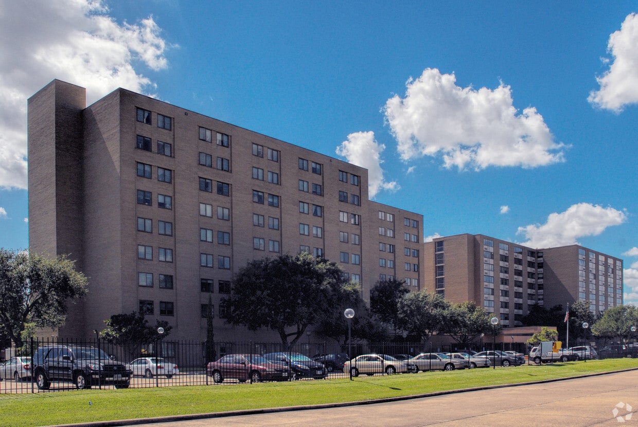

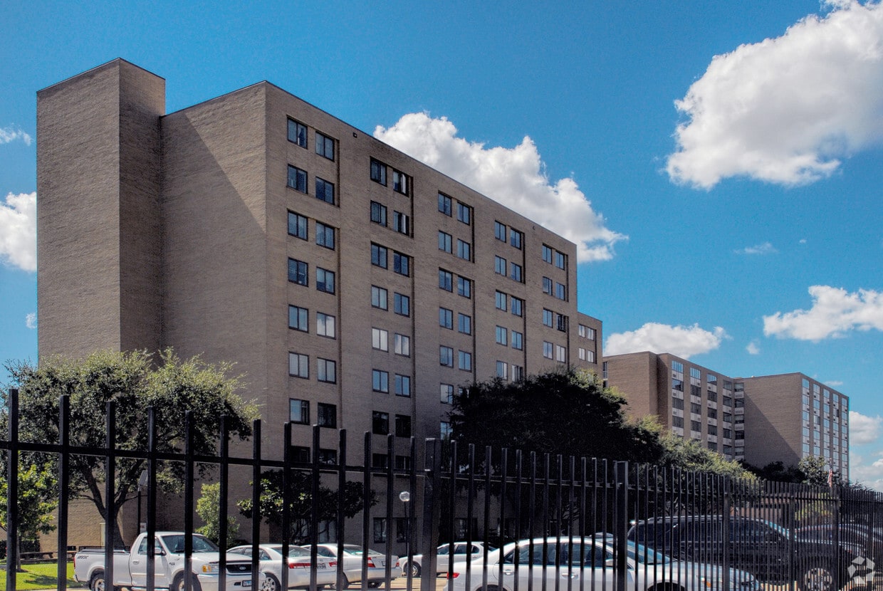
Goldberg B'nai B'rith Towers offers a mixture of style, comfort and livability. The address for this community is on Fondren Rd. in the 77096 area of Houston. Come for a visit to check out the apartment floorplan options. From location to floorplan options, the leasing team will assist you in finding your perfect floorplan. Drop by Goldberg B'nai B'rith Towers today.
Goldberg B'nai B'rith Towers is an apartment community located in Harris County and the 77096 ZIP Code. This area is served by the Houston Independent attendance zone.
Heating
Oven
Range
Kitchen
Greater Fondren Southwest is part of the Brays Oaks District of Houston, Texas. This large neighborhood stretches from Brays Bayou Park to the north and US Route 90 to the south. The Sam Houston Tollway forms the western border of the neighborhood.
Named for oilman Walter Fondren, this historic neighborhood contains some hidden gems and is rapidly gaining in popularity due in part to its proximity to Downtown Houston, which is just 15 miles northeast. Houston Baptist University is just outside the neighborhood and is easily reached by heading north on Fondren Road. Greater Fondren Southwest is considered one of Houston's Super Neighborhoods. There’s an amazing mix of low-lying apartments and single-family homes for rent, meaning every renter will find their perfect fit.
Learn more about living in Greater Fondren Southwest| Colleges & Universities | Distance | ||
|---|---|---|---|
| Colleges & Universities | Distance | ||
| Drive: | 6 min | 2.7 mi | |
| Drive: | 7 min | 2.9 mi | |
| Drive: | 14 min | 8.5 mi | |
| Drive: | 16 min | 8.7 mi |


Transportation options available in Houston include Fannin South, located 8.1 miles from Goldberg B'nai B'rith Towers. Goldberg B'nai B'rith Towers is near William P Hobby, located 19.2 miles or 34 minutes away, and George Bush Intcntl/Houston, located 32.9 miles or 45 minutes away.
| Transit / Subway | Distance | ||
|---|---|---|---|
| Transit / Subway | Distance | ||
|
|
Drive: | 14 min | 8.1 mi |
|
|
Drive: | 14 min | 8.2 mi |
|
|
Drive: | 14 min | 8.2 mi |
| Drive: | 16 min | 8.9 mi | |
|
|
Drive: | 17 min | 9.2 mi |
| Commuter Rail | Distance | ||
|---|---|---|---|
| Commuter Rail | Distance | ||
|
|
Drive: | 24 min | 14.5 mi |
| Airports | Distance | ||
|---|---|---|---|
| Airports | Distance | ||
|
William P Hobby
|
Drive: | 34 min | 19.2 mi |
|
George Bush Intcntl/Houston
|
Drive: | 45 min | 32.9 mi |
Time and distance from Goldberg B'nai B'rith Towers.
| Shopping Centers | Distance | ||
|---|---|---|---|
| Shopping Centers | Distance | ||
| Walk: | 11 min | 0.6 mi | |
| Walk: | 16 min | 0.8 mi | |
| Walk: | 16 min | 0.9 mi |
| Parks and Recreation | Distance | ||
|---|---|---|---|
| Parks and Recreation | Distance | ||
|
Club Creek Park and Vietnam Veterans Memorial
|
Drive: | 9 min | 4.1 mi |
|
Nature Discovery Center
|
Drive: | 12 min | 5.9 mi |
|
Arthur Storey Park
|
Drive: | 12 min | 6.6 mi |
|
Buffalo Bayou Paddling Trail
|
Drive: | 14 min | 6.9 mi |
|
Houston Maritime Museum
|
Drive: | 16 min | 8.8 mi |
| Hospitals | Distance | ||
|---|---|---|---|
| Hospitals | Distance | ||
| Drive: | 9 min | 3.9 mi | |
| Drive: | 10 min | 4.8 mi | |
| Drive: | 14 min | 8.1 mi |
| Military Bases | Distance | ||
|---|---|---|---|
| Military Bases | Distance | ||
| Drive: | 47 min | 32.5 mi | |
| Drive: | 75 min | 58.1 mi |
What Are Walk Score®, Transit Score®, and Bike Score® Ratings?
Walk Score® measures the walkability of any address. Transit Score® measures access to public transit. Bike Score® measures the bikeability of any address.
What is a Sound Score Rating?
A Sound Score Rating aggregates noise caused by vehicle traffic, airplane traffic and local sources
10909 Fondren Rd
Houston, TX 77096


