
110 Roy Apartments
110 Roy St,
Seattle, WA 98119
$2,195 - $5,495
Studio - 2 Beds

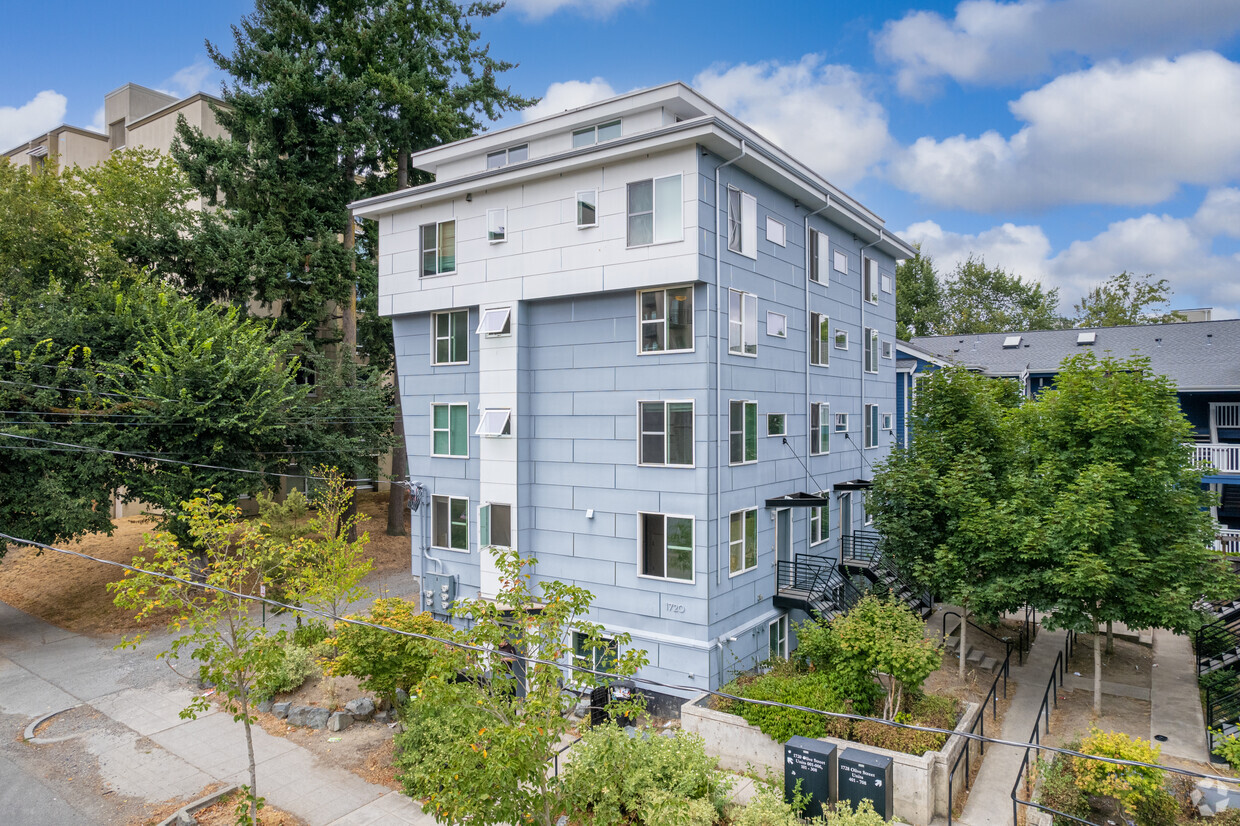
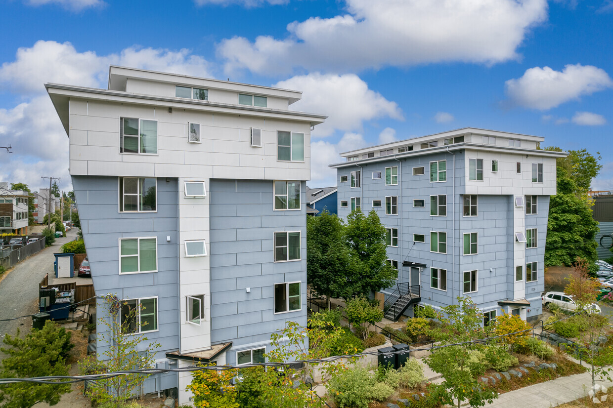

Find your new home at 1720-1728 E Olive St in Seattle, WA. You'll find this community in the Stevens area of Seattle. From pricing to features, the professional leasing staff will assist you in finding your new place. Stop looking and get moving. Contact or stop by the 1720-1728 E Olive St leasing office to learn more about our community.
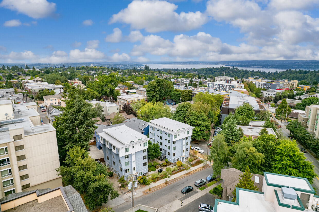
Cap 2 is an apartment community located in King County and the 98122 ZIP Code. This area is served by the Seattle Public Schools attendance zone.
Stevens is a large neighborhood about five miles northwest of Downtown Seattle. This large, urban neighborhood is perfect for a variety of renters with its affordable to upscale rentals, ranging from cozy single-family homes to sleek, modern apartments. Families adore Stevens because they have access to top-notch schools and amazing natural areas. Stevens houses Interlaken Park and a part of the Washington Park Arboretum. The neighborhood also borders Volunteer Park, a sprawling green space home to the Volunteer Park Conservatory, the Asian Art Museum, a playground, tennis courts, and more. Residents also have access to plenty of shopping, dining, and entertainment options along 15th Avenue and East Madison Avenue. Stevens also borders Pike/Pine, which houses some of the city’s best restaurants and nightlife hotspots.
Learn more about living in Stevens| Colleges & Universities | Distance | ||
|---|---|---|---|
| Colleges & Universities | Distance | ||
| Walk: | 11 min | 0.6 mi | |
| Walk: | 13 min | 0.7 mi | |
| Drive: | 5 min | 1.6 mi | |
| Drive: | 12 min | 5.3 mi |


Transportation options available in Seattle include Broadway & Pike-Pine, located 0.6 mile from Cap 2. Cap 2 is near Seattle-Tacoma International, located 15.2 miles or 26 minutes away, and Seattle Paine Field International, located 23.9 miles or 36 minutes away.
| Transit / Subway | Distance | ||
|---|---|---|---|
| Transit / Subway | Distance | ||
| Walk: | 12 min | 0.6 mi | |
| Walk: | 12 min | 0.6 mi | |
| Walk: | 14 min | 0.7 mi | |
| Walk: | 15 min | 0.8 mi | |
| Drive: | 4 min | 1.2 mi |
| Commuter Rail | Distance | ||
|---|---|---|---|
| Commuter Rail | Distance | ||
|
|
Drive: | 7 min | 2.0 mi |
|
|
Drive: | 22 min | 13.7 mi |
|
|
Drive: | 29 min | 17.6 mi |
|
|
Drive: | 31 min | 19.4 mi |
| Drive: | 31 min | 20.5 mi |
| Airports | Distance | ||
|---|---|---|---|
| Airports | Distance | ||
|
Seattle-Tacoma International
|
Drive: | 26 min | 15.2 mi |
|
Seattle Paine Field International
|
Drive: | 36 min | 23.9 mi |
Time and distance from Cap 2.
| Shopping Centers | Distance | ||
|---|---|---|---|
| Shopping Centers | Distance | ||
| Walk: | 13 min | 0.7 mi | |
| Walk: | 16 min | 0.8 mi | |
| Walk: | 17 min | 0.9 mi |
| Parks and Recreation | Distance | ||
|---|---|---|---|
| Parks and Recreation | Distance | ||
|
Volunteer Park
|
Drive: | 4 min | 1.3 mi |
|
Freeway Park
|
Drive: | 4 min | 1.3 mi |
|
Lakeview Park
|
Drive: | 4 min | 1.4 mi |
|
Waterfall Garden Park
|
Drive: | 6 min | 1.7 mi |
|
Washington Park Arboretum
|
Drive: | 9 min | 2.7 mi |
| Hospitals | Distance | ||
|---|---|---|---|
| Hospitals | Distance | ||
| Walk: | 5 min | 0.3 mi | |
| Walk: | 15 min | 0.8 mi | |
| Walk: | 16 min | 0.8 mi |
| Military Bases | Distance | ||
|---|---|---|---|
| Military Bases | Distance | ||
| Drive: | 24 min | 7.4 mi | |
| Drive: | 93 min | 67.6 mi |
What Are Walk Score®, Transit Score®, and Bike Score® Ratings?
Walk Score® measures the walkability of any address. Transit Score® measures access to public transit. Bike Score® measures the bikeability of any address.
What is a Sound Score Rating?
A Sound Score Rating aggregates noise caused by vehicle traffic, airplane traffic and local sources
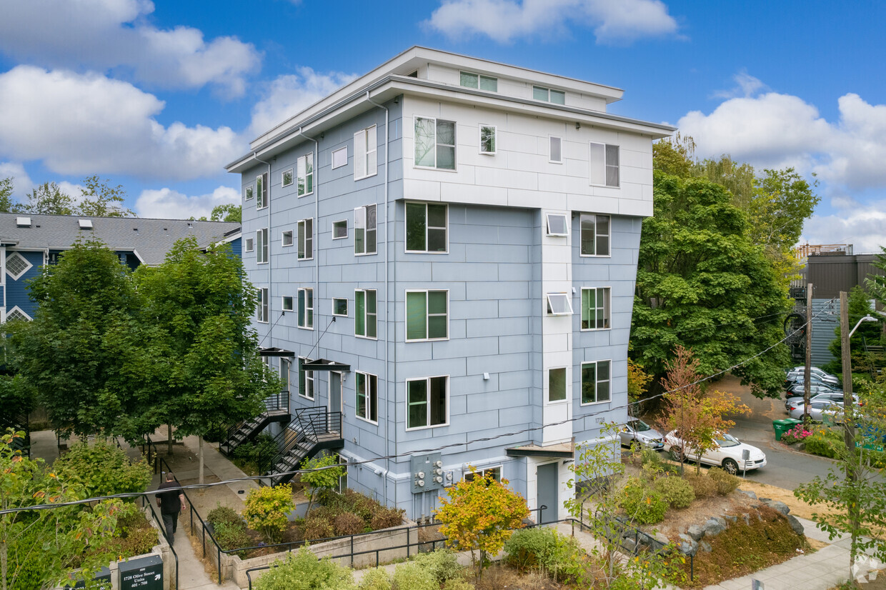
1720-1728 E Olive St
Seattle, WA 98122


