
$1,950
/ Month
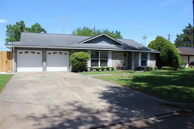
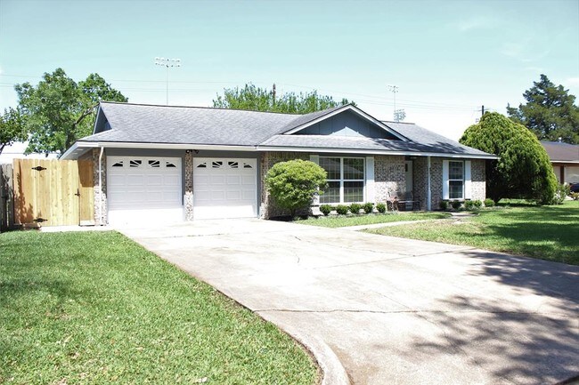
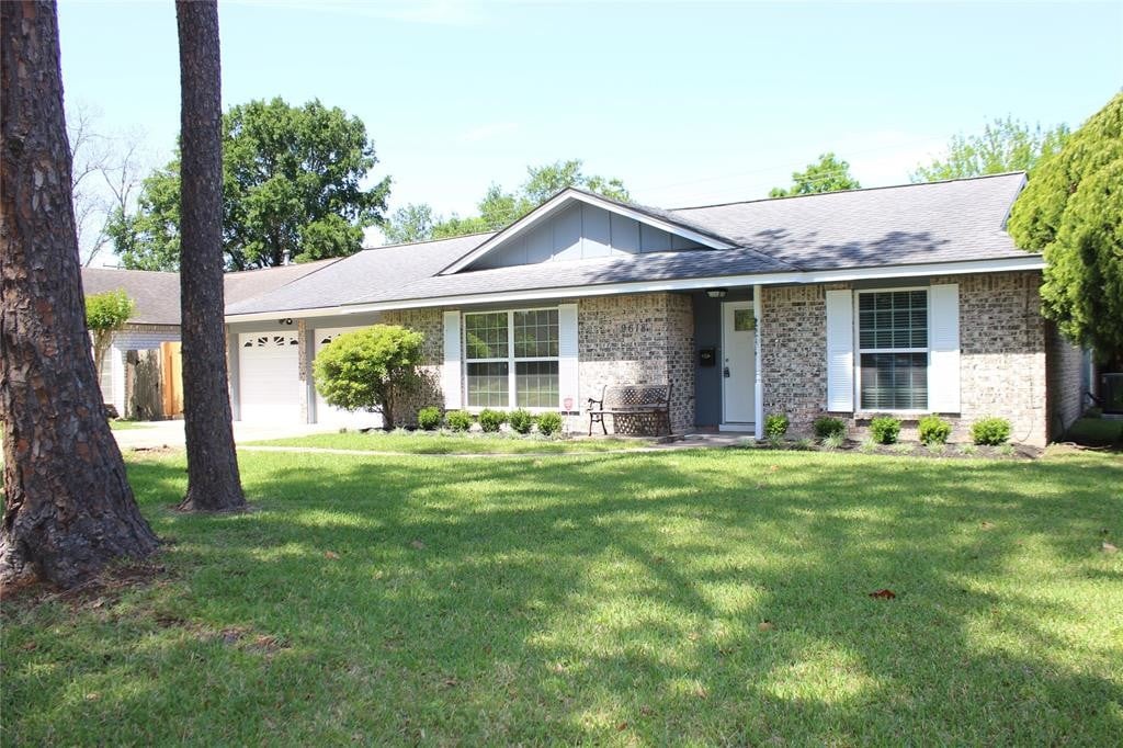
9618 Emnora Ln
Houston, TX 77080
2 Weeks Ago
|
Edit
Favorites
9618 Emnora Ln

Favorites
Check Back Soon for Upcoming Availability
| Beds | Baths | Average SF |
|---|---|---|
| 3 Bedrooms 3 Bedrooms 3 Br | 2 Baths 2 Baths 2 Ba | — |
Fees and Policies
The fees below are based on community-supplied data and may exclude additional fees and utilities.
- Parking
-
Garage--
Details
Lease Options
-
12 Months
About This Property
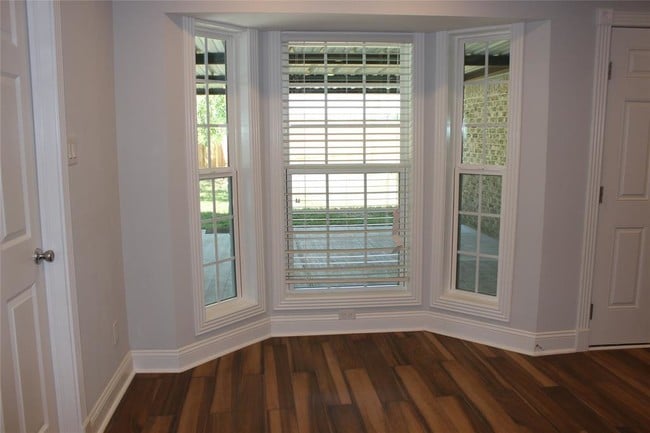
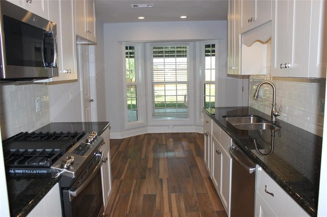
HOME IS OCCUPIED UNTIL SEPT 30. Freshly updated home with new flooring, bathrooms, paint, kitchen. Utility room with built in cabinets. The back yard is HUGE and has a covered porch and a shed. No back yard neighbors and it is walking distance to the neighborhood park. Come check it out, it won't last long!!
9618 Emnora Ln is a house located in Harris County and the 77080 ZIP Code. This area is served by the Spring Branch Independent attendance zone.
House Features
Dishwasher
Microwave
Disposal
Smoke Free
- Smoke Free
- Cable Ready
- Dishwasher
- Disposal
- Microwave
- Carpet
Location
Get Directions
Spring Shadows, also known as Spring Branch North, is a sought-after suburban neighborhood situated about 10 miles northwest of Downtown Houston. Spring Shadows draws a wide variety of residents for its peaceful atmosphere, excellent schools, and central locale. Being largely residential, Spring Shadows offers an array of apartments, townhomes, and houses available for rent along landscaped roads.
The Spring Shadows community enjoys short commute times with proximity to major employment centers like the Energy Corridor, Galleria, Westchase, and Downtown Houston. Getting around from Spring Shadows is a breeze with access to Beltway 8, Interstate 10, Gessner Road, and Hammerly Boulevard.
Learn more about living in Spring ShadowsBelow are rent ranges for similar nearby apartments
Amenities
- Smoke Free
- Cable Ready
- Dishwasher
- Disposal
- Microwave
- Carpet
Education
| Colleges & Universities | Distance | ||
|---|---|---|---|
| Colleges & Universities | Distance | ||
| Drive: | 21 min | 10.4 mi | |
| Drive: | 19 min | 11.0 mi | |
| Drive: | 22 min | 13.0 mi | |
| Drive: | 23 min | 13.6 mi |
9618 Emnora Ln is within 21 minutes or 10.4 miles from Houston Christian University. It is also near Houston Baptist University and The Art Institute of Houston.
Schools


Public Elementary School
Grades PK-5
768 Students
Attendance Zone
Public Middle & High School
Grades 8-12
2,610 Students
Attendance Zone
Public Middle School
Grades 6-8
814 Students
Attendance Zone
Private Elementary, Middle & High School
Grades PK-12
Nearby
Private Elementary & Middle School
Grades PK-9
Nearby
School data provided by
 The GreatSchools Rating helps parents compare schools within a state based on a variety of school quality indicators and provides a helpful picture of how effectively each school serves all of its students. Ratings are on a scale of 1 (below average) to 10 (above average) and can include test scores, college readiness, academic progress, advanced courses, equity, discipline and attendance data. We also advise parents to visit schools, consider other information on school performance and programs, and consider family needs as part of the school selection process.
View GreatSchools Rating Methodology
Data provided by GreatSchools.org © 2025. All rights reserved.
View GreatSchools Rating Methodology
Data provided by GreatSchools.org © 2025. All rights reserved.
Transportation options available in Houston include Lindale Park, located 10.9 miles from 9618 Emnora Ln. 9618 Emnora Ln is near William P Hobby, located 25.6 miles or 41 minutes away, and George Bush Intcntl/Houston, located 27.2 miles or 35 minutes away.
| Transit / Subway | Distance | ||
|---|---|---|---|
| Transit / Subway | Distance | ||
|
|
Drive: | 19 min | 10.9 mi |
|
|
Drive: | 20 min | 11.0 mi |
|
|
Drive: | 21 min | 11.1 mi |
|
|
Drive: | 20 min | 11.4 mi |
|
|
Drive: | 21 min | 12.2 mi |
| Commuter Rail | Distance | ||
|---|---|---|---|
| Commuter Rail | Distance | ||
|
|
Drive: | 21 min | 13.2 mi |
| Airports | Distance | ||
|---|---|---|---|
| Airports | Distance | ||
|
William P Hobby
|
Drive: | 41 min | 25.6 mi |
|
George Bush Intcntl/Houston
|
Drive: | 35 min | 27.2 mi |
Time and distance from 9618 Emnora Ln.
| Shopping Centers | Distance | ||
|---|---|---|---|
| Shopping Centers | Distance | ||
| Walk: | 11 min | 0.6 mi | |
| Walk: | 13 min | 0.7 mi | |
| Walk: | 18 min | 0.9 mi |
9618 Emnora Ln has 3 shopping centers within 0.9 mile, which is about a 18-minute walk. The miles and minutes will be for the farthest away property.
| Parks and Recreation | Distance | ||
|---|---|---|---|
| Parks and Recreation | Distance | ||
|
Edith L. Moore Nature Sanctuary
|
Drive: | 11 min | 5.6 mi |
|
Buffalo Bayou Paddling Trail
|
Drive: | 14 min | 6.5 mi |
|
Bear Creek Pioneers Park
|
Drive: | 16 min | 7.6 mi |
|
Houston Arboretum & Nature Center
|
Drive: | 14 min | 7.9 mi |
|
Memorial Park and Golf Course
|
Drive: | 16 min | 8.8 mi |
9618 Emnora Ln has 5 parks within 8.8 miles, including Edith L. Moore Nature Sanctuary, Buffalo Bayou Paddling Trail, and Bear Creek Pioneers Park.
| Hospitals | Distance | ||
|---|---|---|---|
| Hospitals | Distance | ||
| Drive: | 4 min | 1.7 mi | |
| Drive: | 7 min | 3.3 mi | |
| Drive: | 13 min | 6.7 mi |
9618 Emnora Ln has 3 hospitals within 6.7 miles, the nearest is Houston Behavioral Healthcare Hospital which is 1.7 miles away and a 4 minute drive.
| Military Bases | Distance | ||
|---|---|---|---|
| Military Bases | Distance | ||
| Drive: | 55 min | 39.0 mi | |
| Drive: | 83 min | 64.6 mi |
9618 Emnora Ln is 39.0 miles from Lyndon B Johnson Space Center, and is convenient to other military bases, including Pelican Spit Military Reservation.
You May Also Like
Similar Rentals Nearby


What Are Walk Score®, Transit Score®, and Bike Score® Ratings?
Walk Score® measures the walkability of any address. Transit Score® measures access to public transit. Bike Score® measures the bikeability of any address.
What is a Sound Score Rating?
A Sound Score Rating aggregates noise caused by vehicle traffic, airplane traffic and local sources
9618 Emnora Ln
Houston, TX 77080