66 St James St
66 St James St,
Boston,
MA
02119
2 Weeks Ago
Favorites
66 St James St

Favorites
Check Back Soon for Upcoming Availability
Fees and Policies
Details
Lease Options
-
12 Months
About 66 St James St Boston, MA 02119
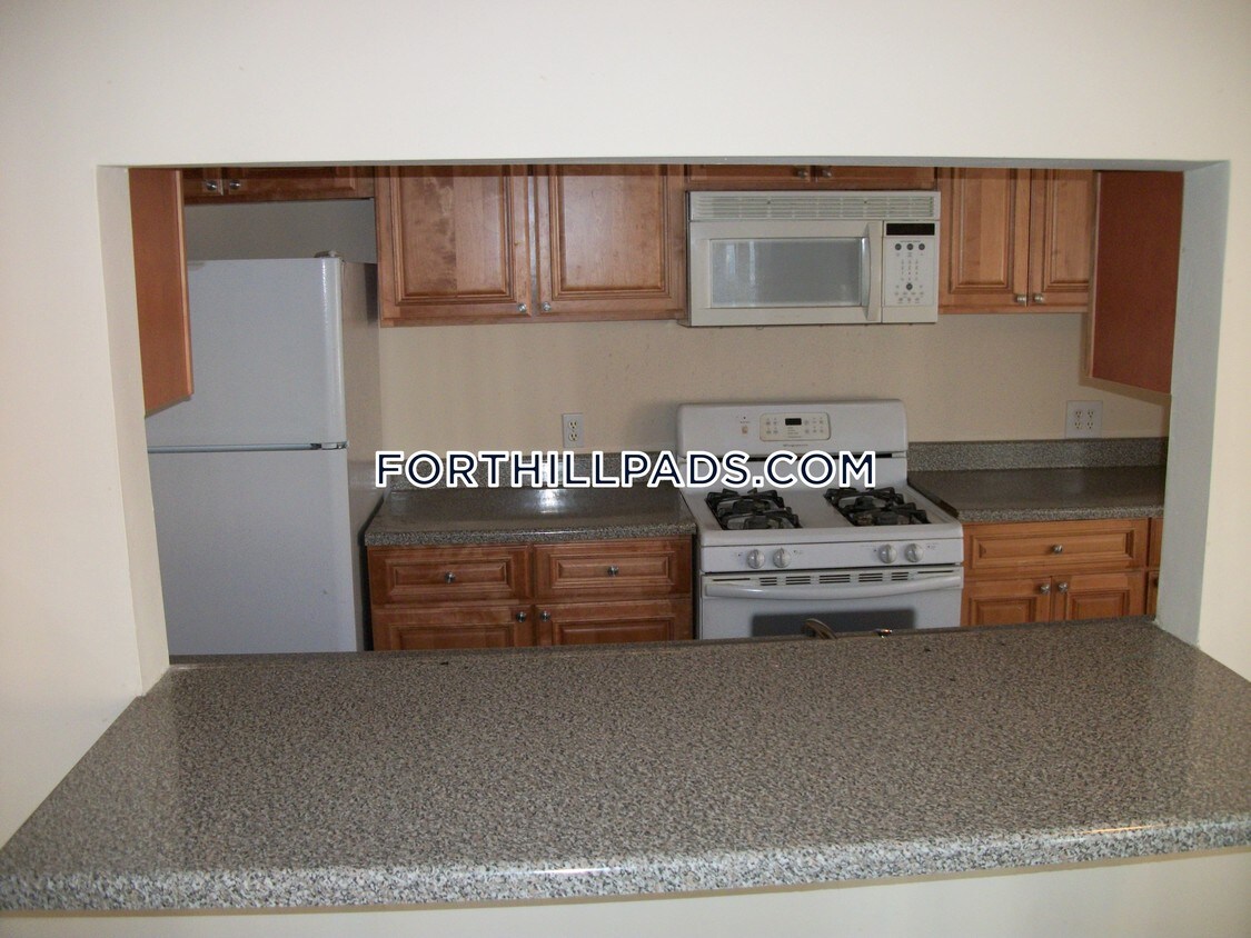
Great size 3 bed with great closet space washer and dryer in unit Large living room 1.5 baths Nice deck tons of street parking Close to NEU, Wentworth, MCPHS,Simmons Call 617-820-3505
66 St James St is an apartment community located in Suffolk County and the 02119 ZIP Code.
Apartment Features
- Washer/Dryer
Location
Get Directions
If you’re looking to be surrounded by culture and community, Washington Park is a great choice for your next home. Located just south of the Frederick Douglas Square Historic District, Washington Park is one of the city’s most historic and diverse neighborhoods. Civil Rights activist Malcolm X once lived in Washington Park and the neighborhood is home to the Museum of the National Center of Afro American Artists. You’ll find locals bonding at community centers like Shelburne Community Center in Malcolm X Park or enjoying a meal at locally owned restaurants. Washington Park neighbors another cultural hub, Nubian Square, which is filled with international grocers and authentic eateries serving everything from suya to mondongo.
Along with a strong sense of community and culture, renters are attracted to Washington Park’s affordability and excellent location. There are apartments, condos, townhomes, and houses available for every budget and style.
Learn more about living in Washington ParkBelow are rent ranges for similar nearby apartments
| Beds | Average Size | Lowest | Typical | Premium |
|---|---|---|---|---|
| Studio Studio Studio | 4016 Sq Ft | $1,585 | $2,181 | $3,240 |
| 1 Bed 1 Bed 1 Bed | 3351-3354 Sq Ft | $1,507 | $2,376 | $3,200 |
| 2 Beds 2 Beds 2 Beds | 2372-2379 Sq Ft | $1,796 | $3,078 | $4,499 |
| 3 Beds 3 Beds 3 Beds | 3602 Sq Ft | $1,200 | $3,542 | $5,000 |
| 4 Beds 4 Beds 4 Beds | 4685 Sq Ft | $975 | $4,502 | $9,500 |
Amenities
- Washer/Dryer
Education
| Colleges & Universities | Distance | ||
|---|---|---|---|
| Colleges & Universities | Distance | ||
| Drive: | 3 min | 1.2 mi | |
| Drive: | 4 min | 1.4 mi | |
| Drive: | 3 min | 1.6 mi | |
| Drive: | 5 min | 1.8 mi |
66 St James St is within 3 minutes or 1.2 miles from Wentworth Inst. of Technology. It is also near Northeastern University and MCPHS University, Boston.
Transportation options available in Boston include Roxbury Crossing Station, located 0.7 mile from 66 St James St. 66 St James St is near General Edward Lawrence Logan International, located 6.0 miles or 12 minutes away.
| Transit / Subway | Distance | ||
|---|---|---|---|
| Transit / Subway | Distance | ||
|
|
Walk: | 13 min | 0.7 mi |
|
|
Walk: | 20 min | 1.0 mi |
|
|
Drive: | 3 min | 1.4 mi |
|
|
Drive: | 3 min | 1.5 mi |
|
|
Drive: | 4 min | 1.9 mi |
| Commuter Rail | Distance | ||
|---|---|---|---|
| Commuter Rail | Distance | ||
| Drive: | 3 min | 1.4 mi | |
|
|
Drive: | 3 min | 1.4 mi |
|
|
Drive: | 4 min | 1.8 mi |
| Drive: | 5 min | 2.3 mi | |
|
|
Drive: | 8 min | 2.4 mi |
| Airports | Distance | ||
|---|---|---|---|
| Airports | Distance | ||
|
General Edward Lawrence Logan International
|
Drive: | 12 min | 6.0 mi |
Time and distance from 66 St James St.
| Shopping Centers | Distance | ||
|---|---|---|---|
| Shopping Centers | Distance | ||
| Walk: | 13 min | 0.7 mi | |
| Drive: | 4 min | 1.8 mi | |
| Drive: | 4 min | 1.8 mi |
66 St James St has 3 shopping centers within 1.8 miles, which is about a 4-minute walk. The miles and minutes will be for the farthest away property.
| Parks and Recreation | Distance | ||
|---|---|---|---|
| Parks and Recreation | Distance | ||
|
Roxbury Heritage State Park
|
Walk: | 8 min | 0.5 mi |
|
Lower Neponset River Trail
|
Drive: | 4 min | 1.9 mi |
|
Franklin Park Zoo
|
Drive: | 4 min | 2.2 mi |
|
Charles River Reservation
|
Drive: | 6 min | 2.9 mi |
|
Coit Observatory
|
Drive: | 7 min | 3.3 mi |
66 St James St has 5 parks within 3.3 miles, including Roxbury Heritage State Park, Lower Neponset River Trail, and Franklin Park Zoo.
| Hospitals | Distance | ||
|---|---|---|---|
| Hospitals | Distance | ||
| Drive: | 2 min | 1.1 mi | |
| Drive: | 3 min | 1.3 mi | |
| Drive: | 4 min | 1.5 mi |
66 St James St has 3 hospitals within 1.5 miles, the nearest is Boston Medical Center which is 1.1 miles away and a 2 minute drive.
| Military Bases | Distance | ||
|---|---|---|---|
| Military Bases | Distance | ||
| Drive: | 32 min | 17.0 mi |
66 St James St is 17.0 miles and a 32 minute drive from Hanscom Air Force Base.
You May Also Like
Similar Rentals Nearby


What Are Walk Score®, Transit Score®, and Bike Score® Ratings?
Walk Score® measures the walkability of any address. Transit Score® measures access to public transit. Bike Score® measures the bikeability of any address.
What is a Sound Score Rating?
A Sound Score Rating aggregates noise caused by vehicle traffic, airplane traffic and local sources