$2,650 / Month
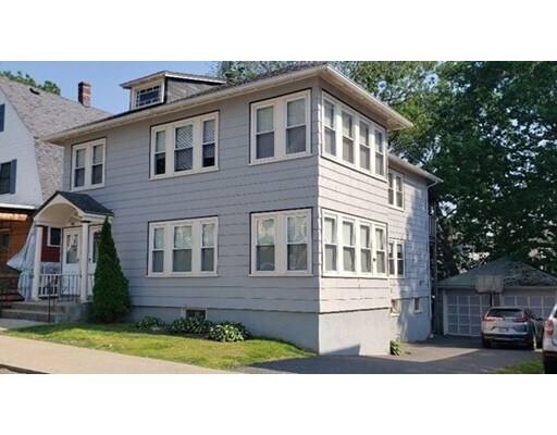
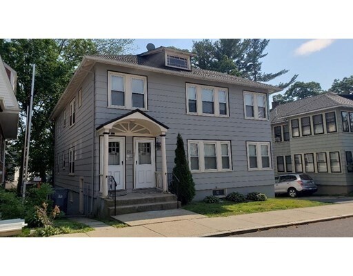
58 Penfield St Unit 2
Boston, MA 02131
2 Weeks Ago
Favorites
58 Penfield St Unit 2

Favorites
Check Back Soon for Upcoming Availability
| Beds | Baths | Average SF |
|---|---|---|
| 2 Bedrooms 2 Bedrooms 2 Br | 1 Bath 1 Bath 1 Ba | 1,000 SF |
Fees and Policies
The fees below are based on community-supplied data and may exclude additional fees and utilities.
Details
Utilities Included
-
Water
-
Sewer
About This Property
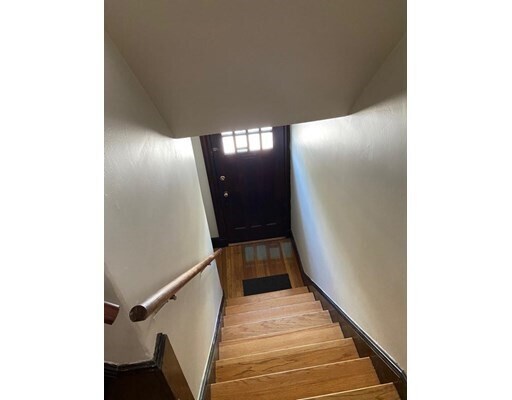
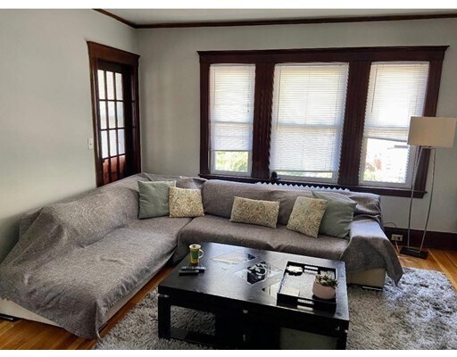
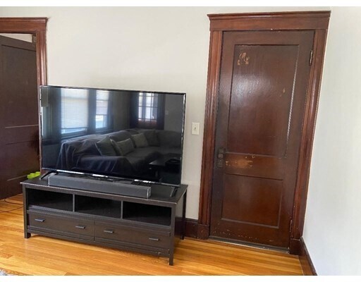
Stunning apartment with old world charm, 2 bedrooms, diningroom with built in china hutch, small room off of living room (with closet) is perfect for a home office and beautiful sunroom with french doors on the other side of living room. Gleaming hardwood floors, updated kitchen and bathroom, apartment has been freshly painted. Private rear covered deck, 2 car tandem parking spots in driveway.. Convenient location near Roslindale Village, shopping, restaurants , the T, commuter rail.. Available July 1st and possibly June 15th. 24 hr notice to show please...
58 Penfield St is an apartment community located in Suffolk County and the 02131 ZIP Code.
Features
Dishwasher
Microwave
Refrigerator
Disposal
- Dishwasher
- Disposal
- Microwave
- Range
- Refrigerator
- Walking/Biking Trails
Location
Get Directions
Metropolitan Hill-Beech Street is a predominantly residential portion of Roslindale, brimming with colorful historic buildings strewn along quiet tree-lined streets. Metropolitan Hill-Beech Street also contains a slew of locally owned shops and diverse eateries on Washington Street in addition to the vibrant Roslindale Village Main Street, which is commonly referred to as Rozzie Square.
Area residents enjoy a small-town feel, and quick access to lush green spaces like Bellevue Hill Park, West Roxbury Parkway, Sherrin Woods, and the George Wright Golf Course. The expansive Franklin Park and its many attractions are just a few minutes north of the area as well. Convenience to the MBTA Needham Line makes commuting and traveling into Boston a breeze.
Learn more about living in Metropolitan Hill-Beech StBelow are rent ranges for similar nearby apartments
| Beds | Average Size | Lowest | Typical | Premium |
|---|---|---|---|---|
| Studio Studio Studio | 556 Sq Ft | $1,733 | $1,828 | $1,939 |
| 1 Bed 1 Bed 1 Bed | 806 Sq Ft | $1,900 | $3,130 | $7,900 |
| 2 Beds 2 Beds 2 Beds | 1301 Sq Ft | $2,300 | $3,250 | $9,500 |
| 3 Beds 3 Beds 3 Beds | 2242 Sq Ft | $1,125 | $3,089 | $13,000 |
| 4 Beds 4 Beds 4 Beds | 523 Sq Ft | $1,100 | $1,472 | $4,000 |
Amenities
- Dishwasher
- Disposal
- Microwave
- Range
- Refrigerator
- Walking/Biking Trails
Expenses
Utilities Included
Water, Sewer
Included
Education
| Colleges & Universities | Distance | ||
|---|---|---|---|
| Colleges & Universities | Distance | ||
| Drive: | 11 min | 4.4 mi | |
| Drive: | 11 min | 4.6 mi | |
| Drive: | 11 min | 4.7 mi | |
| Drive: | 11 min | 5.1 mi |
58 Penfield St Unit 2 is within 11 minutes or 4.4 miles from Curry College. It is also near Wentworth Inst. of Technology and MCPHS University, Boston.
Transportation options available in Boston include Forest Hills Station, located 1.6 miles from 58 Penfield St Unit 2. 58 Penfield St Unit 2 is near General Edward Lawrence Logan International, located 10.0 miles or 21 minutes away.
| Transit / Subway | Distance | ||
|---|---|---|---|
| Transit / Subway | Distance | ||
|
|
Drive: | 5 min | 1.6 mi |
|
|
Drive: | 7 min | 2.6 mi |
|
|
Drive: | 7 min | 3.0 mi |
|
|
Drive: | 8 min | 3.1 mi |
|
|
Drive: | 9 min | 3.6 mi |
| Commuter Rail | Distance | ||
|---|---|---|---|
| Commuter Rail | Distance | ||
|
|
Walk: | 5 min | 0.3 mi |
|
|
Walk: | 12 min | 0.6 mi |
|
|
Drive: | 4 min | 1.3 mi |
|
|
Drive: | 5 min | 1.6 mi |
|
|
Drive: | 6 min | 1.8 mi |
| Airports | Distance | ||
|---|---|---|---|
| Airports | Distance | ||
|
General Edward Lawrence Logan International
|
Drive: | 21 min | 10.0 mi |
Time and distance from 58 Penfield St Unit 2.
| Shopping Centers | Distance | ||
|---|---|---|---|
| Shopping Centers | Distance | ||
| Drive: | 4 min | 1.5 mi | |
| Drive: | 5 min | 1.7 mi | |
| Drive: | 5 min | 2.0 mi |
58 Penfield St Unit 2 has 3 shopping centers within 2.0 miles, which is about a 5-minute drive. The miles and minutes will be for the farthest away property.
| Parks and Recreation | Distance | ||
|---|---|---|---|
| Parks and Recreation | Distance | ||
|
Arnold Arboretum of Harvard University
|
Drive: | 3 min | 1.2 mi |
|
Stony Brook Reservation
|
Drive: | 4 min | 1.9 mi |
|
Mass Audubon's Boston Nature Center and Wildlife Sanctuary
|
Drive: | 7 min | 2.2 mi |
|
Brook Farm Historic Site
|
Drive: | 7 min | 2.7 mi |
|
Franklin Park Zoo
|
Drive: | 9 min | 3.6 mi |
58 Penfield St Unit 2 has 5 parks within 3.6 miles, including Arnold Arboretum of Harvard University, Stony Brook Reservation, and Mass Audubon's Boston Nature Center and Wildlife Sanctuary.
| Hospitals | Distance | ||
|---|---|---|---|
| Hospitals | Distance | ||
| Drive: | 4 min | 1.6 mi | |
| Drive: | 4 min | 1.8 mi | |
| Drive: | 7 min | 3.1 mi |
58 Penfield St Unit 2 has 3 hospitals within 3.1 miles, the nearest is Brigham and Women's Faulkner Hospital which is 1.6 miles away and a 4 minute drive.
| Military Bases | Distance | ||
|---|---|---|---|
| Military Bases | Distance | ||
| Drive: | 27 min | 14.7 mi |
58 Penfield St Unit 2 is 14.7 miles and a 27 minute drive from US Military Reservation.
You May Also Like
Similar Rentals Nearby


What Are Walk Score®, Transit Score®, and Bike Score® Ratings?
Walk Score® measures the walkability of any address. Transit Score® measures access to public transit. Bike Score® measures the bikeability of any address.
What is a Sound Score Rating?
A Sound Score Rating aggregates noise caused by vehicle traffic, airplane traffic and local sources

58 Penfield St
Boston, MA 02131