
$2,500 / Month
525 Talbot Ave Unit 0
Boston, MA 02124
2 Weeks Ago
Favorites
525 Talbot Ave Unit 0

Favorites
Check Back Soon for Upcoming Availability
| Beds | Baths | Average SF |
|---|---|---|
| 2 Bedrooms 2 Bedrooms 2 Br | 1 Bath 1 Bath 1 Ba | 9,999 SF |
About This Property
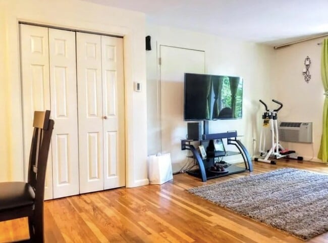
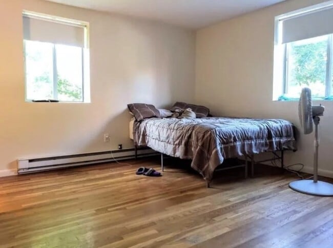
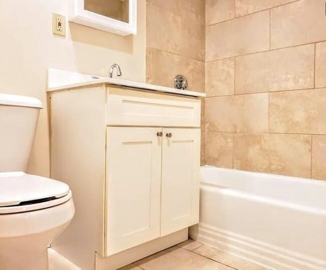
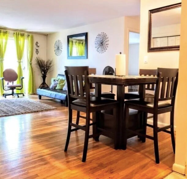
This apartment has everything that you need to feel at home. The kitchen is spacious and has enough cabinets to keep you organized. The living room provides the perfect setting to sit back and relax after a long day at work,and the bedrooms inspire a good night's rest. Heat and hot water included! At 525 Talbot Ave,you will feel right at home immediately. The apartment is conveniently located near Ashmont MBTA station,restaurants,coffee shops,supermarkets,bike shops,and so much more. What are you waiting for? Submit your application today!
525 Talbot Ave is an apartment community located in Suffolk County and the 02124 ZIP Code.
Location
Get Directions
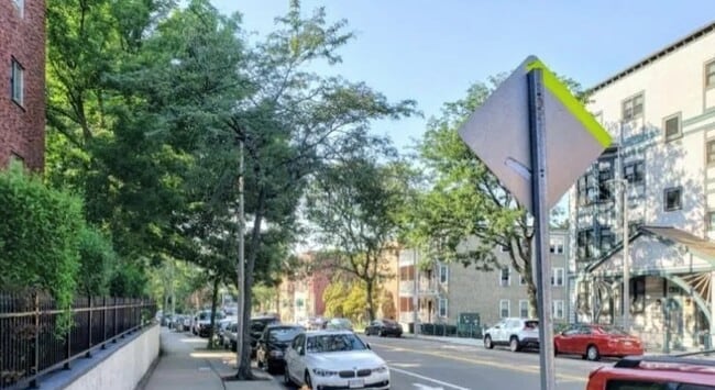
Ashmont is a charming suburban district on the southern end of Boston’s Dorchester area. Several public parks are easily accessible from anywhere in the neighborhood, including the huge Dorchester Park to the south and Roberts Playground on the west side.
Walking to the numerous schools and libraries is a breeze, and the rows of shops, cafes, and pubs along Adams Street and Dorchester Avenue can be quickly reached on foot as well. With Carney Hospital nearby, Ashmont is an excellent location for healthcare professionals.
Downtown Boston is only about twenty minutes away by car, and MBTA Red Line service puts the whole city at your fingertips even without the use of a personal vehicle.
Learn more about living in AshmontBelow are rent ranges for similar nearby apartments
| Beds | Average Size | Lowest | Typical | Premium |
|---|---|---|---|---|
| Studio Studio Studio | 536-537 Sq Ft | $2,050 | $2,340 | $3,250 |
| 1 Bed 1 Bed 1 Bed | 839-841 Sq Ft | $2,120 | $2,665 | $3,905 |
| 2 Beds 2 Beds 2 Beds | 2923-2926 Sq Ft | $2,300 | $3,181 | $5,200 |
| 3 Beds 3 Beds 3 Beds | 3122 Sq Ft | $1,250 | $3,299 | $6,900 |
| 4 Beds 4 Beds 4 Beds | 5288 Sq Ft | $3,300 | $4,650 | $5,000 |
Education
| Colleges & Universities | Distance | ||
|---|---|---|---|
| Colleges & Universities | Distance | ||
| Drive: | 8 min | 3.4 mi | |
| Drive: | 9 min | 4.7 mi | |
| Drive: | 10 min | 5.2 mi | |
| Drive: | 12 min | 5.6 mi |
525 Talbot Ave Unit 0 is within 8 minutes or 3.4 miles from UMass Boston. It is also near Northeastern University and Wentworth Inst. of Technology.
Transportation options available in Boston include Ashmont, located 0.3 mile from 525 Talbot Ave Unit 0. 525 Talbot Ave Unit 0 is near General Edward Lawrence Logan International, located 9.9 miles or 17 minutes away.
| Transit / Subway | Distance | ||
|---|---|---|---|
| Transit / Subway | Distance | ||
|
|
Walk: | 5 min | 0.3 mi |
|
|
Walk: | 9 min | 0.5 mi |
|
|
Walk: | 12 min | 0.7 mi |
|
|
Drive: | 2 min | 1.1 mi |
|
|
Drive: | 3 min | 1.4 mi |
| Commuter Rail | Distance | ||
|---|---|---|---|
| Commuter Rail | Distance | ||
| Walk: | 15 min | 0.8 mi | |
|
|
Drive: | 2 min | 1.6 mi |
| Drive: | 5 min | 1.7 mi | |
| Drive: | 5 min | 2.7 mi | |
|
|
Drive: | 6 min | 2.7 mi |
| Airports | Distance | ||
|---|---|---|---|
| Airports | Distance | ||
|
General Edward Lawrence Logan International
|
Drive: | 17 min | 9.9 mi |
Time and distance from 525 Talbot Ave Unit 0.
| Shopping Centers | Distance | ||
|---|---|---|---|
| Shopping Centers | Distance | ||
| Drive: | 3 min | 1.5 mi | |
| Drive: | 3 min | 1.7 mi | |
| Drive: | 4 min | 2.4 mi |
525 Talbot Ave Unit 0 has 3 shopping centers within 2.4 miles, which is about a 4-minute drive. The miles and minutes will be for the farthest away property.
| Parks and Recreation | Distance | ||
|---|---|---|---|
| Parks and Recreation | Distance | ||
|
Franklin Park Zoo
|
Drive: | 4 min | 2.0 mi |
|
Lower Neponset River Trail
|
Drive: | 4 min | 2.1 mi |
|
Mass Audubon's Boston Nature Center and Wildlife Sanctuary
|
Drive: | 6 min | 2.8 mi |
|
Dorchester Shores Reservation
|
Drive: | 7 min | 3.0 mi |
|
Squantum Point Park
|
Drive: | 9 min | 3.8 mi |
525 Talbot Ave Unit 0 has 5 parks within 3.8 miles, including Franklin Park Zoo, Lower Neponset River Trail, and Mass Audubon's Boston Nature Center and Wildlife Sanctuary.
| Hospitals | Distance | ||
|---|---|---|---|
| Hospitals | Distance | ||
| Walk: | 12 min | 0.7 mi | |
| Drive: | 5 min | 2.8 mi | |
| Drive: | 9 min | 5.0 mi |
525 Talbot Ave Unit 0 has 3 hospitals within 5.0 miles, the nearest is Carney Hospital which is 0.7 mile away and a 12 minute walk.
You May Also Like
Similar Rentals Nearby


What Are Walk Score®, Transit Score®, and Bike Score® Ratings?
Walk Score® measures the walkability of any address. Transit Score® measures access to public transit. Bike Score® measures the bikeability of any address.
What is a Sound Score Rating?
A Sound Score Rating aggregates noise caused by vehicle traffic, airplane traffic and local sources
525 Talbot Ave
Boston, MA 02124