
$3,850 / Month
49 Jerome Ave Unit 49
Newton, MA 02465
2 Weeks Ago
Favorites
49 Jerome Ave Unit 49

Favorites
Check Back Soon for Upcoming Availability
| Beds | Baths | Average SF |
|---|---|---|
| 2 Bedrooms 2 Bedrooms 2 Br | 1 Bath 1 Bath 1 Ba | 1,000 SF |
Fees and Policies
The fees below are based on community-supplied data and may exclude additional fees and utilities.
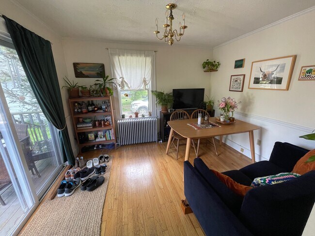
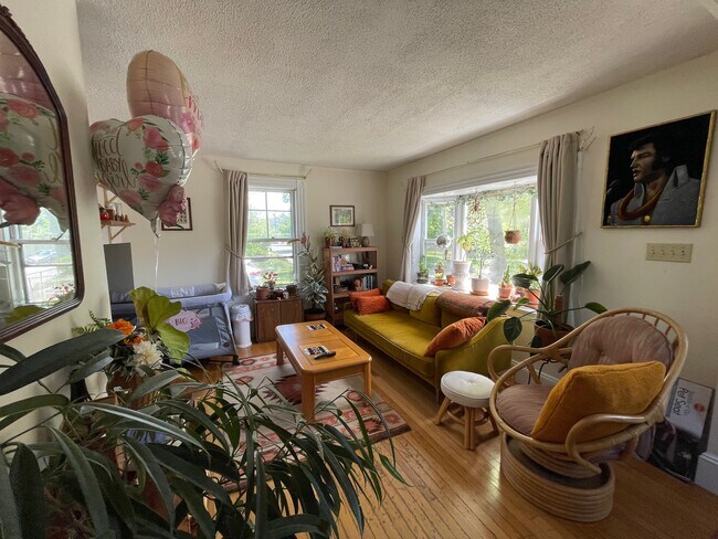
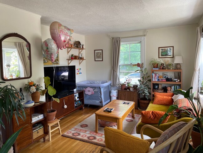
About This Property
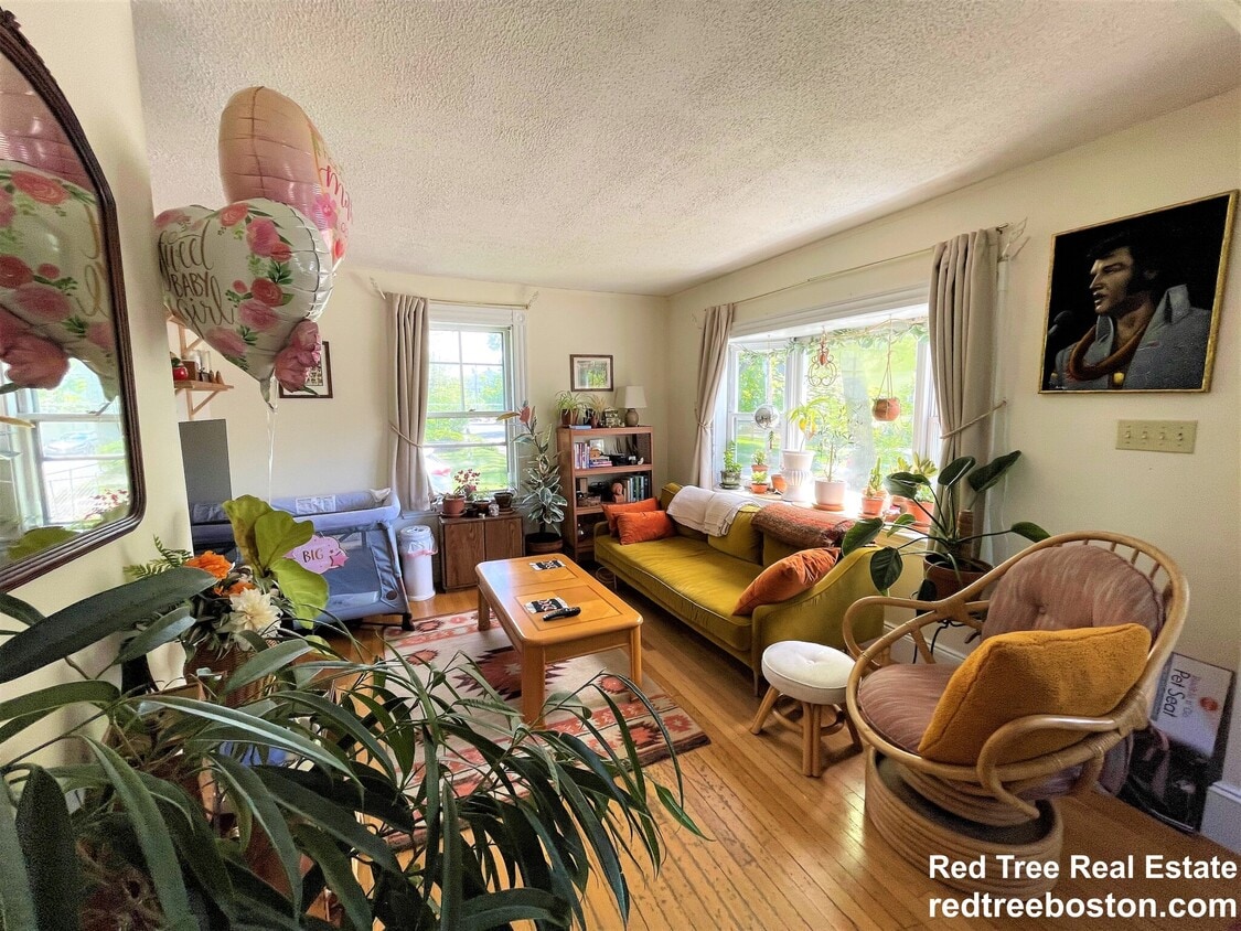
Single family home in West Newton, with fenced in yard. Large Deck. Washer and dryer in basement. Freshly painted and cleaned. New Roof. Pets Ok Near Franklin School.
49 Jerome Ave is an apartment community located in Middlesex County and the 02465 ZIP Code.
Apartment Features
- Washer/Dryer
- Basement
- Deck
- Yard
Location
Get Directions
An affluent suburb just 10 miles west of downtown Boston, Newton is a family-friendly area with plentiful amenities. Newton, Massachusetts houses part of Boston College, as well as a few private universities. Newton prides itself on its great public school district, Newton Public Schools, offering options like Newton South High School. Luxury apartment and condo rentals are spread throughout Newton, giving you a wide range of upscale options to choose from.
Residents appreciate access to the Massachusetts Bay Transportation Authority’s commuter rail, affording them easy commutes to neighboring areas. Enjoy shopping malls like the Shops at Chestnut Hill and Chestnut Hill Square for popular retailers and a variety of eateries. Get outdoors at Cold Spring Park, complete with nature trails and sports fields and courts.
Learn more about living in Newton
Amenities
- Washer/Dryer
- Basement
- Deck
- Yard
Education
| Colleges & Universities | Distance | ||
|---|---|---|---|
| Colleges & Universities | Distance | ||
| Drive: | 8 min | 2.8 mi | |
| Drive: | 7 min | 2.8 mi | |
| Drive: | 10 min | 5.0 mi | |
| Drive: | 12 min | 5.4 mi |
49 Jerome Ave Unit 49 is within 8 minutes or 2.8 miles from Brandeis University. It is also near Bentley University and Boston College.
Transportation options available in Newton include Woodland Station, located 2.4 miles from 49 Jerome Ave Unit 49. 49 Jerome Ave Unit 49 is near General Edward Lawrence Logan International, located 14.1 miles or 23 minutes away, and Worcester Regional, located 40.4 miles or 59 minutes away.
| Transit / Subway | Distance | ||
|---|---|---|---|
| Transit / Subway | Distance | ||
|
|
Drive: | 5 min | 2.4 mi |
|
|
Drive: | 7 min | 2.6 mi |
|
|
Drive: | 6 min | 2.8 mi |
|
|
Drive: | 8 min | 3.5 mi |
|
|
Drive: | 9 min | 3.8 mi |
| Commuter Rail | Distance | ||
|---|---|---|---|
| Commuter Rail | Distance | ||
|
|
Drive: | 4 min | 1.6 mi |
| Drive: | 4 min | 1.7 mi | |
|
|
Drive: | 8 min | 4.0 mi |
|
|
Drive: | 10 min | 5.3 mi |
|
|
Drive: | 11 min | 6.2 mi |
| Airports | Distance | ||
|---|---|---|---|
| Airports | Distance | ||
|
General Edward Lawrence Logan International
|
Drive: | 23 min | 14.1 mi |
|
Worcester Regional
|
Drive: | 59 min | 40.4 mi |
Time and distance from 49 Jerome Ave Unit 49.
| Shopping Centers | Distance | ||
|---|---|---|---|
| Shopping Centers | Distance | ||
| Drive: | 4 min | 1.7 mi | |
| Drive: | 4 min | 1.8 mi | |
| Drive: | 4 min | 2.3 mi |
49 Jerome Ave Unit 49 has 3 shopping centers within 2.3 miles, which is about a 4-minute drive. The miles and minutes will be for the farthest away property.
| Parks and Recreation | Distance | ||
|---|---|---|---|
| Parks and Recreation | Distance | ||
|
Beaver Brook Reservation
|
Drive: | 7 min | 3.4 mi |
|
Hemlock Gorge Reservation
|
Drive: | 10 min | 4.2 mi |
|
Hammond Pond Reservation
|
Drive: | 10 min | 4.4 mi |
|
Land's Sake Farm
|
Drive: | 10 min | 5.1 mi |
|
Mass Audubon's Habitat Education Center and Wildlife Sanctuary
|
Drive: | 11 min | 5.2 mi |
49 Jerome Ave Unit 49 has 5 parks within 5.2 miles, including Beaver Brook Reservation, Hemlock Gorge Reservation, and Hammond Pond Reservation.
| Hospitals | Distance | ||
|---|---|---|---|
| Hospitals | Distance | ||
| Drive: | 4 min | 1.8 mi | |
| Drive: | 5 min | 2.4 mi | |
| Drive: | 7 min | 3.8 mi |
49 Jerome Ave Unit 49 has 3 hospitals within 3.8 miles, the nearest is Walden Behavioral Care which is 1.8 miles away and a 4 minute drive.
| Military Bases | Distance | ||
|---|---|---|---|
| Military Bases | Distance | ||
| Drive: | 19 min | 9.2 mi | |
| Drive: | 19 min | 10.1 mi |
49 Jerome Ave Unit 49 is 9.2 miles from Hanscom Air Force Base, and is convenient to other military bases, including US Military Reservation.
You May Also Like
Similar Rentals Nearby


What Are Walk Score®, Transit Score®, and Bike Score® Ratings?
Walk Score® measures the walkability of any address. Transit Score® measures access to public transit. Bike Score® measures the bikeability of any address.
What is a Sound Score Rating?
A Sound Score Rating aggregates noise caused by vehicle traffic, airplane traffic and local sources
49 Jerome Ave
Newton, MA 02465