
$3,300 / Month
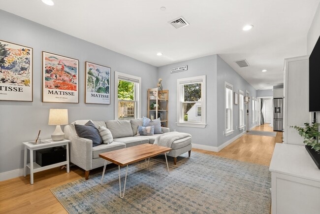
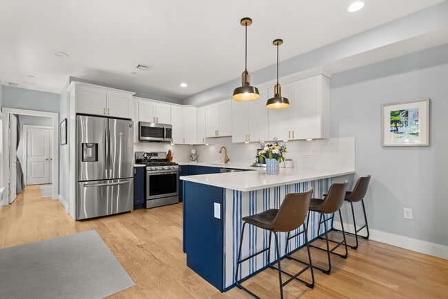
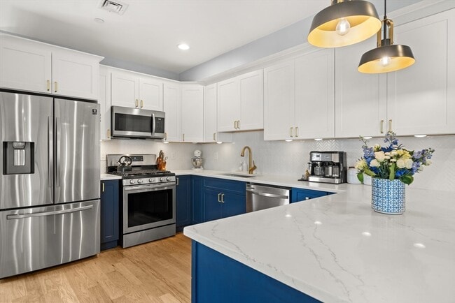
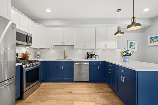
49 Eutaw St Unit 2
Boston, MA 02128
1 Day Ago
Favorites
857-380-6036
-
Bedrooms
2
-
Bathrooms
2
-
Square Feet
995 sq ft
-
Available
Available Aug 31
Highlights
- Pets Allowed
- Smoke Free
49 Eutaw St Unit 2

Favorites
About This Home
12 Month Lease,
$3,300 deposit,
Available Aug 31
Tenant pays tenant agent fee. First, one month security deposit due at lease signing. reserves right to charge $50/cat, $100/dog. Credit 700+ and stable verifiable income required. Tenant for shared shoveling and trash disposal with other units, and heat/hw/electricity.No broker fee
49 Eutaw St is an apartment community located in Suffolk County and the 02128 ZIP Code. This area is served by the Boston Public Schools attendance zone.
* Price shown is base rent and may not include non-optional fees and utilities.
Price, availability, fees, and any applicable rent special are subject to change without notice.
* Square footage definitions vary. Displayed square footage is approximate.
Apartment Features
- Washer/Dryer
- Smoke Free
- Disposal
Fees and Policies
The fees below are based on community-supplied data and may exclude additional fees and utilities.
- Dogs Allowed
-
Fees not specified
- Cats Allowed
-
Fees not specified
- Parking
-
Street--
Details
Utilities Included
-
Water
Property Information
-
2 units
Contact
- Phone Number
- Contact
Location
Get Directions
Eagle Hill is one of Boston’s most historic neighborhoods, with many well-preserved Victorian homes scattered around the community. Bordered on two sides by water, numerous marinas are close at hand in this triangular neighborhood, making it a popular area among boaters and fishermen.
The local dining scene offers plenty to please every taste, representing every corner of Boston’s diverse cultural landscape. With Logan International Airport positioned just a few streets away, Eagle Hill is an excellent location for folks who work at the airport or for the airlines.
Learn more about living in Eagle Hill
Education
| Colleges & Universities | Distance | ||
|---|---|---|---|
| Colleges & Universities | Distance | ||
| Drive: | 6 min | 2.5 mi | |
| Drive: | 8 min | 3.0 mi | |
| Drive: | 8 min | 3.4 mi | |
| Drive: | 9 min | 4.0 mi |
49 Eutaw St Unit 2 is within 6 minutes or 2.5 miles from Suffolk University. It is also near Emerson College and Tufts University, Boston.
Schools


Public Elementary School
Grades PK-6
281 Students
Attendance Zone
Public Elementary & Middle School
Grades PK-8
581 Students
Attendance Zone
Public Middle School
Grades 6-8
362 Students
Attendance Zone
Public Middle & High School
Grades 6-12
530 Students
Attendance Zone
Public Middle & High School
Grades 7-12
1,276 Students
Attendance Zone
Public Middle & High School
Grades 7-12
792 Students
Attendance Zone
Private Elementary & Middle School
Grades PK-8
194 Students
Nearby
Private Middle & High School
Grades 8-12
31 Students
Nearby
School data provided by
 The GreatSchools Rating helps parents compare schools within a state based on a variety of school quality indicators and provides a helpful picture of how effectively each school serves all of its students. Ratings are on a scale of 1 (below average) to 10 (above average) and can include test scores, college readiness, academic progress, advanced courses, equity, discipline and attendance data. We also advise parents to visit schools, consider other information on school performance and programs, and consider family needs as part of the school selection process.
View GreatSchools Rating Methodology
Data provided by GreatSchools.org © 2025. All rights reserved.
View GreatSchools Rating Methodology
Data provided by GreatSchools.org © 2025. All rights reserved.
Transportation options available in Boston include Maverick Station, located 0.8 mile from 49 Eutaw St Unit 2. 49 Eutaw St Unit 2 is near General Edward Lawrence Logan International, located 2.2 miles or 5 minutes away.
| Transit / Subway | Distance | ||
|---|---|---|---|
| Transit / Subway | Distance | ||
|
|
Walk: | 14 min | 0.8 mi |
|
|
Drive: | 3 min | 1.2 mi |
|
|
Drive: | 4 min | 1.9 mi |
|
|
Drive: | 5 min | 2.1 mi |
|
|
Drive: | 6 min | 2.6 mi |
| Commuter Rail | Distance | ||
|---|---|---|---|
| Commuter Rail | Distance | ||
| Drive: | 5 min | 1.6 mi | |
|
|
Drive: | 6 min | 2.2 mi |
|
|
Drive: | 6 min | 3.0 mi |
|
|
Drive: | 12 min | 4.2 mi |
|
|
Drive: | 10 min | 4.7 mi |
| Airports | Distance | ||
|---|---|---|---|
| Airports | Distance | ||
|
General Edward Lawrence Logan International
|
Drive: | 5 min | 2.2 mi |
Time and distance from 49 Eutaw St Unit 2.
| Shopping Centers | Distance | ||
|---|---|---|---|
| Shopping Centers | Distance | ||
| Walk: | 7 min | 0.4 mi | |
| Drive: | 4 min | 1.6 mi | |
| Drive: | 5 min | 2.2 mi |
49 Eutaw St Unit 2 has 3 shopping centers within 2.2 miles, which is about a 5-minute walk. The miles and minutes will be for the farthest away property.
| Parks and Recreation | Distance | ||
|---|---|---|---|
| Parks and Recreation | Distance | ||
|
Boston National Historical Park
|
Drive: | 6 min | 2.4 mi |
|
New England Aquarium
|
Drive: | 6 min | 2.6 mi |
|
Boston Harbor Islands National Recreation Area
|
Drive: | 6 min | 2.7 mi |
|
Boston African American National Historic Site
|
Drive: | 7 min | 2.7 mi |
|
Museum of Science
|
Drive: | 7 min | 2.8 mi |
49 Eutaw St Unit 2 has 5 parks within 2.8 miles, including New England Aquarium, Boston National Historical Park, and Boston African American National Historic Site.
| Hospitals | Distance | ||
|---|---|---|---|
| Hospitals | Distance | ||
| Drive: | 6 min | 2.5 mi | |
| Drive: | 7 min | 2.6 mi | |
| Drive: | 8 min | 3.5 mi |
49 Eutaw St Unit 2 has 3 hospitals within 3.5 miles, the nearest is Shriners Hospital for Children - Boston which is 2.5 miles away and a 6 minute drive.
| Military Bases | Distance | ||
|---|---|---|---|
| Military Bases | Distance | ||
| Drive: | 27 min | 15.6 mi | |
| Drive: | 32 min | 16.7 mi |
49 Eutaw St Unit 2 is 15.6 miles from Fort Miller, and is convenient to other military bases, including Hanscom Air Force Base.
Amenities
- Washer/Dryer
- Smoke Free
- Disposal
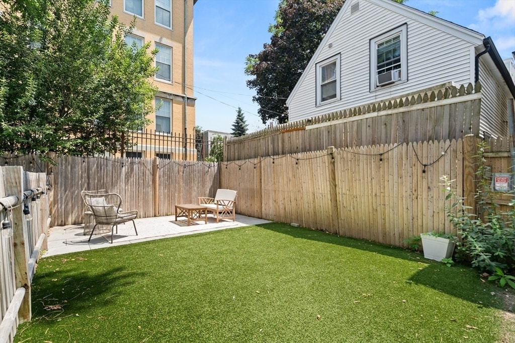
49 Eutaw St Unit 2 Photos
What Are Walk Score®, Transit Score®, and Bike Score® Ratings?
Walk Score® measures the walkability of any address. Transit Score® measures access to public transit. Bike Score® measures the bikeability of any address.
What is a Sound Score Rating?
A Sound Score Rating aggregates noise caused by vehicle traffic, airplane traffic and local sources
49 Eutaw St
Boston, MA 02128