
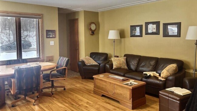
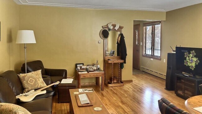
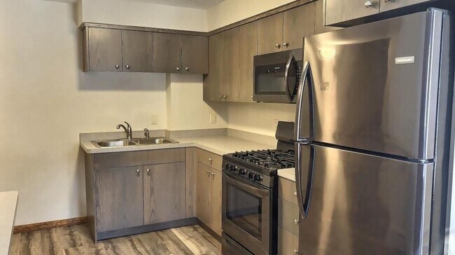
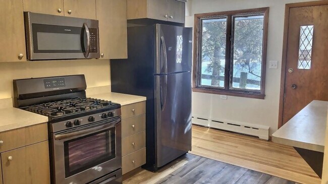
$1,950 / Month
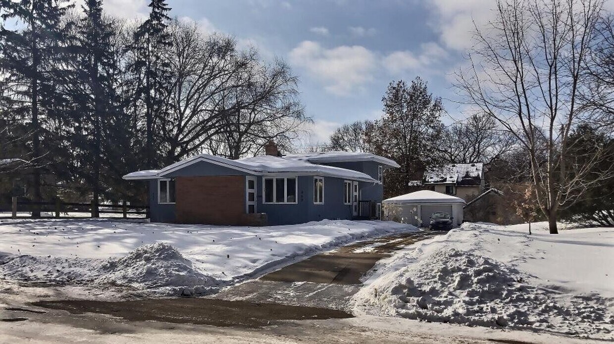
487-489 Desnoyer Ave Unit 489 Desnoyer Ave
Saint Paul, MN 55104
2 Weeks Ago
Favorites
487-489 Desnoyer Ave Unit 489 Desnoyer Ave

Favorites
Check Back Soon for Upcoming Availability
| Beds | Baths | Average SF |
|---|---|---|
| 3 Bedrooms 3 Bedrooms 3 Br | 2 Baths 2 Baths 2 Ba | 1,150 SF |
Location
Get Directions
Along the shore of the Mississippi River, Merriam Park West offers riverfront parks, a large golf course, and quaint local restaurants just minutes from downtown Saint Paul, Minnesota. Stop on in at Izzy’s Ice Cream Café, or grab a treat at Black Coffee and Waffle Bar. Local businesses thrive alongside riverfront community spaces like Shadow Falls Park, a picturesque nature preserve.
The University of Saint Thomas resides on the south end of town, and the neighborhood offers a blend of private and public schools, churches, and every day conveniences. Situated just five miles southeast of Minneapolis and seven miles northeast of the Minneapolis-Saint Paul International Airport, this neighborhood is in a premier location for commuting, shopping, dining, and entertainment.
Learn more about living in Merriam Park WestBelow are rent ranges for similar nearby apartments
Education
| Colleges & Universities | Distance | ||
|---|---|---|---|
| Colleges & Universities | Distance | ||
| Drive: | 4 min | 1.3 mi | |
| Drive: | 8 min | 2.5 mi | |
| Drive: | 6 min | 2.8 mi | |
| Drive: | 9 min | 3.3 mi |
487-489 Desnoyer Ave Unit 489 Desnoyer Ave is within 4 minutes or 1.3 miles from Univ. of St Thomas, St. Paul. It is also near Macalester College and University of Minnesota.
Transportation options available in Saint Paul include Raymond Ave Station, located 1.0 miles from 487-489 Desnoyer Ave Unit 489 Desnoyer Ave. 487-489 Desnoyer Ave Unit 489 Desnoyer Ave is near Minneapolis-St Paul International/Wold-Chamberlain, located 7.9 miles or 18 minutes away.
| Transit / Subway | Distance | ||
|---|---|---|---|
| Transit / Subway | Distance | ||
| Walk: | 19 min | 1.0 mi | |
| Drive: | 4 min | 1.3 mi | |
| Drive: | 6 min | 1.9 mi | |
| Drive: | 5 min | 2.2 mi | |
| Drive: | 6 min | 2.3 mi |
| Commuter Rail | Distance | ||
|---|---|---|---|
| Commuter Rail | Distance | ||
|
|
Drive: | 14 min | 6.0 mi |
|
|
Drive: | 11 min | 6.4 mi |
|
|
Drive: | 22 min | 14.2 mi |
|
|
Drive: | 31 min | 22.7 mi |
|
|
Drive: | 33 min | 24.3 mi |
| Airports | Distance | ||
|---|---|---|---|
| Airports | Distance | ||
|
Minneapolis-St Paul International/Wold-Chamberlain
|
Drive: | 18 min | 7.9 mi |
Time and distance from 487-489 Desnoyer Ave Unit 489 Desnoyer Ave.
| Shopping Centers | Distance | ||
|---|---|---|---|
| Shopping Centers | Distance | ||
| Drive: | 6 min | 1.8 mi | |
| Drive: | 7 min | 2.6 mi | |
| Drive: | 7 min | 3.0 mi |
487-489 Desnoyer Ave Unit 489 Desnoyer Ave has 3 shopping centers within 3.0 miles, which is about a 7-minute drive. The miles and minutes will be for the farthest away property.
| Parks and Recreation | Distance | ||
|---|---|---|---|
| Parks and Recreation | Distance | ||
|
Tower Hill Park
|
Drive: | 5 min | 1.7 mi |
|
Brackett Park
|
Drive: | 5 min | 1.7 mi |
|
Luxton Park
|
Drive: | 7 min | 2.0 mi |
|
Longfellow Park
|
Drive: | 6 min | 2.1 mi |
|
Matthews Park
|
Drive: | 7 min | 2.2 mi |
487-489 Desnoyer Ave Unit 489 Desnoyer Ave has 5 parks within 2.2 miles, including Brackett Park, Tower Hill Park, and Luxton Park.
| Hospitals | Distance | ||
|---|---|---|---|
| Hospitals | Distance | ||
| Drive: | 7 min | 3.4 mi | |
| Drive: | 11 min | 3.9 mi | |
| Drive: | 11 min | 4.0 mi |
487-489 Desnoyer Ave Unit 489 Desnoyer Ave has 3 hospitals within 4.0 miles, the nearest is University of Minnesota Medical Center, Fairview which is 3.4 miles away and a 7 minute drive.
| Military Bases | Distance | ||
|---|---|---|---|
| Military Bases | Distance | ||
| Drive: | 16 min | 6.0 mi |
487-489 Desnoyer Ave Unit 489 Desnoyer Ave is 6.0 miles and a 16 minute drive from Fort Snelling Military Reservation.
You May Also Like
Similar Rentals Nearby


What Are Walk Score®, Transit Score®, and Bike Score® Ratings?
Walk Score® measures the walkability of any address. Transit Score® measures access to public transit. Bike Score® measures the bikeability of any address.
What is a Sound Score Rating?
A Sound Score Rating aggregates noise caused by vehicle traffic, airplane traffic and local sources
487-489 Desnoyer Ave
Saint Paul, MN 55104