$3,400
Total Monthly Price
12 Month Lease
48 Dudley St
Boston, MA 02119
Favorites
857-269-1487
-
Bedrooms
3
-
Bathrooms
1
-
Square Feet
9,999 sq ft
-
Available
Available Jun 1
Highlight
- Hardwood Floors
48 Dudley St

Favorites
About This Home
12 Month Lease,
$3,400 deposit,
Available Jun 1
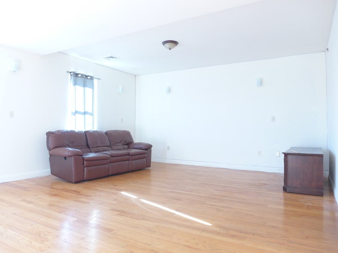
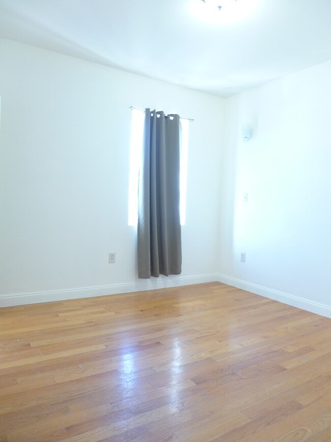
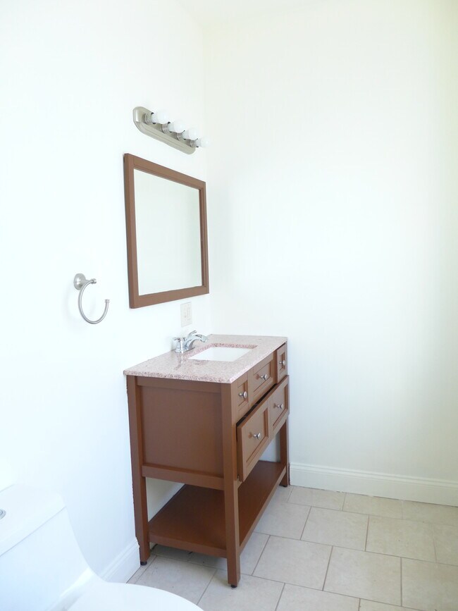
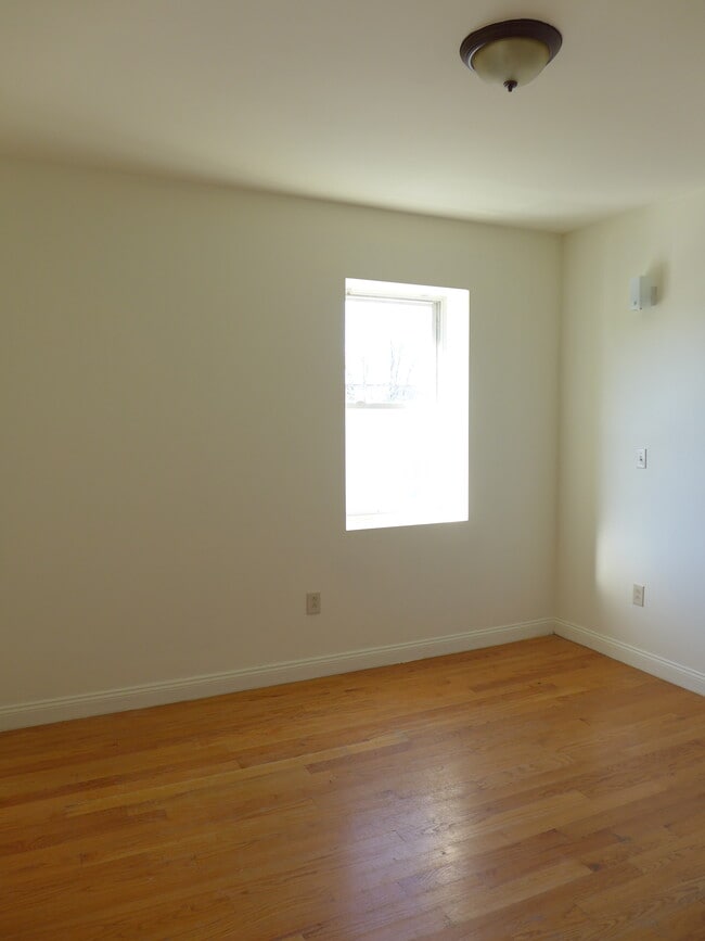
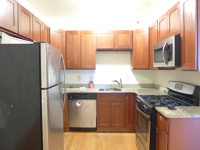
Large sunny living room Three spacious bedrooms One and a half modern bathrooms Hardwood flooring throughout Central air conditioning Well-lit top floor unit Stainless steel kitchen Gas stove Dishwasher Laundry in unit Easy access to Nubian Square Short distance to the Orange Line
48 Dudley St is an apartment community located in Suffolk County and the 02119 ZIP Code. This area is served by the Boston Public Schools attendance zone.
* Price shown is total price based on community-supplied monthly required fees. Excludes user-selected optional fees and variable or usage-based fees and required charges due at or prior to move-in or at move-out. Price, availability, fees, and any applicable rent special are subject to change without notice.
* Square footage definitions vary. Displayed square footage is approximate.
Apartment Features
Washer/Dryer
Air Conditioning
Dishwasher
Hardwood Floors
- Washer/Dryer
- Air Conditioning
- Dishwasher
- Kitchen
- Hardwood Floors
Fees and Policies
The fees listed below are community-provided and may exclude utilities or add-ons. All payments are made directly to the property and are non-refundable unless otherwise specified.
Details
Property Information
-
3 units
Contact
- Phone Number
- Contact
Location
Get Directions
Situated between the South End and Dudley Square, Lower Roxbury is a predominantly residential neighborhood brimming with apartments and town houses available for rent. Residents enjoy a walkable urban environment filled with diverse historical architecture.
Warren Street and Washington Street are the neighborhood’s main commercial thoroughfares, touting rows of specialty shops, markets, and eateries in historic buildings. Northeastern University, Wentworth Institute of Technology, and Massachusetts College of Art and Design are all just northwest of Lower Roxbury, offering the community a bevy of cultural and educational amenities. Getting around from Lower Roxbury is easy with access to multiple T stops on the Orange Line.
Learn more about living in Lower Roxbury
Education
| Colleges & Universities | Distance | ||
|---|---|---|---|
| Colleges & Universities | Distance | ||
| Walk: | 18 min | 0.9 mi | |
| Drive: | 3 min | 1.3 mi | |
| Drive: | 3 min | 1.5 mi | |
| Drive: | 5 min | 1.8 mi |
48 Dudley St is within 18 minutes or 0.9 mile from Wentworth Inst. of Technology. It is also near MCPHS University, Boston and MassArt.
Schools


Public Elementary & Middle School
Grades PK-8
716 Students
Attendance Zone
Public Elementary School
Grades PK-5
167 Students
Attendance Zone
Public Middle School
Grades 6-8
331 Students
Attendance Zone
Public Middle & High School
Grades 6-12
1,518 Students
Attendance Zone
Public High School
Grades 9-12
313 Students
Attendance Zone
Public High School
Grades 9-12
1,024 Students
Attendance Zone
Private Elementary, Middle & High School
Grades K-12
Nearby
Private Elementary & Middle School
Grades K-8
Nearby
Private Elementary School
Grades PK-5
104 Students
Nearby
Private Middle & High School
Grades 6-12
292 Students
Nearby
School data provided by
 The GreatSchools Rating helps parents compare schools within a state based on a variety of school quality indicators and provides a helpful picture of how effectively each school serves all of its students. Ratings are on a scale of 1 (below average) to 10 (above average) and can include test scores, college readiness, academic progress, advanced courses, equity, discipline and attendance data. We also advise parents to visit schools, consider other information on school performance and programs, and consider family needs as part of the school selection process.
View GreatSchools Rating Methodology
Data provided by GreatSchools.org © 2026. All rights reserved.
View GreatSchools Rating Methodology
Data provided by GreatSchools.org © 2026. All rights reserved.
Transportation options available in Boston include Roxbury Crossing Station, located 0.5 mile from 48 Dudley St. 48 Dudley St is near General Edward Lawrence Logan International, located 6.0 miles or 12 minutes away.
| Transit / Subway | Distance | ||
|---|---|---|---|
| Transit / Subway | Distance | ||
|
|
Walk: | 9 min | 0.5 mi |
|
|
Drive: | 2 min | 1.2 mi |
|
|
Drive: | 3 min | 1.3 mi |
|
|
Drive: | 3 min | 1.4 mi |
|
|
Drive: | 5 min | 1.8 mi |
| Commuter Rail | Distance | ||
|---|---|---|---|
| Commuter Rail | Distance | ||
| Drive: | 3 min | 1.4 mi | |
|
|
Drive: | 3 min | 1.4 mi |
|
|
Drive: | 4 min | 1.7 mi |
|
|
Drive: | 8 min | 2.3 mi |
|
|
Drive: | 10 min | 5.1 mi |
| Airports | Distance | ||
|---|---|---|---|
| Airports | Distance | ||
|
General Edward Lawrence Logan International
|
Drive: | 12 min | 6.0 mi |
Getting Around
 What do Walkability, Transit, Drivability, and Bikeability mean?
Walkability measures the walking distance to day-to-day needs.
Transit measures access to public transportation.
Drivability measures congestion, parking availability, and access to major roads.
Bikeability measures the suitability for cycling.
How It Works
What do Walkability, Transit, Drivability, and Bikeability mean?
Walkability measures the walking distance to day-to-day needs.
Transit measures access to public transportation.
Drivability measures congestion, parking availability, and access to major roads.
Bikeability measures the suitability for cycling.
How It Works
Exceptionally Walkable
Walkability
100
/ 100
Exceptional Public Transit
Transit
100
/ 100
Fairly Drivable
Drivability
50
/ 100
Very Bikeable
Bikeability
80
/ 100
Scores provided by
-
Soundscore™
-
/ 100
Traffic
-Airport
-Businesses
-Scores provided by
HowLoud What is a Sound Score Rating? A Sound Score Rating aggregates noise caused by vehicle traffic, airplane traffic and local sources. How It WorksTime and distance from 48 Dudley St.
| Shopping Centers | Distance | ||
|---|---|---|---|
| Shopping Centers | Distance | ||
| Walk: | 18 min | 1.0 mi | |
| Drive: | 4 min | 1.6 mi | |
| Drive: | 12 min | 6.3 mi |
48 Dudley St has 3 shopping centers within 6.3 miles, which is about a 12-minute drive. The miles and minutes will be for the farthest away property.
| Parks and Recreation | Distance | ||
|---|---|---|---|
| Parks and Recreation | Distance | ||
|
Roxbury Heritage State Park
|
Walk: | 4 min | 0.2 mi |
|
Lower Neponset River Trail
|
Drive: | 4 min | 1.9 mi |
|
Franklin Park Zoo
|
Drive: | 4 min | 2.1 mi |
|
Charles River Reservation
|
Drive: | 6 min | 2.8 mi |
|
Coit Observatory
|
Drive: | 7 min | 3.2 mi |
48 Dudley St has 5 parks within 3.2 miles, including Roxbury Heritage State Park, Lower Neponset River Trail, and Franklin Park Zoo.
| Hospitals | Distance | ||
|---|---|---|---|
| Hospitals | Distance | ||
| Walk: | 17 min | 0.9 mi | |
| Drive: | 3 min | 1.2 mi | |
| Drive: | 3 min | 1.4 mi |
48 Dudley St has 3 hospitals within 1.4 miles, the nearest is Boston Medical Center which is 0.9 mile away and a 17 minute walk.
| Military Bases | Distance | ||
|---|---|---|---|
| Military Bases | Distance | ||
| Drive: | 30 min | 15.8 mi | |
| Drive: | 32 min | 16.3 mi | |
| Drive: | 37 min | 22.3 mi |
48 Dudley St has 3 military bases within 22.3 miles, the nearest is US Military Reservation which is 15.8 miles away and a 30 minute drive.
Amenities
- Washer/Dryer
- Air Conditioning
- Dishwasher
- Kitchen
- Hardwood Floors
48 Dudley St Photos
What Are Walk Score®, Transit Score®, and Bike Score® Ratings?
Walk Score® measures the walkability of any address. Transit Score® measures access to public transit. Bike Score® measures the bikeability of any address.
What is a Sound Score Rating?
A Sound Score Rating aggregates noise caused by vehicle traffic, airplane traffic and local sources.

48 Dudley St
Boston, MA 02119