$3,800
Total Monthly Price
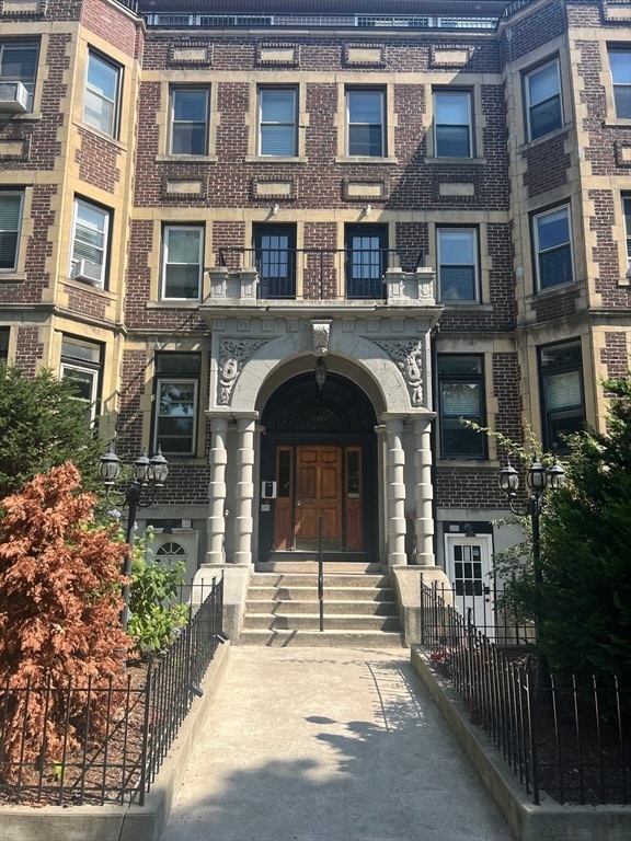
390 Riverway Unit 6
Boston, MA 02115
Today
Favorites
617-333-8956
-
Bedrooms
2
-
Bathrooms
2
-
Square Feet
850 sq ft
-
Available
Available Sep 1
Highlights
- Medical Services
- Property is near public transit
- Jogging Path
- Cooling Available
- Park
- Shops
390 Riverway Unit 6

Favorites
About This Home
$3,800 deposit,
Available Sep 1
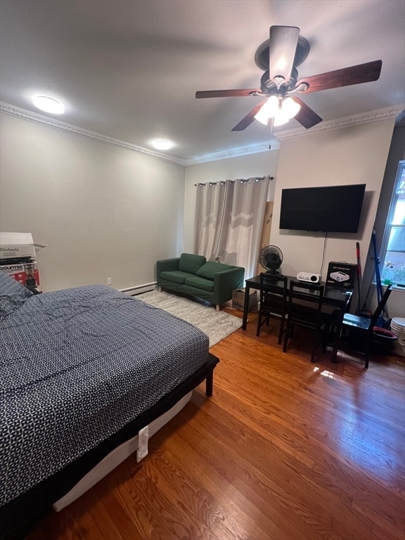
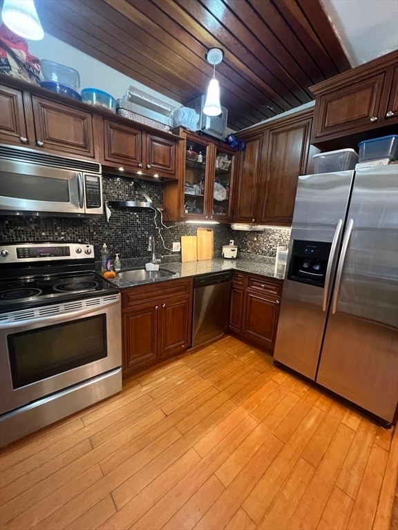
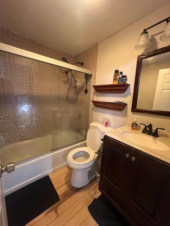
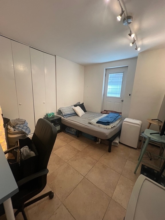
Enjoy two levels of comfortable living with direct courtyard access in this beautifully maintained residence. Ideally situated at the crossroads of the Emerald Necklace,Brookline Village,and Longwood Medical,with convenient access to the Green Line,this home offers both charm and convenience.Step inside to a bright open-concept living and dining area featuring a wood-burning fireplace,perfect for relaxing or entertaining. The adjacent kitchen is generously sized with stainless steel appliances,hardwood cabinetry,and granite countertops. A full bath completes the main level.The lower level features two spacious bedrooms,an additional full bath,and direct access to the serene common courtyard.Don’t miss this opportunity—schedule your private showing today! MLS# 73419071
390 Riverway is an apartment community located in Suffolk County and the 02115 ZIP Code.
* Price shown is total price including community-supplied monthly required fees. Price, availability, fees, and any applicable rent special are subject to change without notice.
* Square footage definitions vary. Displayed square footage is approximate.
Home Details
Year Built
Built in 1900
Accessible Home Design
Entry on the 1st floor
Bedrooms and Bathrooms
2 Full Bathrooms
2 Bedrooms
Home Design
Apartment
Interior Spaces
850 Sq Ft Home
Listing and Financial Details
Security Deposit $3,800
Property Available on 9/1/25
12 Month Lease Term
Assessor Parcel Number 3352068
Rent includes water
Location
Property is near public transit
Property is near schools
Utilities
Cooling Available
Central Heating
Community Details
Amenities
Medical Services
Shops
Coin Laundry
Overview
No Home Owners Association
Pet Policy
No Pets Allowed
Recreation
Jogging Path
Park
Bike Trail
Contact
- Listed by Hunter Ware | Access
- Phone Number
-
Source
 MLS Property Information Network
The property listing data and information set forth herein were provided to MLS Property Information Network, Inc. from third party sources, including sellers, lessors and public records, and were compiled by MLS Property Information Network, Inc. The property listing data and information are for the personal, non-commercial use of consumers having a good faith interest in purchasing or leasing listed properties of the type displayed to them and may not be used for any purpose other than to identify prospective properties which such consumers may have a good faith interest in purchasing or leasing. MLS Property Information Network, Inc. and its subscribers disclaim any and all representations and warranties as to the accuracy of the property listing data and information set forth herein. All properties are subject to prior sale, change or withdrawal. Copyright © 2025 MLS Property Information Network, Inc. All rights reserved.
Location
Get Directions
Boston is the iconic capital and largest city of Massachusetts, known for its historical significance, top-notch culinary scene, and beautiful Bayfront views. Nestled on Massachusetts Bay, Boston is home to numerous universities including Harvard University, Boston College, Northeastern University, the University of Massachusetts-Boston, the Berklee College of Music, and the Benjamin Franklin Institute of Technology. In fact, there are 54 colleges and universities in the Boston area, dating all the way back to 1636 when Harvard was established.
Boston played a crucial role in the American Revolution, being the site of major events like the Boston Massacre and the Boston Tea Party. This city is filled with historic sites, landmarks, and architecture like the Boston Common, the first park in the country, dating back to 1624. Locals frequent Freedom Trail for its walking park that begins at the park and leads past several historic sites, including Paul Revere’s House and Faneuil Hall.
Learn more about living in Boston
Education
| Colleges & Universities | Distance | ||
|---|---|---|---|
| Colleges & Universities | Distance | ||
| Walk: | 13 min | 0.7 mi | |
| Drive: | 2 min | 1.2 mi | |
| Drive: | 3 min | 1.4 mi | |
| Drive: | 3 min | 1.4 mi |
390 Riverway Unit 6 is within 13 minutes or 0.7 mile from MCPHS University, Boston. It is also near MassArt and Simmons College.
Transportation options available in Boston include Mission Park Station, located 0.2 mile from 390 Riverway Unit 6. 390 Riverway Unit 6 is near General Edward Lawrence Logan International, located 7.4 miles or 14 minutes away.
| Transit / Subway | Distance | ||
|---|---|---|---|
| Transit / Subway | Distance | ||
|
|
Walk: | 3 min | 0.2 mi |
|
|
Walk: | 4 min | 0.3 mi |
|
|
Walk: | 5 min | 0.3 mi |
|
|
Walk: | 8 min | 0.4 mi |
|
|
Walk: | 11 min | 0.6 mi |
| Commuter Rail | Distance | ||
|---|---|---|---|
| Commuter Rail | Distance | ||
|
|
Drive: | 3 min | 1.4 mi |
|
|
Drive: | 6 min | 2.3 mi |
|
|
Drive: | 8 min | 2.5 mi |
|
|
Drive: | 9 min | 4.3 mi |
| Drive: | 15 min | 6.4 mi |
| Airports | Distance | ||
|---|---|---|---|
| Airports | Distance | ||
|
General Edward Lawrence Logan International
|
Drive: | 14 min | 7.4 mi |
Time and distance from 390 Riverway Unit 6.
| Shopping Centers | Distance | ||
|---|---|---|---|
| Shopping Centers | Distance | ||
| Walk: | 15 min | 0.8 mi | |
| Drive: | 4 min | 1.4 mi | |
| Drive: | 4 min | 1.7 mi |
390 Riverway Unit 6 has 3 shopping centers within 1.7 miles, which is about a 4-minute walk. The miles and minutes will be for the farthest away property.
| Parks and Recreation | Distance | ||
|---|---|---|---|
| Parks and Recreation | Distance | ||
|
Frederick Law Olmsted National Historic Site
|
Drive: | 3 min | 1.2 mi |
|
Roxbury Heritage State Park
|
Drive: | 3 min | 1.4 mi |
|
John Fitzgerald Kennedy National Historic Site
|
Drive: | 4 min | 1.5 mi |
|
Coit Observatory
|
Drive: | 4 min | 2.2 mi |
|
Charles River Reservation
|
Drive: | 5 min | 2.5 mi |
390 Riverway Unit 6 has 5 parks within 2.5 miles, including Frederick Law Olmsted National Historic Site, Roxbury Heritage State Park, and John Fitzgerald Kennedy National Historic Site.
| Hospitals | Distance | ||
|---|---|---|---|
| Hospitals | Distance | ||
| Walk: | 9 min | 0.5 mi | |
| Walk: | 10 min | 0.5 mi | |
| Walk: | 15 min | 0.8 mi |
390 Riverway Unit 6 has 3 hospitals within 0.8 mile, the nearest is New England Baptist Hospital which is 0.5 mile away and a 9 minute walk.
| Military Bases | Distance | ||
|---|---|---|---|
| Military Bases | Distance | ||
| Drive: | 26 min | 14.2 mi | |
| Drive: | 30 min | 15.5 mi |
390 Riverway Unit 6 is 14.2 miles from US Military Reservation, and is convenient to other military bases, including Hanscom Air Force Base.
You May Also Like
Similar Rentals Nearby


What Are Walk Score®, Transit Score®, and Bike Score® Ratings?
Walk Score® measures the walkability of any address. Transit Score® measures access to public transit. Bike Score® measures the bikeability of any address.
What is a Sound Score Rating?
A Sound Score Rating aggregates noise caused by vehicle traffic, airplane traffic and local sources

390 Riverway
Boston, MA 02115