$3,300 / Month
34 Colgate Rd Unit 2
Boston, MA 02131
Today
Favorites
781-439-1576
-
Bedrooms
2
-
Bathrooms
1
-
Square Feet
868 sq ft
-
Available
Available Now
Highlights
- Golf Course Community
- Medical Services
- Property is near public transit
- 1 Fireplace
- Jogging Path
- Porch
34 Colgate Rd Unit 2

Favorites
About This Home
$3,300 deposit,
Available Now
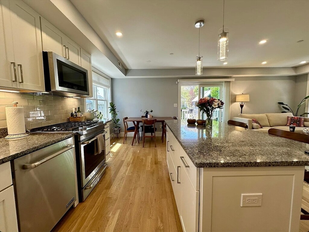
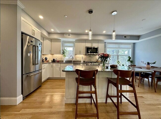
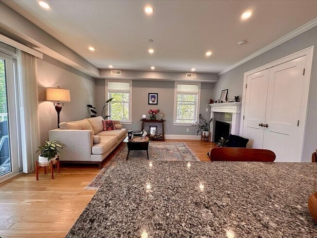
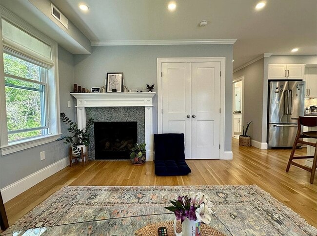
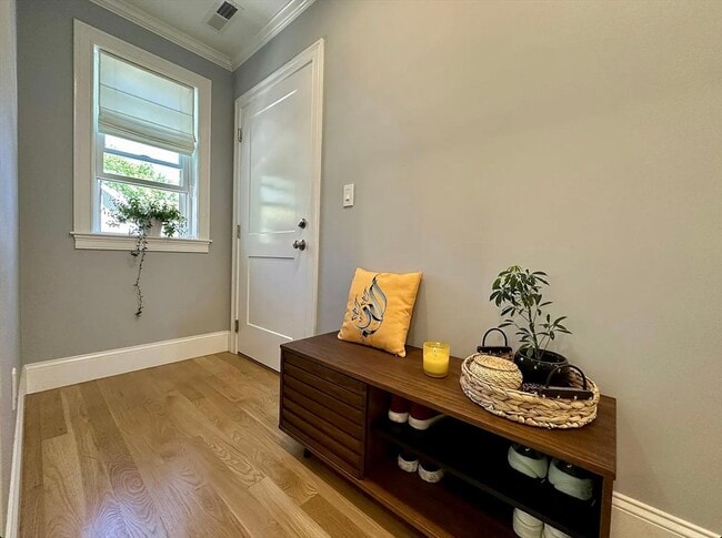
Welcome to your dream home,a modern oasis built in 2020,tucked away at the serene terminus of a tranquil cul-de-sac. Inside,indulge in the convenience of in-unit laundry and the assurance of off-street parking for two vehicles,ensuring every aspect of your lifestyle is catered to. The heart of this home is the chef's kitchen,boasting JennAir appliances,an expansive island,and exquisite finishes throughout. It seamlessly transitions into the spacious living and dining area,adorned with a cozy gas fireplace. There are large closets in both bedrooms and the common space and for additional storage,there is a deeded unit in the basement. Located near the Arboretum and Roslindale Square,this location cannot be beat. Book your appointment today before it is too late! MLS# 73412952
34 Colgate Rd is an apartment community located in Suffolk County and the 02131 ZIP Code.
* Price shown is base rent and may not include non-optional fees and utilities.
Price, availability, fees, and any applicable rent special are subject to change without notice.
* Square footage definitions vary. Displayed square footage is approximate.
Home Details
Year Built
Built in 2019
Accessible Home Design
Entry on the 2nd floor
Bedrooms and Bathrooms
Primary bedroom located on second floor
1 Full Bathroom
2 Bedrooms
Home Design
Apartment
Interior Spaces
1 Fireplace
868 Sq Ft Home
Kitchen
Range
Freezer
Microwave
Dishwasher
Disposal
Laundry
Dryer
Laundry on upper level
Washer
Listing and Financial Details
Security Deposit $3,300
12 Month Lease Term
Assessor Parcel Number W:19 P:02907 S:004,1390762
Rent includes water, sewer
Location
Property is near public transit
Property is near schools
Lot Details
2,295.68 Acre Lot
Outdoor Features
Porch
Parking
1 Car Parking Space
Schools
Bps Elementary And Middle School
Bps High School
Utilities
Cooling Available
Heating System Uses Natural Gas
Community Details
Amenities
Medical Services
Shops
Coin Laundry
Overview
Property has a Home Owners Association
Pet Policy
No Pets Allowed
Recreation
Golf Course Community
Jogging Path
Park
Bike Trail
Fees and Policies
The fees below are based on community-supplied data and may exclude additional fees and utilities.
Contact
- Listed by ME Collective Group | Compass
- Phone Number
-
Source
 MLS Property Information Network
The property listing data and information set forth herein were provided to MLS Property Information Network, Inc. from third party sources, including sellers, lessors and public records, and were compiled by MLS Property Information Network, Inc. The property listing data and information are for the personal, non-commercial use of consumers having a good faith interest in purchasing or leasing listed properties of the type displayed to them and may not be used for any purpose other than to identify prospective properties which such consumers may have a good faith interest in purchasing or leasing. MLS Property Information Network, Inc. and its subscribers disclaim any and all representations and warranties as to the accuracy of the property listing data and information set forth herein. All properties are subject to prior sale, change or withdrawal. Copyright © 2025 MLS Property Information Network, Inc. All rights reserved.
Location
Get Directions
Amenities
- Dishwasher
- Disposal
- Microwave
- Range
- Refrigerator
- Freezer
- Porch
Lower Washington-Mount Hope is a walkable neighborhood about eight miles south of Boston via Interstate 93 or public transit. Despite this area’s dense population, Lower Washington-Mount Hope has many wooded areas, and large parks like Bussey Brook Meadow and Franklin Park surround the neighborhood. Along with residential neighborhoods, a few shops and eateries can be found in town along American Legion Highway. Many residents travel to the western corner of town to get to the shopping plaza off Corinth Street for all the necessities. The western part of the neighborhood is also where most of the rentals in this area are located. Apartments, condos, and townhomes ranging from moderately priced to luxury can be found here.
Learn more about living in Lower Washington-Mount Hope
Education
| Colleges & Universities | Distance | ||
|---|---|---|---|
| Colleges & Universities | Distance | ||
| Drive: | 8 min | 3.7 mi | |
| Drive: | 8 min | 4.1 mi | |
| Drive: | 9 min | 4.3 mi | |
| Drive: | 10 min | 4.6 mi |
34 Colgate Rd Unit 2 is within 8 minutes or 3.7 miles from Wentworth Inst. of Technology. It is also near MCPHS University, Boston and MassArt.
Transportation options available in Boston include Forest Hills Station, located 0.8 mile from 34 Colgate Rd Unit 2. 34 Colgate Rd Unit 2 is near General Edward Lawrence Logan International, located 9.0 miles or 19 minutes away.
| Transit / Subway | Distance | ||
|---|---|---|---|
| Transit / Subway | Distance | ||
|
|
Walk: | 14 min | 0.8 mi |
|
|
Drive: | 4 min | 1.7 mi |
|
|
Drive: | 5 min | 2.2 mi |
|
|
Drive: | 6 min | 2.6 mi |
|
|
Drive: | 8 min | 3.3 mi |
| Commuter Rail | Distance | ||
|---|---|---|---|
| Commuter Rail | Distance | ||
|
|
Walk: | 14 min | 0.8 mi |
|
|
Walk: | 16 min | 0.8 mi |
|
|
Drive: | 5 min | 1.8 mi |
|
|
Drive: | 7 min | 2.3 mi |
| Drive: | 7 min | 3.6 mi |
| Airports | Distance | ||
|---|---|---|---|
| Airports | Distance | ||
|
General Edward Lawrence Logan International
|
Drive: | 19 min | 9.0 mi |
Time and distance from 34 Colgate Rd Unit 2.
| Shopping Centers | Distance | ||
|---|---|---|---|
| Shopping Centers | Distance | ||
| Drive: | 5 min | 1.7 mi | |
| Drive: | 5 min | 1.9 mi | |
| Drive: | 6 min | 2.3 mi |
34 Colgate Rd Unit 2 has 3 shopping centers within 2.3 miles, which is about a 6-minute drive. The miles and minutes will be for the farthest away property.
| Parks and Recreation | Distance | ||
|---|---|---|---|
| Parks and Recreation | Distance | ||
|
Arnold Arboretum of Harvard University
|
Walk: | 17 min | 0.9 mi |
|
Mass Audubon's Boston Nature Center and Wildlife Sanctuary
|
Drive: | 6 min | 1.9 mi |
|
Franklin Park Zoo
|
Drive: | 7 min | 2.7 mi |
|
Lower Neponset River Trail
|
Drive: | 7 min | 2.8 mi |
|
Frederick Law Olmsted National Historic Site
|
Drive: | 8 min | 3.4 mi |
34 Colgate Rd Unit 2 has 5 parks within 3.4 miles, including Arnold Arboretum of Harvard University, Mass Audubon's Boston Nature Center and Wildlife Sanctuary, and Franklin Park Zoo.
| Hospitals | Distance | ||
|---|---|---|---|
| Hospitals | Distance | ||
| Drive: | 3 min | 1.3 mi | |
| Drive: | 5 min | 1.9 mi | |
| Drive: | 4 min | 2.1 mi |
34 Colgate Rd Unit 2 has 3 hospitals within 2.1 miles, the nearest is Brigham and Women's Faulkner Hospital which is 1.3 miles away and a 3 minute drive.
| Military Bases | Distance | ||
|---|---|---|---|
| Military Bases | Distance | ||
| Drive: | 27 min | 15.0 mi |
34 Colgate Rd Unit 2 is 15.0 miles and a 27 minute drive from US Military Reservation.
You May Also Like
Similar Rentals Nearby


What Are Walk Score®, Transit Score®, and Bike Score® Ratings?
Walk Score® measures the walkability of any address. Transit Score® measures access to public transit. Bike Score® measures the bikeability of any address.
What is a Sound Score Rating?
A Sound Score Rating aggregates noise caused by vehicle traffic, airplane traffic and local sources

34 Colgate Rd
Boston, MA 02131