
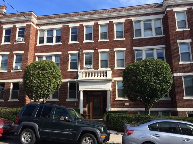
32 Ransom Rd
Boston, MA 02135
-
Bedrooms
2
-
Bathrooms
1
-
Square Feet
690 - 734 sq ft
-
Available
Available Now

3 Available Units
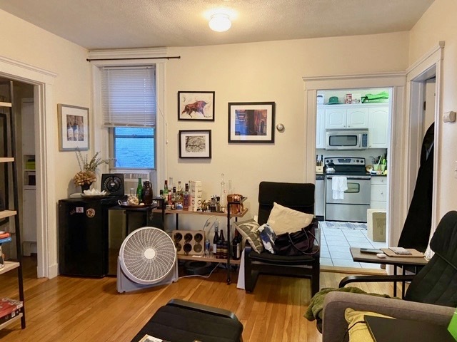
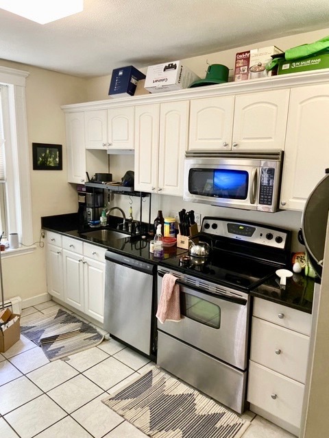
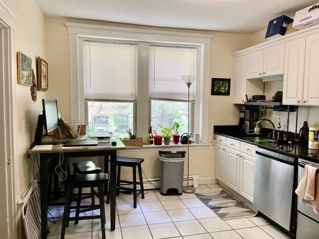
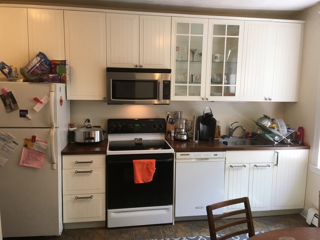
Condominio, front-facing las de dos habitaciones cuenta con pisos de madera noble y una nueva cocina comedor con encimeras de granito y electrodomésticos de acabado de acero inoxidable. Baño está renovado, así y ventanas son nuevos. Instalaciones de lavandería en el sótano. Calle tranquila cerca de la T, tiendas & restaurantes, Whole Foods y mucho más. Fully-staffed compañía de administración profesional en el lugar. Amplia sala de estar y habitación principal, segunda habitación es un poco más pequeño. Perfecta para una pareja buscando una habitación para un espacio de oficina.
32 Ransom Rd is an apartment community located in Suffolk County and the 02135 ZIP Code. This area is served by the Boston Public Schools attendance zone.
Apartment Features
- Lavavajillas
- Instalaciones de lavandería
Fees and Policies
The fees below are based on community-supplied data and may exclude additional fees and utilities.
Details
Utilities Included
-
Water
-
Heat
-
Trash Removal
-
Sewer
Lease Options
-
12 meses
Property Information
-
3 units
Contact
- Contact
Saint Elizabeth’s is a Brighton neighborhood situated about 10 miles away from Boston. Thanks to Saint Elizabeth’s top border sitting on Highway 20, commuting in and out of Brighton is easy. Some residents travel by car, but buses and railways make commuting via public transportation a breeze.
The neighborhood’s best amenities are two world-renowned hospitals, Saint Elizabeth’s Medical Center and Franciscan Children’s, that sit on the edge of town. Other great amenities of Saint Elizabeth’s include many local parks like Ringer Playground and Chestnut Hill Reservoir, which has great trails and greenspace. This neighborhood is also equipped with cozy coffee shops, restaurants serving international and American classics, and shopping plazas with grocers and convenience stores.
Saint Elizabeth’s has several rental options ranging from apartments to single-family homes.
Learn more about living in St Elizabeth's| Colleges & Universities | Distance | ||
|---|---|---|---|
| Colleges & Universities | Distance | ||
| Drive: | 4 min | 1.5 mi | |
| Drive: | 4 min | 1.7 mi | |
| Drive: | 5 min | 2.5 mi | |
| Drive: | 7 min | 3.0 mi |


View GreatSchools Rating Methodology
Data provided by GreatSchools.org © 2026. All rights reserved.
Transportation options available in Boston include Sutherland Street Station, located 0.2 mile from 32 Ransom Rd. 32 Ransom Rd is near General Edward Lawrence Logan International, located 9.6 miles or 17 minutes away.
| Transit / Subway | Distance | ||
|---|---|---|---|
| Transit / Subway | Distance | ||
|
|
Walk: | 3 min | 0.2 mi |
|
|
Walk: | 3 min | 0.2 mi |
|
|
Walk: | 8 min | 0.4 mi |
|
|
Walk: | 11 min | 0.6 mi |
|
|
Drive: | 3 min | 1.2 mi |
| Commuter Rail | Distance | ||
|---|---|---|---|
| Commuter Rail | Distance | ||
|
|
Drive: | 7 min | 3.7 mi |
|
|
Drive: | 8 min | 3.8 mi |
|
|
Drive: | 8 min | 3.8 mi |
| Drive: | 9 min | 4.6 mi | |
|
|
Drive: | 10 min | 5.3 mi |
| Airports | Distance | ||
|---|---|---|---|
| Airports | Distance | ||
|
General Edward Lawrence Logan International
|
Drive: | 17 min | 9.6 mi |
Time and distance from 32 Ransom Rd.
| Shopping Centers | Distance | ||
|---|---|---|---|
| Shopping Centers | Distance | ||
| Walk: | 6 min | 0.3 mi | |
| Walk: | 12 min | 0.7 mi | |
| Drive: | 5 min | 1.6 mi |
| Parks and Recreation | Distance | ||
|---|---|---|---|
| Parks and Recreation | Distance | ||
|
Chestnut Hill Reservation
|
Walk: | 13 min | 0.7 mi |
|
John Fitzgerald Kennedy National Historic Site
|
Drive: | 4 min | 1.9 mi |
|
Frederick Law Olmsted National Historic Site
|
Drive: | 5 min | 2.5 mi |
|
Hammond Pond Reservation
|
Drive: | 6 min | 2.7 mi |
|
Coit Observatory
|
Drive: | 6 min | 2.9 mi |
| Hospitals | Distance | ||
|---|---|---|---|
| Hospitals | Distance | ||
| Walk: | 12 min | 0.6 mi | |
| Walk: | 14 min | 0.7 mi | |
| Drive: | 3 min | 1.9 mi |
| Military Bases | Distance | ||
|---|---|---|---|
| Military Bases | Distance | ||
| Drive: | 28 min | 12.9 mi | |
| Drive: | 23 min | 13.5 mi |
- Lavavajillas
- Instalaciones de lavandería
32 Ransom Rd Photos
What Are Walk Score®, Transit Score®, and Bike Score® Ratings?
Walk Score® measures the walkability of any address. Transit Score® measures access to public transit. Bike Score® measures the bikeability of any address.
What is a Sound Score Rating?
A Sound Score Rating aggregates noise caused by vehicle traffic, airplane traffic and local sources
32 Ransom Rd
Boston, MA 02135